 |
Community Contact |
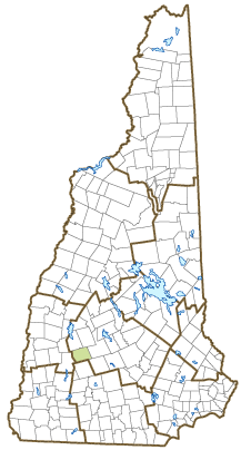
Town of Bradford
Board of Selectmen
PO Box 436
Bradford, NH
03221-0436
|
| Telephone |
(603) 938-5900 |
| Fax |
(603) 938-5694 |
| E-mail |
administrator@bradfordnh.org |
| Web Site |
www.bradfordnh.org
|
| Municipal Office Hours |
Town Administrator: Monday to Thursday, 8:30-12 and 1-4, Friday, 8:30-12; Town Clerk/Tax Collector: Tuesday, 8-12 and 1-4, Wednesday, 12-5, Thursday, 10-7
|
| County |
Merrimack |
| Labor Market Area |
New London, NH LMA |
| Tourism Region |
Dartmouth-Lake Sunapee |
| Planning Commission |
Central NH Regional |
| Regional Development |
Capital Regional Development Council
|
| Election Districts |
|
| US Congress |
District District 2 |
| Executive Council |
District District 2 |
| State Senate |
District District 7 |
| State Representative |
Merrimack County District 8 |
| Incorporated: 1787 |
| Origin: First granted in 1771, the town was named New Bradford, then Bradfordton, most likely because many settlers were from Bradford, Massachusetts. It was incorporated as Bradford in 1787, the year of the Constitutional Convention. Meeting in Exeter, Anti-Federalist members of the New Hampshire delegation were opposed the Constitution. However, political maneuvering postponed the state convention. When reconvened in Concord several months later, under the leadership of moderator Colonel Thomas Stickney, the delegation approved ratification on June 21, 1788. |
| Villages and Place Names: Box Corner, Bradford Center
|
| Population, Year of the First Census Taken: 217 residents in 1790 |
| Population Trends: Population change for Bradford totaled 1,002 over 50 years, from 679 in 1970 to 1,681 in 2020. The 2022 Census estimate for Bradford was 1,709 residents, which ranked 155th among New Hampshire's incorporated cities and towns. |
| Population Density and Land Area, 2022 (US Census Bureau): 48.5 persons per square mile of land area. Bradford contains 35.2 square miles of land area and 0.7 square miles of inland water area. |
| Municipal Services |
| Type of Government |
Selectmen |
| Budget: Municipal Appropriations, 2022 |
$3,362,250 |
| Budget: School Appropriations, 2021-2022 |
$3,442,755 |
| Zoning Ordinance |
1989/23 |
| Master Plan |
2020 |
| Capitol Improvement Plan |
Yes |
| Industrial Plans Reviewed By |
|
| Boards and Commissions | |
| Elected: | Selectmen; Planning; Zoning; Library; Budget; Cemetery; Trust Funds; Treasurer |
| Appointed: | Conservation; Energy |
| Public Library |
Brown Memorial |
| Emergency Services |
| Police Department |
Full-time |
| Fire Department |
Part-time |
| Emergency Medical Service |
Volunteer |
| Nearest Hospital(s) |
Distance |
Staffed Beds |
| New London Hospital, New London |
13 miles |
25 |
| Concord Hospital, Concord |
26 miles |
236 |
|
|
|
| Utilities |
| Electric Supplier |
Eversource Energy |
| Natural Gas Supplier |
None |
| Water Supplier |
Private wells |
| Sanitation |
Private septic |
| Municipal Wastewater Treatment Plant |
No |
| Solid Waste Disposal |
| Curbside Trash Pickup | None |
| Pay-As-You-Throw Program | No |
| Recycling Program | Mandatory |
| Telephone Company |
TDS Telecom |
| Cellular Telephone Access |
Limited |
| Cable Television Access |
Yes |
| Public Access Television Station |
No |
| High Speed Internet Service: |
| Business | Yes |
| Residential | Yes |
| (NH Dept. of Revenue Administration) Property Taxes |
| 2022 Total Tax Rate (per $1,000 of value) |
$24.69 |
| 2022 Equalization Ratio |
68.9 |
| 2022 Full Value Tax Rate (per $1,000 of value) |
$16.97 |
| 2022 Percent of Local Assessed Value by Property Type |
| Residential Land and Buildings | 91.9% |
| Commercial Land and Buildings | 5.9% |
| Public Utilities, Current Use, and Other | 2.2% |
| (ACS 2017-2021) Housing |
| Total Housing Units |
861 |
| Single-Family Units, Detached or Attached |
812 |
| Units in Multiple-Family Structures: |
|
| Two to Four Units in Structure |
44 |
| Five or More Units in Structure |
5 |
| Mobile Homes and Other Housing Units |
0 |
(US Census Bureau) Population
(1-Year Estimates/Decennial) |
| Total Population |
Community |
County |
| 2022 |
1,709 |
156,020 |
| 2020 |
1,662 |
153,808 |
| 2010 |
1,650 |
146,445 |
| 2000 |
1,458 |
136,716 |
| 1990 |
1,410 |
120,618 |
| 1980 |
1,115 |
98,302 |
| |
| Demographics, American Community Survey (ACS) 2017-2021 |
| Population by Gender |
| Male: 823 |
|
Female: 720 |
| Population by Age Group |
| Under age 5 |
|
87 |
| Age 5 to 19 |
|
245 |
| Age 20 to 34 |
|
279 |
| Age 35 to 54 |
|
316 |
| Age 55 to 64 |
|
310 |
| Age 65 and over |
|
306 |
| Median Age |
|
47.4 years |
| Educational Attainment, population 25 years and over |
|
1,142 |
| High school graduate or higher |
|
94.6% |
| Bachelor's degree or higher |
|
37.0% |
| (ACS 2017-2021) Income, Inflation Adjusted $ |
| Per capita income |
$40,986 |
| Median family income |
$97,546 |
| Median household income |
$77,750 |
| Median Earnings, full-time, year-round workers |
| Male |
$52,436 |
| Female |
$41,538 |
| Individuals below the poverty level |
1.2% |
| (NHES - ELMI) Labor Force |
| Annual Average |
2012 |
2022 |
| Civilian Labor Force |
943 |
953 |
| Employed |
894 |
927 |
| Unemployed |
49 |
26 |
| Unemployment Rate |
5.2% |
2.7% |
| (NHES - ELMI) Employment & Wages |
| Annual Average Covered Employment |
2012 |
2022 |
| Goods Producing Industries |
| Average Employment |
83 |
40 |
| Average Weekly Wage |
$862 |
$1,052 |
| |
|
|
| Service Providing Industries |
| Average Employment |
213 |
322 |
| Average Weekly Wage |
$425 |
$852 |
| |
|
|
| Total Private Industry |
| Average Employment |
295 |
362 |
| Average Weekly Wage |
$547 |
$875 |
| |
|
|
| Government (Federal, State, and Local) |
| Average Employment |
81 |
82 |
| Average Weekly Wage |
$628 |
$817 |
| |
|
|
| Total, Private plus Government |
| Average Employment |
377 |
444 |
| Average Weekly Wage |
$565 |
$864 |
If "n" appears, data does not meet disclosure standards.
| (NH Dept. of Education) Education and Child Care |
| Schools students attend: |
Grades K-12 are part of Kearsarge Regional (Bradford, Newbury, New London, Springfield, Sutton, Warner, Wilmot) |
SAU 65 |
| Career Technology Center(s): |
Concord Regional Technical Center |
| Educational Facilities (includes Charter Schools) |
Elementary |
Middle/Junior High |
High School |
Private/Parochial |
| Number of Schools |
1 |
|
|
|
| Grade Levels |
K 1-5 |
|
|
|
| Total Enrollment |
169 |
|
|
|
| 2022 NH Licensed Child Care Facilities (Bureau of Child Care Licensing): |
Total Facilities: 2 |
Total Capacity: 86 |
| Nearest Community/Technical College: NHTI-Concord; River Valley |
| Nearest Colleges or Universities: Colby-Sawyer; Magdalen; New England; Granite State; UNH School of Law |
| Largest Businesses |
Product/Service |
Employees |
Established |
| Bradford Machine, Inc. |
Machine job shop |
3 |
1974 |
| Barns of Bradford |
Retail home furnishings |
3 |
1970 |
| Kearsarge Regional Elementary School |
Education |
50 |
1986 |
| Appleseed Restaurant |
Restaurant |
25 |
1977 |
| Lumber Barn |
Retail store |
25 |
|
|
|
|
|
|
|
|
|
|
|
|
|
|
|
|
|
|
|
|
|
Employer Information Supplied by Municipality
| (Distance estimated from city/town hall) Transportation |
| Road Access |
US Routes |
|
|
State Routes |
103, 114 |
| Nearest Interstate, Exit |
I-89, Exit 9 |
|
Distance |
7 miles |
| Railroad |
No |
| Public Transportation |
No |
| |
| Nearest Public Use Airport, General Aviation |
| Parlin Field, Newport | Runway | 3,450 ft. asphalt |
| Lighted? |
No |
Navigational Aids? |
No |
| Nearest Airport with Scheduled Service |
| Manchester-Boston Regional |
Distance |
48 miles |
| Number of Passenger Airlines Serving Airport |
4 |
| |
| Driving distance to selected cities: |
| Manchester, NH |
41 miles |
| Portland, ME |
134 miles |
| Boston, MA |
92 miles |
| New York City, NY |
262 miles |
| Montreal, Quebec |
224 miles |
| (ACS 2017-2021) Commuting to Work |
| Workers 16 years and over |
952 |
| Drove alone, car/truck/van |
75.5% |
| Carpooled, car/truck/van |
3.7% |
| Public transportation |
1.6% |
| Walked |
1.4% |
| Other Means |
0.3% |
| Worked at home |
17.5% |
| Mean Travel Time to Work |
33.3 minutes |
| |
| Percent of Working Residents: |
(ACS 2017-2021) |
| Working in community of residence |
28.3% |
| Commuting to another NH community |
63.1% |
| Commuting out-of-state |
8.6% |
| Recreation, Attractions, and Events |
| Municipal Parks |
| YMCA/YWCA |
| Boys Club/Girls Club |
| Golf Courses |
| Swimming: Indoor Facility |
| Swimming: Outdoor Facility |
| Tennis Courts: Indoor Facility |
| Tennis Courts: Outdoor Facility |
| Ice Skating Rink: Indoor Facility |
| Bowling Facilities |
| Museums |
| Cinemas |
| Performing Arts Facilities |
| Tourist Attractions |
| Youth Organizations (i.e., Scouts, 4-H) |
| Youth Sports: Baseball |
| Youth Sports: Soccer |
| Youth Sports: Football |
| Youth Sports: Basketball |
| Youth Sports: Hockey |
| Campgrounds |
| Fishing/Hunting |
| Boating/Marinas |
| Snowmobile Trails |
| Bicycle Trails |
| Cross Country Skiing |
| Beach or Waterfront Recreational Area |
| Overnight or Day Camps |
| |
|
|
Nearest Ski Area(s): Pat's Peak, Mount Sunapee |
| |
|
|
Other: Lake Massasecum; Outdoor Ice Skating Rink |
Economic & Labor Market Information Bureau, NH Employment Security, October 2023. Community Response Received 6/15/23
All information regarding the communities is from sources deemed reliable and is submitted subject to errors, omissions, modifications, and withdrawals without notice. No warranty or representation is made as to the accuracy of the information contained herein. Specific questions regarding individual cities and towns should be directed to the community contact.


