 |
Community Contact |
Sandown Board of Selectmen
Thomas Tombarello, Chairman
320 Main Street, PO Box 1756
Sandown, NH
03873
|
| Telephone |
(603) 887-3646 |
| Fax |
(603) 887-5163 |
| E-mail |
townofsandown@sandown.us |
| Web Site |
www.sandown.us/
|
| Municipal Office Hours |
Board of Selectmen, Administrator, Town Clerk/Tax Collector: Monday, 8-12 and 1-7, Tuesday to Thursday, 8-4, closed Friday
|
| County |
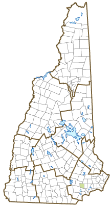
Rockingham |
| Labor Market Area |
Haverhill-Newburyport-Amesbury Town, MA-NH NECTA Division |
| Tourism Region |
Seacoast |
| Planning Commission |
Rockingham |
| Regional Development |
Regional Economic Development Corp.
|
| Election Districts |
|
| US Congress |
District District 1 |
| Executive Council |
District District 3 |
| State Senate |
District District 23 |
| State Representative |
Rockingham County District 9 |
| Incorporated: 1756 |
| Origin: This territory was part of the original Kingston grant of 1694. As the western portion of Kingston became more heavily populated, residents felt that they could support a meetinghouse of their own, and petitioned Governor Benning Wentworth for separation. Sandown was incorporated as a separate parish in 1756. It was named for picturesque Sandown on the Isle of Wight. The first minister of Sandown, Reverend Joseph Cotton, built the Sandown Church in 1773. The church had an eleven-foot high pulpit and marble columns supporting the gallery, and is an excellent example of early New England church architecture. |
| Villages and Place Names: unknown
|
| Population, Year of the First Census Taken: 561 residents in 1790 |
| Population Trends: Population change for Sandown totaled 5,811 over 50 years, from 741 in 1970 to 6,552 in 2020. The 2022 Census estimate for Sandown was 6,621 residents, which ranked 50th among New Hampshire's incorporated cities and towns. |
| Population Density and Land Area, 2022 (US Census Bureau): 473.3 persons per square mile of land area. Sandown contains 14.0 square miles of land area and 0.4 square miles of inland water area. |
| Municipal Services |
| Type of Government |
Selectmen |
| Budget: Municipal Appropriations, 2022 |
$4,924,225 |
| Budget: School Appropriations, 2021-2022 |
$15,625,460 |
| Zoning Ordinance |
1956/21 |
| Master Plan |
2013 |
| Capitol Improvement Plan |
Yes |
| Industrial Plans Reviewed By |
Planning Board |
| Boards and Commissions | |
| Elected: | Selectmen; Planning; Budget; Library; Cemetery; Checklist; Trust Funds; Fire Engineers |
| Appointed: | Conservation; Zoning; Cable; Recreation; Ballot Clerks; Old Home Day; Senior Affairs Transportation; Heritage; Joint Loss Mgmnt; Old Home Day; Senior Affairs Transportation |
| Public Library |
Sandown Public |
| Emergency Services |
| Police Department |
Full-time |
| Fire Department |
Full-time Chief, per diem & volunteer |
| Emergency Medical Service |
Volunteer |
| Nearest Hospital(s) |
Distance |
Staffed Beds |
| Parkland Medical Center, Derry |
10 miles |
50 |
|
|
|
|
|
|
| Utilities |
| Electric Supplier |
Eversource Energy; NH Electric Coop |
| Natural Gas Supplier |
None |
| Water Supplier |
Private wells |
| Sanitation |
Private septic |
| Municipal Wastewater Treatment Plant |
No |
| Solid Waste Disposal |
| Curbside Trash Pickup | None |
| Pay-As-You-Throw Program | No |
| Recycling Program | Voluntary |
| Telephone Company |
Granite State |
| Cellular Telephone Access |
Yes |
| Cable Television Access |
Yes |
| Public Access Television Station |
Yes |
| High Speed Internet Service: |
| Business | Yes |
| Residential | Yes |
| (NH Dept. of Revenue Administration) Property Taxes |
| 2022 Total Tax Rate (per $1,000 of value) |
$28.37 |
| 2022 Equalization Ratio |
60.2 |
| 2022 Full Value Tax Rate (per $1,000 of value) |
$16.88 |
| 2022 Percent of Local Assessed Value by Property Type |
| Residential Land and Buildings | 97.3% |
| Commercial Land and Buildings | 1.5% |
| Public Utilities, Current Use, and Other | 1.2% |
| (ACS 2017-2021) Housing |
| Total Housing Units |
2,287 |
| Single-Family Units, Detached or Attached |
2,003 |
| Units in Multiple-Family Structures: |
|
| Two to Four Units in Structure |
246 |
| Five or More Units in Structure |
19 |
| Mobile Homes and Other Housing Units |
19 |
(US Census Bureau) Population
(1-Year Estimates/Decennial) |
| Total Population |
Community |
County |
| 2022 |
6,621 |
319,424 |
| 2020 |
6,548 |
314,176 |
| 2010 |
5,986 |
295,223 |
| 2000 |
5,171 |
278,748 |
| 1990 |
4,069 |
246,744 |
| 1980 |
2,057 |
190,345 |
| |
| Demographics, American Community Survey (ACS) 2017-2021 |
| Population by Gender |
| Male: 3,223 |
|
Female: 3,275 |
| Population by Age Group |
| Under age 5 |
|
424 |
| Age 5 to 19 |
|
1,241 |
| Age 20 to 34 |
|
1,109 |
| Age 35 to 54 |
|
1,910 |
| Age 55 to 64 |
|
1,030 |
| Age 65 and over |
|
784 |
| Median Age |
|
38.9 years |
| Educational Attainment, population 25 years and over |
|
4,530 |
| High school graduate or higher |
|
93.2% |
| Bachelor's degree or higher |
|
31.1% |
| (ACS 2017-2021) Income, Inflation Adjusted $ |
| Per capita income |
$39,998 |
| Median family income |
$118,259 |
| Median household income |
$116,048 |
| Median Earnings, full-time, year-round workers |
| Male |
$69,139 |
| Female |
$65,066 |
| Individuals below the poverty level |
9.8% |
| (NHES - ELMI) Labor Force |
| Annual Average |
2012 |
2022 |
| Civilian Labor Force |
3,895 |
4,300 |
| Employed |
3,674 |
4,193 |
| Unemployed |
221 |
107 |
| Unemployment Rate |
5.7% |
2.5% |
| (NHES - ELMI) Employment & Wages |
| Annual Average Covered Employment |
2012 |
2022 |
| Goods Producing Industries |
| Average Employment |
51 |
86 |
| Average Weekly Wage |
$560 |
$898 |
| |
|
|
| Service Providing Industries |
| Average Employment |
148 |
195 |
| Average Weekly Wage |
$660 |
$987 |
| |
|
|
| Total Private Industry |
| Average Employment |
199 |
282 |
| Average Weekly Wage |
$634 |
$960 |
| |
|
|
| Government (Federal, State, and Local) |
| Average Employment |
67 |
66 |
| Average Weekly Wage |
$471 |
$674 |
| |
|
|
| Total, Private plus Government |
| Average Employment |
266 |
348 |
| Average Weekly Wage |
$593 |
$906 |
If "n" appears, data does not meet disclosure standards.
| (NH Dept. of Education) Education and Child Care |
| Schools students attend: |
Grades K-12 are part of Timberlane Regional (Atkinson, Danville, Plaistow, Sandown) |
SAU 55 |
| Career Technology Center(s): |
Pinkerton Academy Center for CTE |
| Educational Facilities (includes Charter Schools) |
Elementary |
Middle/Junior High |
High School |
Private/Parochial |
| Number of Schools |
2 |
|
|
|
| Grade Levels |
P K 1-5 |
|
|
9-12 |
| Total Enrollment |
466 |
|
|
|
| 2022 NH Licensed Child Care Facilities (Bureau of Child Care Licensing): |
Total Facilities: 1 |
Total Capacity: 102 |
| Nearest Community/Technical College: Manchester; Great Bay |
| Nearest Colleges or Universities: University of NH; UNH Manchester; Franklin Pierce-Manchester; Southern NH University; MCPHS |
| Largest Businesses |
Product/Service |
Employees |
Established |
| Compliance Worldwide, Inc |
EMC Test Lab |
7 |
1999 |
| Fox Den Retirement Community |
Assisted living facility |
20 |
1994 |
| Playmates Learning Center |
Childcare center |
14 |
1988 |
| Sue Padden Real Estate |
Real estate agency |
13 |
2004 |
| All Japanese Import Auto, Inc. |
Automotive repair/service |
4 |
1997 |
| Zorvino Vineyards |
Vineyard & function facility |
|
|
| Chickadee Hill Cakes |
specialty cake shop |
|
|
|
|
|
|
|
|
|
|
|
|
|
|
Employer Information Supplied by Municipality
| (Distance estimated from city/town hall) Transportation |
| Road Access |
US Routes |
|
|
State Routes |
121, 121A |
| Nearest Interstate, Exit |
I-93, Exit 4 |
|
Distance |
10 miles |
| Railroad |
No |
| Public Transportation |
CART |
| |
| Nearest Public Use Airport, General Aviation |
| Manchester-Boston Regional | Runway | 9,250 ft. asphalt |
| Lighted? |
Yes |
Navigational Aids? |
Yes |
| Nearest Airport with Scheduled Service |
| Manchester-Boston Regional |
Distance |
22 miles |
| Number of Passenger Airlines Serving Airport |
4 |
| |
| Driving distance to selected cities: |
| Manchester, NH |
20 miles |
| Portland, ME |
87 miles |
| Boston, MA |
48 miles |
| New York City, NY |
248 miles |
| Montreal, Quebec |
274 miles |
| (ACS 2017-2021) Commuting to Work |
| Workers 16 years and over |
3,518 |
| Drove alone, car/truck/van |
81.9% |
| Carpooled, car/truck/van |
3.2% |
| Public transportation |
0.0% |
| Walked |
0.8% |
| Other Means |
0.0% |
| Worked at home |
14.1% |
| Mean Travel Time to Work |
33.6 minutes |
| |
| Percent of Working Residents: |
(ACS 2017-2021) |
| Working in community of residence |
20.9% |
| Commuting to another NH community |
50.5% |
| Commuting out-of-state |
28.6% |
| Recreation, Attractions, and Events |
| Municipal Parks |
| YMCA/YWCA |
| Boys Club/Girls Club |
| Golf Courses |
| Swimming: Indoor Facility |
| Swimming: Outdoor Facility |
| Tennis Courts: Indoor Facility |
| Tennis Courts: Outdoor Facility |
| Ice Skating Rink: Indoor Facility |
| Bowling Facilities |
| Museums |
| Cinemas |
| Performing Arts Facilities |
| Tourist Attractions |
| Youth Organizations (i.e., Scouts, 4-H) |
| Youth Sports: Baseball |
| Youth Sports: Soccer |
| Youth Sports: Football |
| Youth Sports: Basketball |
| Youth Sports: Hockey |
| Campgrounds |
| Fishing/Hunting |
| Boating/Marinas |
| Snowmobile Trails |
| Bicycle Trails |
| Cross Country Skiing |
| Beach or Waterfront Recreational Area |
| Overnight or Day Camps |
| |
|
|
Nearest Ski Area(s): Gunstock, Pat's Peak |
| |
|
|
Other: Old Meeting House; Train Depot Museum |
Economic & Labor Market Information Bureau, NH Employment Security, October 2023. Community Response Received 6/1/23
All information regarding the communities is from sources deemed reliable and is submitted subject to errors, omissions, modifications, and withdrawals without notice. No warranty or representation is made as to the accuracy of the information contained herein. Specific questions regarding individual cities and towns should be directed to the community contact.


