 |
Community Contact |
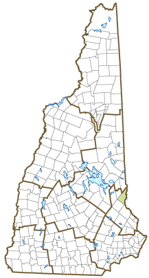
Town of Milton
Chris Jacobs, Town Administrator
PO Box 310
Milton, NH
03851
|
| Telephone |
(603) 652-4501 x1 |
| Fax |
(603) 652-4120 |
| E-mail |
miltonta@miltonnh-us.com |
| Web Site |
www.miltonnh-us.com
|
| Municipal Office Hours |
Selectmen's Office: Monday to Friday, 8-4; Town Clerk/Tax Collector: Monday, Tuesday, Wednesday, Friday, 8:30-3:30, Thursday, 8:30-5
|
| County |
Strafford |
| Labor Market Area |
Dover-Durham, NH-ME Metropolitan NECTA |
| Tourism Region |
Lakes |
| Planning Commission |
Strafford Regional |
| Regional Development |
Wentworth Economic Development Corp.
|
| Election Districts |
|
| US Congress |
District District 1 |
| Executive Council |
District District 1 |
| State Senate |
District District 3 |
| State Representative |
Strafford County District 2 |
| Incorporated: 1802 |
| Origin: This town was originally the north parish of Rochester known as Three Ponds or Milton Mills. Located along the Maine border on the Salmon River, it was the location of several mills, and the scene of early manufacturing. Following the 1798 incorporation of the northwest parish as Farmington, Rochester's territory was over 20 miles long, making travel to the meetinghouse difficult, and the north parish was incorporated as Milton in 1802. The name Milton may have come from a relative of the Wentworths, William Fitzwilliam, Earl of Fitzwilliam and Viscount Milton. Milton's Mount Teneriffe was named in honor of the volcano on the Canary Islands. |
| Villages and Place Names: Hayes Corner, Laskey Corner, Milton Mills, Town House
|
| Population, Year of the First Census Taken: 1,005 residents in 1810 |
| Population Trends: Population change for Milton totaled 2,624 over 50 years, from 1,859 in 1970 to 4,483 in 2020. The 2022 Census estimate for Milton was 4,573 residents, which ranked 85th among New Hampshire's incorporated cities and towns. |
| Population Density and Land Area, 2022 (US Census Bureau): 138.3 persons per square mile of land area. Milton contains 33.0 square miles of land area and 1.2 square miles of inland water area. |
| Municipal Services |
| Type of Government |
Selectmen |
| Budget: Municipal Appropriations, 2023 |
$4,980,452 |
| Budget: School Appropriations, 2023-2024 |
$11,504,266 |
| Zoning Ordinance |
1989/23 |
| Master Plan |
2005 |
| Capitol Improvement Plan |
Yes |
| Industrial Plans Reviewed By |
Building Inspector |
| Boards and Commissions | |
| Elected: | Selectmen; Planning; Zoning; Library; Cemetery; Budget; School; Water District; Trust Funds |
| Appointed: | Recreation; Conservation; Economic Development; Town House |
| Public Library |
Milton Free Public |
| Emergency Services |
| Police Department |
Full & part-time |
| Fire Department |
Full & part-time |
| Emergency Medical Service |
Full-time |
| Nearest Hospital(s) |
Distance |
Staffed Beds |
| Frisbie Memorial, Rochester |
8 miles |
27 |
|
|
|
|
|
|
| Utilities |
| Electric Supplier |
Eversource Energy |
| Natural Gas Supplier |
None |
| Water Supplier |
Milton Water District |
| Sanitation |
Municipal |
| Municipal Wastewater Treatment Plant |
Yes |
| Solid Waste Disposal |
| Curbside Trash Pickup | None |
| Pay-As-You-Throw Program | No |
| Recycling Program | Mandatory |
| Telephone Company |
Breezeline |
| Cellular Telephone Access |
Yes |
| Cable Television Access |
Yes |
| Public Access Television Station |
No |
| High Speed Internet Service: |
| Business | Yes |
| Residential | Yes |
| (NH Dept. of Revenue Administration) Property Taxes |
| 2022 Total Tax Rate (per $1,000 of value) |
$24.48 |
| 2022 Equalization Ratio |
60.2 |
| 2022 Full Value Tax Rate (per $1,000 of value) |
$14.60 |
| 2022 Percent of Local Assessed Value by Property Type |
| Residential Land and Buildings | 87.5% |
| Commercial Land and Buildings | 9.2% |
| Public Utilities, Current Use, and Other | 3.3% |
| (ACS 2017-2021) Housing |
| Total Housing Units |
1,858 |
| Single-Family Units, Detached or Attached |
1,529 |
| Units in Multiple-Family Structures: |
|
| Two to Four Units in Structure |
73 |
| Five or More Units in Structure |
81 |
| Mobile Homes and Other Housing Units |
175 |
(US Census Bureau) Population
(1-Year Estimates/Decennial) |
| Total Population |
Community |
County |
| 2022 |
4,573 |
132,275 |
| 2020 |
4,482 |
130,889 |
| 2010 |
4,598 |
123,143 |
| 2000 |
3,940 |
112,676 |
| 1990 |
3,690 |
104,348 |
| 1980 |
2,438 |
85,324 |
| |
| Demographics, American Community Survey (ACS) 2017-2021 |
| Population by Gender |
| Male: 2,226 |
|
Female: 2,277 |
| Population by Age Group |
| Under age 5 |
|
243 |
| Age 5 to 19 |
|
862 |
| Age 20 to 34 |
|
955 |
| Age 35 to 54 |
|
910 |
| Age 55 to 64 |
|
818 |
| Age 65 and over |
|
715 |
| Median Age |
|
38.8 years |
| Educational Attainment, population 25 years and over |
|
3,249 |
| High school graduate or higher |
|
92.2% |
| Bachelor's degree or higher |
|
22.3% |
| (ACS 2017-2021) Income, Inflation Adjusted $ |
| Per capita income |
$33,973 |
| Median family income |
$106,076 |
| Median household income |
$80,238 |
| Median Earnings, full-time, year-round workers |
| Male |
$56,263 |
| Female |
$50,119 |
| Individuals below the poverty level |
5.8% |
| (NHES - ELMI) Labor Force |
| Annual Average |
2012 |
2022 |
| Civilian Labor Force |
2,311 |
2,302 |
| Employed |
2,157 |
2,240 |
| Unemployed |
154 |
62 |
| Unemployment Rate |
6.7% |
2.7% |
| (NHES - ELMI) Employment & Wages |
| Annual Average Covered Employment |
2012 |
2022 |
| Goods Producing Industries |
| Average Employment |
236 |
325 |
| Average Weekly Wage |
$808 |
$1,036 |
| |
|
|
| Service Providing Industries |
| Average Employment |
230 |
345 |
| Average Weekly Wage |
$685 |
$913 |
| |
|
|
| Total Private Industry |
| Average Employment |
465 |
670 |
| Average Weekly Wage |
$747 |
$973 |
| |
|
|
| Government (Federal, State, and Local) |
| Average Employment |
65 |
69 |
| Average Weekly Wage |
$631 |
$882 |
| |
|
|
| Total, Private plus Government |
| Average Employment |
530 |
739 |
| Average Weekly Wage |
$733 |
$964 |
If "n" appears, data does not meet disclosure standards.
| (NH Dept. of Education) Education and Child Care |
| Schools students attend: |
Milton operates grades K-12 |
SAU 64 |
| Career Technology Center(s): |
Dover Career Technical Center |
| Educational Facilities (includes Charter Schools) |
Elementary |
Middle/Junior High |
High School |
Private/Parochial |
| Number of Schools |
1 |
1 |
1 |
1 |
| Grade Levels |
P K 1-5 |
6-8 |
9-12 |
9-12 |
| Total Enrollment |
249 |
146 |
108 |
27 |
| 2022 NH Licensed Child Care Facilities (Bureau of Child Care Licensing): |
Total Facilities: 3 |
Total Capacity: 114 |
| Nearest Community/Technical College: Lakes Region; Great Bay |
| Nearest Colleges or Universities: University of NH |
| Largest Businesses |
Product/Service |
Employees |
Established |
| Index Packaging |
Foam packaging |
157 |
1968 |
| Milton School District |
Education |
115 |
|
| Iron Mountain |
Document storage |
20 |
2001 |
| Eastern Boats |
Boat manufacturing |
38 |
1981 |
| Town of Milton |
Municipal services |
132 |
|
| ProLine |
Aluminum trailer manufacturer |
13 |
|
|
|
|
|
|
|
|
|
|
|
|
|
|
|
|
|
Employer Information Supplied by Municipality
| (Distance estimated from city/town hall) Transportation |
| Road Access |
US Routes |
|
|
State Routes |
16, 75, 125 |
| Nearest Interstate, Exit |
Spaulding Tpk., Exits 17-18; I-95, Exit 5 |
|
Distance |
Local access; 30 miles |
| Railroad |
NH Northcoast |
| Public Transportation |
No |
| |
| Nearest Public Use Airport, General Aviation |
| Skyhaven, Rochester | Runway | 4,200 ft. asphalt |
| Lighted? |
Yes |
Navigational Aids? |
Yes |
| Nearest Airport with Scheduled Service |
| Portland (ME) International |
Distance |
48 miles |
| Number of Passenger Airlines Serving Airport |
8 |
| |
| Driving distance to selected cities: |
| Manchester, NH |
52 miles |
| Portland, ME |
49 miles |
| Boston, MA |
83 miles |
| New York City, NY |
294 miles |
| Montreal, Quebec |
268 miles |
| (ACS 2017-2021) Commuting to Work |
| Workers 16 years and over |
2,289 |
| Drove alone, car/truck/van |
79.2% |
| Carpooled, car/truck/van |
9.7% |
| Public transportation |
0.5% |
| Walked |
0.4% |
| Other Means |
0.9% |
| Worked at home |
9.2% |
| Mean Travel Time to Work |
30.7 minutes |
| |
| Percent of Working Residents: |
(ACS 2017-2021) |
| Working in community of residence |
15.1% |
| Commuting to another NH community |
77.9% |
| Commuting out-of-state |
7.0% |
| Recreation, Attractions, and Events |
| Municipal Parks |
| YMCA/YWCA |
| Boys Club/Girls Club |
| Golf Courses |
| Swimming: Indoor Facility |
| Swimming: Outdoor Facility |
| Tennis Courts: Indoor Facility |
| Tennis Courts: Outdoor Facility |
| Ice Skating Rink: Indoor Facility |
| Bowling Facilities |
| Museums |
| Cinemas |
| Performing Arts Facilities |
| Tourist Attractions |
| Youth Organizations (i.e., Scouts, 4-H) |
| Youth Sports: Baseball |
| Youth Sports: Soccer |
| Youth Sports: Football |
| Youth Sports: Basketball |
| Youth Sports: Hockey |
| Campgrounds |
| Fishing/Hunting |
| Boating/Marinas |
| Snowmobile Trails |
| Bicycle Trails |
| Cross Country Skiing |
| Beach or Waterfront Recreational Area |
| Overnight or Day Camps |
| |
|
|
Nearest Ski Area(s): King Pine |
| |
|
|
Other: New Hampshire Farm Museum |
Economic & Labor Market Information Bureau, NH Employment Security, October 2023. Community Response Received 6/28/23
All information regarding the communities is from sources deemed reliable and is submitted subject to errors, omissions, modifications, and withdrawals without notice. No warranty or representation is made as to the accuracy of the information contained herein. Specific questions regarding individual cities and towns should be directed to the community contact.


