 |
Community Contact |
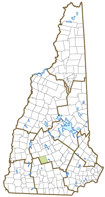
Town of Henniker
Diane Kendall, Town Administrator
18 Depot Hill Road
Henniker, NH
03242
|
| Telephone |
(603) 428-3221 |
| Fax |
(603) 428-4366 |
| E-mail |
townadministrator@hennikernh.gov |
| Web Site |
www.henniker.org
|
| Municipal Office Hours |
Town Administrator: Monday to Friday, 8-4; Town Clerk/Tax Collector: Monday, Wednesday, Friday, 8-4, Tuesday, 10-6, closed Thursday
|
| County |
Merrimack |
| Labor Market Area |
Hillsborough, NH LMA |
| Tourism Region |
Merrimack Valley |
| Planning Commission |
Central NH Regional |
| Regional Development |
Capital Regional Development Council
|
| Election Districts |
|
| US Congress |
District District 2 |
| Executive Council |
District District 2 |
| State Senate |
District District 7 |
| State Representative |
Merrimack County District 8 |
| Incorporated: 1768 |
| Origin: This area was first known as Number 6, one of a line of settlements running between the Merrimack and Connecticut Rivers. Some early settlers were families from Marlborough, Massachusetts, who named it New Marlborough. In 1752 the Masonian Proprietors granted the land to Andrew Todd, who gave it the name Todd's-town. The town was incorporated as Henniker in 1768 by Governor John Wentworth, in honor of Sir John Henniker, a London merchant who had shipping interests in Boston and Portsmouth prior to the Revolution. This town has the distinction of being the only Henniker on earth. |
| Villages and Place Names: Colby, Henniker Junction, West Henniker, Emerson Station
|
| Population, Year of the First Census Taken: 1,127 residents in 1790 |
| Population Trends: Population change for Thenniker totaled 3,429 over 50 years, from 2,348 in 1970 to 5,777 in 2020. The 2022 Census estimate for Thenniker was 6,189 residents, which ranked 57th among New Hampshire's incorporated cities and towns. |
| Population Density and Land Area, 2022 (US Census Bureau): 140.3 persons per square mile of land area. Henniker contains 44.1 square miles of land area and 0.7 square miles of inland water area. |
| Municipal Services |
| Type of Government |
Selectmen |
| Budget: Municipal Appropriations, 2022 |
$6,068,540 |
| Budget: School Appropriations, 2021-2022 |
$9,103,356 |
| Zoning Ordinance |
1973/23 |
| Master Plan |
2015 |
| Capitol Improvement Plan |
Yes |
| Industrial Plans Reviewed By |
Planning Board |
| Boards and Commissions | |
| Elected: | Selectmen; Planning; Cemetery; Water; Checklist; Library; Trust Funds |
| Appointed: | Please visit www.henniker.org for a list of boards & committees to which citizens may be appointed. |
| Public Library |
Tucker Free |
| Emergency Services |
| Police Department |
Full-time |
| Fire Department |
Municipal |
| Emergency Medical Service |
Municipal |
| Nearest Hospital(s) |
Distance |
Staffed Beds |
| Concord Hospital, Concord |
15 miles |
236 |
|
|
|
|
|
|
| Utilities |
| Electric Supplier |
Eversource Energy |
| Natural Gas Supplier |
None |
| Water Supplier |
Cogswell Springs Water Works |
| Sanitation |
Municipal |
| Municipal Wastewater Treatment Plant |
Yes |
| Solid Waste Disposal |
| Curbside Trash Pickup | Private |
| Pay-As-You-Throw Program | No |
| Recycling Program | Voluntary |
| Telephone Company |
TDS Telecom |
| Cellular Telephone Access |
Yes |
| Cable Television Access |
Yes |
| Public Access Television Station |
No |
| High Speed Internet Service: |
| Business | Yes |
| Residential | Yes |
| (NH Dept. of Revenue Administration) Property Taxes |
| 2022 Total Tax Rate (per $1,000 of value) |
$21.44 |
| 2022 Equalization Ratio |
98.7 |
| 2022 Full Value Tax Rate (per $1,000 of value) |
$20.90 |
| 2022 Percent of Local Assessed Value by Property Type |
| Residential Land and Buildings | 76.3% |
| Commercial Land and Buildings | 21.7% |
| Public Utilities, Current Use, and Other | 2.0% |
| (ACS 2017-2021) Housing |
| Total Housing Units |
2,287 |
| Single-Family Units, Detached or Attached |
1,603 |
| Units in Multiple-Family Structures: |
|
| Two to Four Units in Structure |
235 |
| Five or More Units in Structure |
307 |
| Mobile Homes and Other Housing Units |
142 |
(US Census Bureau) Population
(1-Year Estimates/Decennial) |
| Total Population |
Community |
County |
| 2022 |
6,189 |
156,020 |
| 2020 |
6,185 |
153,808 |
| 2010 |
4,836 |
146,445 |
| 2000 |
4,444 |
136,716 |
| 1990 |
4,164 |
120,618 |
| 1980 |
3,246 |
98,302 |
| |
| Demographics, American Community Survey (ACS) 2017-2021 |
| Population by Gender |
| Male: 3,024 |
|
Female: 2,647 |
| Population by Age Group |
| Under age 5 |
|
300 |
| Age 5 to 19 |
|
1,088 |
| Age 20 to 34 |
|
1,514 |
| Age 35 to 54 |
|
869 |
| Age 55 to 64 |
|
792 |
| Age 65 and over |
|
1,108 |
| Median Age |
|
33.0 years |
| Educational Attainment, population 25 years and over |
|
3,550 |
| High school graduate or higher |
|
97.9% |
| Bachelor's degree or higher |
|
38.4% |
| (ACS 2017-2021) Income, Inflation Adjusted $ |
| Per capita income |
$35,317 |
| Median family income |
$113,875 |
| Median household income |
$79,500 |
| Median Earnings, full-time, year-round workers |
| Male |
$46,761 |
| Female |
$52,574 |
| Individuals below the poverty level |
14.5% |
| (NHES - ELMI) Labor Force |
| Annual Average |
2012 |
2022 |
| Civilian Labor Force |
2,731 |
2,809 |
| Employed |
2,598 |
2,747 |
| Unemployed |
133 |
62 |
| Unemployment Rate |
4.9% |
2.2% |
| (NHES - ELMI) Employment & Wages |
| Annual Average Covered Employment |
2012 |
2022 |
| Goods Producing Industries |
| Average Employment |
307 |
310 |
| Average Weekly Wage |
$871 |
$1,209 |
| |
|
|
| Service Providing Industries |
| Average Employment |
1,149 |
1,191 |
| Average Weekly Wage |
$520 |
$833 |
| |
|
|
| Total Private Industry |
| Average Employment |
1,455 |
1,501 |
| Average Weekly Wage |
$594 |
$911 |
| |
|
|
| Government (Federal, State, and Local) |
| Average Employment |
218 |
181 |
| Average Weekly Wage |
$706 |
$951 |
| |
|
|
| Total, Private plus Government |
| Average Employment |
1,673 |
1,682 |
| Average Weekly Wage |
$609 |
$915 |
If "n" appears, data does not meet disclosure standards.
| (NH Dept. of Education) Education and Child Care |
| Schools students attend: |
Henniker operates grades K-8; grades 9-12 are part of John Stark Regional (Henniker, Weare) |
SAU 24 |
| Career Technology Center(s): |
Concord Regional Technical Center |
| Educational Facilities (includes Charter Schools) |
Elementary |
Middle/Junior High |
High School |
Private/Parochial |
| Number of Schools |
1 |
|
|
|
| Grade Levels |
P K 1-8 |
|
|
9-12 |
| Total Enrollment |
400 |
|
|
|
| 2022 NH Licensed Child Care Facilities (Bureau of Child Care Licensing): |
Total Facilities: 4 |
Total Capacity: 194 |
| Nearest Community/Technical College: NHTI-Concord |
| Nearest Colleges or Universities: New England; UNH School of Law, Granite State |
| Largest Businesses |
Product/Service |
Employees |
Established |
| Pats Peak |
Ski area |
22 year round/600+ Seasonal |
1965 |
| New England College |
Education |
216 |
1946 |
| Michie Corporation |
Ready mixed concrete, forms, stone |
70 |
1974 |
| Contoocook Artesian Well |
Water drilling |
20 |
|
| Henniker School District |
Education |
400 |
1985 |
| Henniker Crushed Stone |
Stone, sand |
23 |
1972 |
| Patenaude Lumber |
Lumber |
23 |
1978 |
| Town of Henniker |
Municipal services |
110 |
|
| HHP, Inc. |
Pallets, dimension lumber |
59 |
1966 |
|
|
|
|
Employer Information Supplied by Municipality
| (Distance estimated from city/town hall) Transportation |
| Road Access |
US Routes |
202 |
|
State Routes |
9, 114 |
| Nearest Interstate, Exit |
I-89, Exit 5 |
|
Distance |
9 miles |
| Railroad |
No |
| Public Transportation |
No |
| |
| Nearest Public Use Airport, General Aviation |
| Hawthorne-Feather, Antrim | Runway | 3,260 ft. asphalt |
| Lighted? |
Yes |
Navigational Aids? |
No |
| Nearest Airport with Scheduled Service |
| Manchester-Boston Regional |
Distance |
30 miles |
| Number of Passenger Airlines Serving Airport |
4 |
| |
| Driving distance to selected cities: |
| Manchester, NH |
31 miles |
| Portland, ME |
124 miles |
| Boston, MA |
82 miles |
| New York City, NY |
257 miles |
| Montreal, Quebec |
234 miles |
| (ACS 2017-2021) Commuting to Work |
| Workers 16 years and over |
2,942 |
| Drove alone, car/truck/van |
73.7% |
| Carpooled, car/truck/van |
5.9% |
| Public transportation |
0.0% |
| Walked |
5.3% |
| Other Means |
0.6% |
| Worked at home |
14.6% |
| Mean Travel Time to Work |
25.5 minutes |
| |
| Percent of Working Residents: |
(ACS 2017-2021) |
| Working in community of residence |
33.9% |
| Commuting to another NH community |
64.1% |
| Commuting out-of-state |
2.0% |
| Recreation, Attractions, and Events |
| Municipal Parks |
| YMCA/YWCA |
| Boys Club/Girls Club |
| Golf Courses |
| Swimming: Indoor Facility |
| Swimming: Outdoor Facility |
| Tennis Courts: Indoor Facility |
| Tennis Courts: Outdoor Facility |
| Ice Skating Rink: Indoor Facility |
| Bowling Facilities |
| Museums |
| Cinemas |
| Performing Arts Facilities |
| Tourist Attractions |
| Youth Organizations (i.e., Scouts, 4-H) |
| Youth Sports: Baseball |
| Youth Sports: Soccer |
| Youth Sports: Football |
| Youth Sports: Basketball |
| Youth Sports: Hockey |
| Campgrounds |
| Fishing/Hunting |
| Boating/Marinas |
| Snowmobile Trails |
| Bicycle Trails |
| Cross Country Skiing |
| Beach or Waterfront Recreational Area |
| Overnight or Day Camps |
| |
|
|
Nearest Ski Area(s): Pats Peak |
| |
|
|
Other: Canoeing; Kayaking; Hiking Trails; Community Center; Teen Center; Farmer's Market; Concert series; Riverwalk; Currier & Ives Byway |
Economic & Labor Market Information Bureau, NH Employment Security, October 2023. Community Response Received 7/6/23
All information regarding the communities is from sources deemed reliable and is submitted subject to errors, omissions, modifications, and withdrawals without notice. No warranty or representation is made as to the accuracy of the information contained herein. Specific questions regarding individual cities and towns should be directed to the community contact.


