 |
Community Contact |
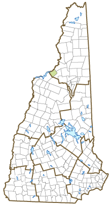
Town of Dalton
Jo Beth Dudley
756 Dalton Road
Dalton, NH
03598
|
| Telephone |
(603) 837-7027 |
| Fax |
(603) 837-9642 |
| E-mail |
selectmen@townofdalton.com |
| Web Site |
http://townofdalton.com
|
| Municipal Office Hours |
Selectboard: Wednesday, 8-2, Monday and Friday by appointment; Town Clerk/Tax Collector: Tuesday, 1-6, Thursday, 7-1
|
| County |
Coos |
| Labor Market Area |
Littleton, NH-VT LMA, NH part |
| Tourism Region |
Great North Woods |
| Planning Commission |
North Country Council |
| Regional Development |
Coos Economic Development Corp.
|
| Election Districts |
|
| US Congress |
District District 2 |
| Executive Council |
District District 1 |
| State Senate |
District District 1 |
| State Representative |
Coos County District 1 |
| Incorporated: 1784 |
| Origin: This territory, first granted in 1764 under the name Chiswick, originally encompassed Lisbon, Littleton, and Dalton. In 1770, a portion of the grant was renamed Apthorp, after relatives of the Wentworths. At that time, the grantees were bought out by Colonel Moses Little, commander of the 24th Massachusetts Bay Regiment and relative of the Apthorp family. In 1784, the grant was divided into two towns, Littleton, named for the Colonel, and Dalton, which bears the name of the Colonel's great-grandson, Tristram Dalton, a prominent colonial merchant and classmate of Governor John Wentworth at Harvard. |
| Villages and Place Names: Cushman, Scott
|
| Population, Year of the First Census Taken: 14 residents in 1790 |
| Population Trends: Population change for Dalton totaled 482 over 50 years, from 425 in 1970 to 907 in 2020. The 2022 Census estimate for Dalton was 931 residents, which ranked 189th among New Hampshire's incorporated cities and towns. |
| Population Density and Land Area, 2022 (US Census Bureau): 33.8 persons per square mile of land area. Dalton contains 27.5 square miles of land area and 0.8 square miles of inland water area. |
| Municipal Services |
| Type of Government |
Selectmen |
| Budget: Municipal Appropriations, 2023 |
$955,100 |
| Budget: School Appropriations, 2022-2023 |
$1,988,205 |
| Zoning Ordinance |
No Board |
| Master Plan |
2023 |
| Capitol Improvement Plan |
No |
| Industrial Plans Reviewed By |
Planning Board |
| Boards and Commissions | |
| Elected: | Selectmen; Library |
| Appointed: | Planning; Conservation |
| Public Library |
Dalton Public |
| Emergency Services |
| Police Department |
Part-time |
| Fire Department |
Volunteer |
| Emergency Medical Service |
Volunteer |
| Nearest Hospital(s) |
Distance |
Staffed Beds |
| Weeks Medical Center, Lancaster |
12 miles |
25 |
|
|
|
|
|
|
| Utilities |
| Electric Supplier |
Eversource Energy |
| Natural Gas Supplier |
None |
| Water Supplier |
Private wells |
| Sanitation |
Private septic |
| Municipal Wastewater Treatment Plant |
No |
| Solid Waste Disposal |
| Curbside Trash Pickup | None |
| Pay-As-You-Throw Program | Yes |
| Recycling Program | Voluntary |
| Telephone Company |
Consolidated Communications |
| Cellular Telephone Access |
Limited |
| Cable Television Access |
Limited |
| Public Access Television Station |
No |
| High Speed Internet Service: |
| Business | No |
| Residential | Limited |
| (NH Dept. of Revenue Administration) Property Taxes |
| 2022 Total Tax Rate (per $1,000 of value) |
$25.55 |
| 2022 Equalization Ratio |
54.5 |
| 2022 Full Value Tax Rate (per $1,000 of value) |
$13.88 |
| 2022 Percent of Local Assessed Value by Property Type |
| Residential Land and Buildings | 89.9% |
| Commercial Land and Buildings | 3.8% |
| Public Utilities, Current Use, and Other | 6.3% |
| (ACS 2017-2021) Housing |
| Total Housing Units |
564 |
| Single-Family Units, Detached or Attached |
386 |
| Units in Multiple-Family Structures: |
|
| Two to Four Units in Structure |
0 |
| Five or More Units in Structure |
0 |
| Mobile Homes and Other Housing Units |
178 |
(US Census Bureau) Population
(1-Year Estimates/Decennial) |
| Total Population |
Community |
County |
| 2022 |
931 |
31,504 |
| 2020 |
933 |
31,268 |
| 2010 |
979 |
33,055 |
| 2000 |
928 |
33,156 |
| 1990 |
824 |
34,879 |
| 1980 |
672 |
35,014 |
| |
| Demographics, American Community Survey (ACS) 2017-2021 |
| Population by Gender |
| Male: 434 |
|
Female: 601 |
| Population by Age Group |
| Under age 5 |
|
48 |
| Age 5 to 19 |
|
217 |
| Age 20 to 34 |
|
171 |
| Age 35 to 54 |
|
224 |
| Age 55 to 64 |
|
238 |
| Age 65 and over |
|
137 |
| Median Age |
|
41.6 years |
| Educational Attainment, population 25 years and over |
|
722 |
| High school graduate or higher |
|
90.4% |
| Bachelor's degree or higher |
|
18.8% |
| (ACS 2017-2021) Income, Inflation Adjusted $ |
| Per capita income |
$29,358 |
| Median family income |
$80,000 |
| Median household income |
$62,986 |
| Median Earnings, full-time, year-round workers |
| Male |
$55,948 |
| Female |
$41,750 |
| Individuals below the poverty level |
17.5% |
| (NHES - ELMI) Labor Force |
| Annual Average |
2012 |
2022 |
| Civilian Labor Force |
460 |
427 |
| Employed |
432 |
415 |
| Unemployed |
28 |
12 |
| Unemployment Rate |
6.1% |
2.8% |
| (NHES - ELMI) Employment & Wages |
| Annual Average Covered Employment |
2012 |
2022 |
| Goods Producing Industries |
| Average Employment |
7 |
n |
| Average Weekly Wage |
$940 |
n |
| |
|
|
| Service Providing Industries |
| Average Employment |
30 |
n |
| Average Weekly Wage |
$681 |
n |
| |
|
|
| Total Private Industry |
| Average Employment |
37 |
34 |
| Average Weekly Wage |
$733 |
$1,082 |
| |
|
|
| Government (Federal, State, and Local) |
| Average Employment |
11 |
17 |
| Average Weekly Wage |
$396 |
$273 |
| |
|
|
| Total, Private plus Government |
| Average Employment |
48 |
51 |
| Average Weekly Wage |
$656 |
$814 |
If "n" appears, data does not meet disclosure standards.
| (NH Dept. of Education) Education and Child Care |
| Schools students attend: |
Grades K-12 are part of White Mountains Regional (Carroll, Dalton, Jefferson, Lancaster, Whitefield) |
SAU 36 |
| Career Technology Center(s): |
Hugh J. Gallen Career & Technical Center (Littleton); White Mountains RHS (Whitefield) |
| Educational Facilities (includes Charter Schools) |
Elementary |
Middle/Junior High |
High School |
Private/Parochial |
| Number of Schools |
|
|
|
|
| Grade Levels |
|
|
|
9-12 |
| Total Enrollment |
|
|
|
|
| 2022 NH Licensed Child Care Facilities (Bureau of Child Care Licensing): |
Total Facilities: 0 |
Total Capacity: 0 |
| Nearest Community/Technical College: White Mountains |
| Nearest Colleges or Universities: Plymouth State; Northern VT - Lyndon (VT) |
| Largest Businesses |
Product/Service |
Employees |
Established |
| Town of Dalton |
Municipal services |
|
|
| Team O'Neil Rally School |
Driving School |
|
1997 |
| JR's Cycle Repair |
Motorcycle service/repair |
|
|
| Top of the Hill Store |
Convenience store/deli |
|
Hillside Gravel Pit |
| Quarry |
|
|
|
|
|
|
|
|
|
|
|
|
|
|
|
|
|
|
|
|
|
|
|
Employer Information Supplied by Municipality
| (Distance estimated from city/town hall) Transportation |
| Road Access |
US Routes |
|
|
State Routes |
135, 142 |
| Nearest Interstate, Exit |
I-93, Exit 43 |
|
Distance |
9 miles |
| Railroad |
Maine Central |
| Public Transportation |
No |
| |
| Nearest Public Use Airport, General Aviation |
| Mt Washington Reg, Whitefield | Runway | 4,001 ft. asphalt |
| Lighted? |
Yes |
Navigational Aids? |
Yes |
| Nearest Airport with Scheduled Service |
| Lebanon Municipal |
Distance |
76 miles |
| Number of Passenger Airlines Serving Airport |
1 |
| |
| Driving distance to selected cities: |
| Manchester, NH |
115 miles |
| Portland, ME |
113 miles |
| Boston, MA |
166 miles |
| New York City, NY |
346 miles |
| Montreal, Quebec |
175 miles |
| (ACS 2017-2021) Commuting to Work |
| Workers 16 years and over |
539 |
| Drove alone, car/truck/van |
82.6% |
| Carpooled, car/truck/van |
11.5% |
| Public transportation |
0.0% |
| Walked |
0.7% |
| Other Means |
1.7% |
| Worked at home |
3.5% |
| Mean Travel Time to Work |
21.6 minutes |
| |
| Percent of Working Residents: |
(ACS 2017-2021) |
| Working in community of residence |
5.6% |
| Commuting to another NH community |
90.1% |
| Commuting out-of-state |
4.3% |
| Recreation, Attractions, and Events |
| Municipal Parks |
| YMCA/YWCA |
| Boys Club/Girls Club |
| Golf Courses |
| Swimming: Indoor Facility |
| Swimming: Outdoor Facility |
| Tennis Courts: Indoor Facility |
| Tennis Courts: Outdoor Facility |
| Ice Skating Rink: Indoor Facility |
| Bowling Facilities |
| Museums |
| Cinemas |
| Performing Arts Facilities |
| Tourist Attractions |
| Youth Organizations (i.e., Scouts, 4-H) |
| Youth Sports: Baseball |
| Youth Sports: Soccer |
| Youth Sports: Football |
| Youth Sports: Basketball |
| Youth Sports: Hockey |
| Campgrounds |
| Fishing/Hunting |
| Boating/Marinas |
| Snowmobile Trails |
| Bicycle Trails |
| Cross Country Skiing |
| Beach or Waterfront Recreational Area |
| Overnight or Day Camps |
| |
|
|
Nearest Ski Area(s): Bretton Woods; Cannon |
| |
|
|
Other: Forest Lake State Park and Beach; Team O'Neil Rally School; David Dana Forest |
Economic & Labor Market Information Bureau, NH Employment Security, October 2023. Community Response Received 7/13/23
All information regarding the communities is from sources deemed reliable and is submitted subject to errors, omissions, modifications, and withdrawals without notice. No warranty or representation is made as to the accuracy of the information contained herein. Specific questions regarding individual cities and towns should be directed to the community contact.


