 |
Community Contact |
Columbia Board of Selectmen
Marcia Parkhurst, Secretary
PO Box 157
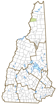
Colebrook, NH
03576
|
| Telephone |
(603) 237-5255 |
| Fax |
(603) 237-8270 |
| E-mail |
towncolumbia@myfairpoint.net |
| Web Site |
www.columbianh.org
|
| Municipal Office Hours |
Selectmen's Assistant/Town Clerk: Monday to Thursday, 10-4; Tax Collector: second and fourth Saturday each month, 10-12
|
| County |
Coos |
| Labor Market Area |
Colebrook, NH-VT LMA, NH part |
| Tourism Region |
Great North Woods |
| Planning Commission |
North Country Council |
| Regional Development |
Coos Economic Development Corp.
|
| Election Districts |
|
| US Congress |
District District 2 |
| Executive Council |
District District 1 |
| State Senate |
District District 1 |
| State Representative |
Coos County District 3 |
| Incorporated: 1797 |
| Origin: Columbia was first chartered in 1762, and named Preston for Richard Graham, Viscount Preston of Scotland. The original grantees were a members of the Society of Friends from Long Island, known as Quakers. The town was regranted in 1770 due to grantees failing to meet the prescribed terms, and renamed Cockburntown, after Sir James Cockburn of Scotland, and was so incorporated in 1797. The town kept that name until 1811, when Governor John Langdon renamed the town Columbia in the spirit of patriotism preceding the War of 1812. |
| Villages and Place Names: Bungy, Cones, Georges, Meriden Hill, Tinkerville
|
| Population, Year of the First Census Taken: 34 residents in 1790 |
| Population Trends: Population change for Columbia totaled 177 over 50 years, from 467 in 1970 to 644 in 2020. The 2022 Census estimate for Columbia was 660 residents, which ranked 211th among New Hampshire's incorporated cities and towns. |
| Population Density and Land Area, 2022 (US Census Bureau): 10.8 persons per square mile of land area. Columbia contains 61.2 square miles of land area and 0.1 square miles of inland water area. |
| Municipal Services |
| Type of Government |
Selectmen |
| Budget: Municipal Appropriations, 2021 |
$626,500 |
| Budget: School Appropriations, 2020-2021 |
$1,465,459 |
| Zoning Ordinance |
1971/10 |
| Master Plan |
2007 |
| Capitol Improvement Plan |
No |
| Industrial Plans Reviewed By |
Planning Board |
| Boards and Commissions | |
| Elected: | Selectmen; Planning; School |
| Appointed: | Conservation |
| Public Library |
No Library |
| Emergency Services |
| Police Department |
No |
| Fire Department |
No |
| Emergency Medical Service |
Volunteer |
| Nearest Hospital(s) |
Distance |
Staffed Beds |
| Upper Connecticut Valley, Colebrook |
5 miles |
16 |
|
|
|
|
|
|
| Utilities |
| Electric Supplier |
Eversource Energy; NH Electric Coop |
| Natural Gas Supplier |
None |
| Water Supplier |
Private wells |
| Sanitation |
Private septic |
| Municipal Wastewater Treatment Plant |
No |
| Solid Waste Disposal |
| Curbside Trash Pickup | Private |
| Pay-As-You-Throw Program | No |
| Recycling Program | Voluntary |
| Telephone Company |
Consolidated Communications |
| Cellular Telephone Access |
Limited |
| Cable Television Access |
Limited |
| Public Access Television Station |
No |
| High Speed Internet Service: |
| Business | Limited |
| Residential | Limited |
| (NH Dept. of Revenue Administration) Property Taxes |
| 2022 Total Tax Rate (per $1,000 of value) |
$15.30 |
| 2022 Equalization Ratio |
56.0 |
| 2022 Full Value Tax Rate (per $1,000 of value) |
$8.40 |
| 2022 Percent of Local Assessed Value by Property Type |
| Residential Land and Buildings | 66.6% |
| Commercial Land and Buildings | 3.8% |
| Public Utilities, Current Use, and Other | 29.6% |
| (ACS 2017-2021) Housing |
| Total Housing Units |
476 |
| Single-Family Units, Detached or Attached |
394 |
| Units in Multiple-Family Structures: |
|
| Two to Four Units in Structure |
2 |
| Five or More Units in Structure |
0 |
| Mobile Homes and Other Housing Units |
80 |
(US Census Bureau) Population
(1-Year Estimates/Decennial) |
| Total Population |
Community |
County |
| 2022 |
660 |
31,504 |
| 2020 |
659 |
31,268 |
| 2010 |
757 |
33,055 |
| 2000 |
752 |
33,156 |
| 1990 |
656 |
34,879 |
| 1980 |
673 |
35,014 |
| |
| Demographics, American Community Survey (ACS) 2017-2021 |
| Population by Gender |
| Male: 377 |
|
Female: 258 |
| Population by Age Group |
| Under age 5 |
|
2 |
| Age 5 to 19 |
|
120 |
| Age 20 to 34 |
|
90 |
| Age 35 to 54 |
|
154 |
| Age 55 to 64 |
|
130 |
| Age 65 and over |
|
139 |
| Median Age |
|
47.8 years |
| Educational Attainment, population 25 years and over |
|
462 |
| High school graduate or higher |
|
85.5% |
| Bachelor's degree or higher |
|
14.7% |
| (ACS 2017-2021) Income, Inflation Adjusted $ |
| Per capita income |
$36,558 |
| Median family income |
$63,438 |
| Median household income |
$47,708 |
| Median Earnings, full-time, year-round workers |
| Male |
$38,000 |
| Female |
$43,500 |
| Individuals below the poverty level |
14.0% |
| (NHES - ELMI) Labor Force |
| Annual Average |
2012 |
2022 |
| Civilian Labor Force |
327 |
318 |
| Employed |
305 |
306 |
| Unemployed |
22 |
12 |
| Unemployment Rate |
6.7% |
3.8% |
| (NHES - ELMI) Employment & Wages |
| Annual Average Covered Employment |
2012 |
2022 |
| Goods Producing Industries |
| Average Employment |
44 |
51 |
| Average Weekly Wage |
$938 |
$1,772 |
| |
|
|
| Service Providing Industries |
| Average Employment |
n |
22 |
| Average Weekly Wage |
n |
$288 |
| |
|
|
| Total Private Industry |
| Average Employment |
48 |
72 |
| Average Weekly Wage |
$881 |
$1,331 |
| |
|
|
| Government (Federal, State, and Local) |
| Average Employment |
6 |
6 |
| Average Weekly Wage |
$870 |
$1,019 |
| |
|
|
| Total, Private plus Government |
| Average Employment |
54 |
78 |
| Average Weekly Wage |
$879 |
$1,307 |
If "n" appears, data does not meet disclosure standards.
| (NH Dept. of Education) Education and Child Care |
| Schools students attend: |
Grades K-12 are tuitioned to Colebrook |
SAU 7 |
| Career Technology Center(s): |
Berlin Regional Career & Technical Center |
| Educational Facilities (includes Charter Schools) |
Elementary |
Middle/Junior High |
High School |
Private/Parochial |
| Number of Schools |
|
|
|
|
| Grade Levels |
|
|
|
9-12 |
| Total Enrollment |
|
|
|
|
| 2022 NH Licensed Child Care Facilities (Bureau of Child Care Licensing): |
Total Facilities: 0 |
Total Capacity: 0 |
| Nearest Community/Technical College: White Mountains |
| Nearest Colleges or Universities: Plymouth State; Northern VT - Lyndon (VT) |
| Largest Businesses |
Product/Service |
Employees |
Established |
| Columbia Sand & Gravel, Inc. |
Aggregate |
|
|
| Blue Mountain Variety |
Convenience store |
|
|
|
|
|
|
|
|
|
|
|
|
|
|
|
|
|
|
|
|
|
|
|
|
|
|
|
|
|
|
|
|
|
|
Employer Information Supplied by Municipality
| (Distance estimated from city/town hall) Transportation |
| Road Access |
US Routes |
3 |
|
State Routes |
|
| Nearest Interstate, Exit |
I-91 (VT), Exit 28; Aut-55 (QC), Exit 21 |
|
Distance |
45 miles; 46 miles |
| Railroad |
State owned line |
| Public Transportation |
No |
| |
| Nearest Public Use Airport, General Aviation |
| Gifford Field, Colebrook | Runway | 2,440 ft. turf |
| Lighted? |
No |
Navigational Aids? |
No |
| Nearest Airport with Scheduled Service |
| Portland (ME) International |
Distance |
139 miles |
| Number of Passenger Airlines Serving Airport |
8 |
| |
| Driving distance to selected cities: |
| Manchester, NH |
147 miles |
| Portland, ME |
135 miles |
| Boston, MA |
200 miles |
| New York City, NY |
379 miles |
| Montreal, Quebec |
132 miles |
| (ACS 2017-2021) Commuting to Work |
| Workers 16 years and over |
300 |
| Drove alone, car/truck/van |
77.7% |
| Carpooled, car/truck/van |
8.0% |
| Public transportation |
0.0% |
| Walked |
4.0% |
| Other Means |
3.7% |
| Worked at home |
6.7% |
| Mean Travel Time to Work |
23.7 minutes |
| |
| Percent of Working Residents: |
(ACS 2017-2021) |
| Working in community of residence |
16.0% |
| Commuting to another NH community |
75.0% |
| Commuting out-of-state |
9.0% |
| Recreation, Attractions, and Events |
| Municipal Parks |
| YMCA/YWCA |
| Boys Club/Girls Club |
| Golf Courses |
| Swimming: Indoor Facility |
| Swimming: Outdoor Facility |
| Tennis Courts: Indoor Facility |
| Tennis Courts: Outdoor Facility |
| Ice Skating Rink: Indoor Facility |
| Bowling Facilities |
| Museums |
| Cinemas |
| Performing Arts Facilities |
| Tourist Attractions |
| Youth Organizations (i.e., Scouts, 4-H) |
| Youth Sports: Baseball |
| Youth Sports: Soccer |
| Youth Sports: Football |
| Youth Sports: Basketball |
| Youth Sports: Hockey |
| Campgrounds |
| Fishing/Hunting |
| Boating/Marinas |
| Snowmobile Trails |
| Bicycle Trails |
| Cross Country Skiing |
| Beach or Waterfront Recreational Area |
| Overnight or Day Camps |
| |
|
|
Nearest Ski Area(s): Bretton Woods, Jay Peak |
| |
|
|
Other: Camps |
Economic & Labor Market Information Bureau, NH Employment Security, October 2023. Community Response Received 6/6/23
All information regarding the communities is from sources deemed reliable and is submitted subject to errors, omissions, modifications, and withdrawals without notice. No warranty or representation is made as to the accuracy of the information contained herein. Specific questions regarding individual cities and towns should be directed to the community contact.


