 |
Community Contact |
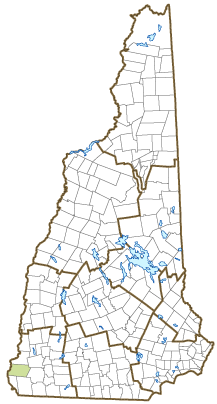
Town of Chesterfield
Alissa Thompson, Town Administrator
PO Box 175
Chesterfield, NH
03443
|
| Telephone |
(603) 363-4624 |
| Fax |
(603) 363-8047 |
| E-mail |
townadmin@nhchesterfield.com |
| Web Site |
www.nhchesterfield.com
|
| Municipal Office Hours |
Selectmen, Town Hall, and Assessors: Monday to Thursday, 8-4, Friday, 9-12; Town Clerk: Tuesday and Wednesday, 9-1 and 4-7, last Saturday each month by appointment; Tax Collector: Monday, 2-6
|
| County |
Cheshire |
| Labor Market Area |
Keene, NH Micropolitan NECTA |
| Tourism Region |
Monadnock |
| Planning Commission |
Southwest Region |
| Regional Development |
Monadnock Economic Development Corp.
|
| Election Districts |
|
| US Congress |
District District 2 |
| Executive Council |
District District 2 |
| State Senate |
District District 10 |
| State Representative |
Cheshire County Districts 6, 15 |
| Incorporated: 1752 |
| Origin: Established in 1735 while New Hampshire was still under governance of Massachusetts, this town was the site of Fort Number 1 in the line of protective trading forts bordering the Connecticut River. After New Hampshire became an independent province under Governor Benning Wentworth, the town was incorporated in 1752 as Chesterfield, after Philip Stanhope, fourth Earl of Chesterfield. The Earl served as Secretary of State and joined William Pitt in opposing what they considered England's unfair treatment of the American Colonies. Chesterfield was the birthplace of Harlan Fiske Stone, Chief Justice of the Supreme Court from 1941 to 1946. |
| Villages and Place Names: Spofford, West Chesterfield
|
| Population, Year of the First Census Taken: 1,905 residents in 1790 |
| Population Trends: Population change for Chesterfield totaled 1,749 over 50 years, from 1,817 in 1970 to 3,566 in 2020. The 2022 Census estimate for Chesterfield was 3,634 residents, which ranked 103rd among New Hampshire's incorporated cities and towns. |
| Population Density and Land Area, 2022 (US Census Bureau): 79.7 persons per square mile of land area. Chesterfield contains 45.6 square miles of land area and 2.0 square miles of inland water area. |
| Municipal Services |
| Type of Government |
Selectmen |
| Budget: Municipal Appropriations, 2021 |
$4,948,368 |
| Budget: School Appropriations, 2021-2022 |
$8,965,731 |
| Zoning Ordinance |
1956/22 |
| Master Plan |
2016 |
| Capitol Improvement Plan |
Yes |
| Industrial Plans Reviewed By |
Planning Board |
| Boards and Commissions | |
| Elected: | Selectmen; Budget; School; Library; Cemetery |
| Appointed: | Planning; Zoning; Conservation |
| Public Library |
Chesterfield Public |
| Emergency Services |
| Police Department |
Full-time |
| Fire Department |
Volunteer |
| Emergency Medical Service |
Volunteer |
| Nearest Hospital(s) |
Distance |
Staffed Beds |
| Brattleboro Memorial, Brattleboro VT |
9 miles |
47 |
| Cheshire Medical Center, Keene |
14 miles |
94 |
|
|
|
| Utilities |
| Electric Supplier |
Eversource Energy |
| Natural Gas Supplier |
None |
| Water Supplier |
Private wells |
| Sanitation |
Private septic |
| Municipal Wastewater Treatment Plant |
No |
| Solid Waste Disposal |
| Curbside Trash Pickup | None |
| Pay-As-You-Throw Program | No |
| Recycling Program | Mandatory |
| Telephone Company |
Consolidated Communications |
| Cellular Telephone Access |
Yes |
| Cable Television Access |
Yes |
| Public Access Television Station |
No |
| High Speed Internet Service: |
| Business | Yes |
| Residential | Yes |
| (NH Dept. of Revenue Administration) Property Taxes |
| 2022 Total Tax Rate (per $1,000 of value) |
$19.42 |
| 2022 Equalization Ratio |
75.7 |
| 2022 Full Value Tax Rate (per $1,000 of value) |
$14.65 |
| 2022 Percent of Local Assessed Value by Property Type |
| Residential Land and Buildings | 90.1% |
| Commercial Land and Buildings | 8.3% |
| Public Utilities, Current Use, and Other | 1.6% |
| (ACS 2017-2021) Housing |
| Total Housing Units |
1,892 |
| Single-Family Units, Detached or Attached |
1,746 |
| Units in Multiple-Family Structures: |
|
| Two to Four Units in Structure |
94 |
| Five or More Units in Structure |
0 |
| Mobile Homes and Other Housing Units |
52 |
(US Census Bureau) Population
(1-Year Estimates/Decennial) |
| Total Population |
Community |
County |
| 2022 |
3,634 |
77,350 |
| 2020 |
3,552 |
76,458 |
| 2010 |
3,604 |
77,117 |
| 2000 |
3,554 |
73,993 |
| 1990 |
3,080 |
70,223 |
| 1980 |
2,561 |
62,116 |
| |
| Demographics, American Community Survey (ACS) 2017-2021 |
| Population by Gender |
| Male: 2,049 |
|
Female: 1,513 |
| Population by Age Group |
| Under age 5 |
|
160 |
| Age 5 to 19 |
|
689 |
| Age 20 to 34 |
|
515 |
| Age 35 to 54 |
|
780 |
| Age 55 to 64 |
|
537 |
| Age 65 and over |
|
881 |
| Median Age |
|
45.7 years |
| Educational Attainment, population 25 years and over |
|
2,668 |
| High school graduate or higher |
|
93.6% |
| Bachelor's degree or higher |
|
40.8% |
| (ACS 2017-2021) Income, Inflation Adjusted $ |
| Per capita income |
$45,245 |
| Median family income |
$104,693 |
| Median household income |
$86,635 |
| Median Earnings, full-time, year-round workers |
| Male |
$58,813 |
| Female |
$52,201 |
| Individuals below the poverty level |
6.5% |
| (NHES - ELMI) Labor Force |
| Annual Average |
2012 |
2022 |
| Civilian Labor Force |
2,010 |
1,860 |
| Employed |
1,915 |
1,807 |
| Unemployed |
95 |
53 |
| Unemployment Rate |
4.7% |
2.8% |
| (NHES - ELMI) Employment & Wages |
| Annual Average Covered Employment |
2012 |
2022 |
| Goods Producing Industries |
| Average Employment |
166 |
114 |
| Average Weekly Wage |
$1,091 |
$1,423 |
| |
|
|
| Service Providing Industries |
| Average Employment |
1,008 |
1,216 |
| Average Weekly Wage |
$878 |
$1,147 |
| |
|
|
| Total Private Industry |
| Average Employment |
1,175 |
1,330 |
| Average Weekly Wage |
$908 |
$1,170 |
| |
|
|
| Government (Federal, State, and Local) |
| Average Employment |
138 |
129 |
| Average Weekly Wage |
$579 |
$767 |
| |
|
|
| Total, Private plus Government |
| Average Employment |
1,313 |
1,459 |
| Average Weekly Wage |
$873 |
$1,135 |
If "n" appears, data does not meet disclosure standards.
| (NH Dept. of Education) Education and Child Care |
| Schools students attend: |
Chesterfield operates grades K-8; grades 9-12 are tuitioned to Keene |
SAU 29 |
| Career Technology Center(s): |
Cheshire Career Center (Keene); Fall Mountain RHS - CTE |
| Educational Facilities (includes Charter Schools) |
Elementary |
Middle/Junior High |
High School |
Private/Parochial |
| Number of Schools |
1 |
|
|
|
| Grade Levels |
K 1-8 |
|
|
9-12 |
| Total Enrollment |
263 |
|
|
|
| 2022 NH Licensed Child Care Facilities (Bureau of Child Care Licensing): |
Total Facilities: 1 |
Total Capacity: 20 |
| Nearest Community/Technical College: River Valley |
| Nearest Colleges or Universities: Keene State; Franklin Pierce-Lebanon; Antioch New England |
| Largest Businesses |
Product/Service |
Employees |
Established |
| United Natural Foods |
Food warehouse |
|
1988 |
| Ames Performance |
Classic Pontiac Parts Distributor |
23 |
2008 |
| Fed Ex Ground |
Package delivery service |
28 |
2008 |
| Foard Panel |
Wall panel construction |
28+/- |
1988 |
| Thomas Companies |
Construction, drilling, & blasting |
65 |
1971 |
| Westfield Construction |
Construction |
15 |
1996 |
| Chesterfield Tire |
Tire sales and service |
13 |
1998 |
| Tire Warehouse |
Tire sales & service |
|
1990 |
| Perkins Home Center |
Home lumber supply |
45 |
1988 |
|
|
|
|
Employer Information Supplied by Municipality
| (Distance estimated from city/town hall) Transportation |
| Road Access |
US Routes |
|
|
State Routes |
9, 9A, 63 |
| Nearest Interstate, Exit |
I-91 (VT), Exit 3 |
|
Distance |
6 miles |
| Railroad |
No |
| Public Transportation |
No |
| |
| Nearest Public Use Airport, General Aviation |
| Dillant-Hopkins, Swanzey | Runway | 6,201 ft. asphalt |
| Lighted? |
Yes |
Navigational Aids? |
Yes |
| Nearest Airport with Scheduled Service |
| Manchester-Boston Regional |
Distance |
67 miles |
| Number of Passenger Airlines Serving Airport |
4 |
| |
| Driving distance to selected cities: |
| Manchester, NH |
78 miles |
| Portland, ME |
170 miles |
| Boston, MA |
110 miles |
| New York City, NY |
204 miles |
| Montreal, Quebec |
248 miles |
| (ACS 2017-2021) Commuting to Work |
| Workers 16 years and over |
1,676 |
| Drove alone, car/truck/van |
73.3% |
| Carpooled, car/truck/van |
7.5% |
| Public transportation |
0.0% |
| Walked |
2.3% |
| Other Means |
2.0% |
| Worked at home |
15.0% |
| Mean Travel Time to Work |
20.6 minutes |
| |
| Percent of Working Residents: |
(ACS 2017-2021) |
| Working in community of residence |
28.4% |
| Commuting to another NH community |
38.5% |
| Commuting out-of-state |
33.1% |
| Recreation, Attractions, and Events |
| Municipal Parks |
| YMCA/YWCA |
| Boys Club/Girls Club |
| Golf Courses |
| Swimming: Indoor Facility |
| Swimming: Outdoor Facility |
| Tennis Courts: Indoor Facility |
| Tennis Courts: Outdoor Facility |
| Ice Skating Rink: Indoor Facility |
| Bowling Facilities |
| Museums |
| Cinemas |
| Performing Arts Facilities |
| Tourist Attractions |
| Youth Organizations (i.e., Scouts, 4-H) |
| Youth Sports: Baseball |
| Youth Sports: Soccer |
| Youth Sports: Football |
| Youth Sports: Basketball |
| Youth Sports: Hockey |
| Campgrounds |
| Fishing/Hunting |
| Boating/Marinas |
| Snowmobile Trails |
| Bicycle Trails |
| Cross Country Skiing |
| Beach or Waterfront Recreational Area |
| Overnight or Day Camps |
| |
|
|
Nearest Ski Area(s): Mount Ascutney (VT) |
| |
|
|
Other: Chesterfield Gorge; Pisgah State Park |
Economic & Labor Market Information Bureau, NH Employment Security, October 2023. Community Response Received 6/1/23
All information regarding the communities is from sources deemed reliable and is submitted subject to errors, omissions, modifications, and withdrawals without notice. No warranty or representation is made as to the accuracy of the information contained herein. Specific questions regarding individual cities and towns should be directed to the community contact.


