 |
Community Contact |
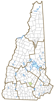
Town of Bow
David Stack, Town Manager
10 Grandview Road, Town Hall
Bow, NH
03304
|
| Telephone |
(603) 223-3910 |
| Fax |
(603) 224-6680 |
| E-mail |
dstack@bownh.gov |
| Web Site |
www.bownh.gov
|
| Municipal Office Hours |
Town Manager, Town Clerk/Tax Collector: Monday to Friday, 7:30-4
|
| County |
Merrimack |
| Labor Market Area |
Concord, NH Micropolitan NECTA |
| Tourism Region |
Merrimack Valley |
| Planning Commission |
Central NH Regional |
| Regional Development |
Capital Regional Development Council
|
| Election Districts |
|
| US Congress |
District District 2 |
| Executive Council |
District District 2 |
| State Senate |
District District 15 |
| State Representative |
Merrimack County District 9 |
| Incorporated: 1727 |
| Origin: This community was one of several established in the Merrimack Valley to relieve population congestion in the seacoast. When drawn on a map, the line of communities formed a bow. There is also a bend in the Merrimack River within its borders, and the name Bow may have come from either source. Grants in this expansion were given to many prominent Portsmouth families, causing concern by residents of Rumford to the north, who objected to being hemmed in from the south, and protested to the English crown against extension of such colonization. Upon settlement of the dispute, Rumford was renamed Concord. Bow is the birthplace of Mary Baker Eddy, founder of the First Church of Christ, Scientist and leader of the Christian Science movement. |
| Villages and Place Names: Bow Bog, Bow Center, Bow Junction, Bow Mills, South Bow
|
| Population, Year of the First Census Taken: 568 residents in 1790 |
| Population Trends: Population change for Bow totaled 5,849 over 50 years, from 2,479 in 1970 to 8,328 in 2020. The 2022 Census estimate for Bow was 8,386 residents, which ranked 39th among New Hampshire's incorporated cities and towns. |
| Population Density and Land Area, 2022 (US Census Bureau): 297.7 persons per square mile of land area. Bow contains 28.2 square miles of land area and 0.4 square miles of inland water area. |
| Municipal Services |
| Type of Government |
Selectmen/Town Manager |
| Budget: Municipal Appropriations, 2023-2024 |
$15,710,180 |
| Budget: School Appropriations, 2023-2024 |
$34,889,478 |
| Zoning Ordinance |
1955/22 |
| Master Plan |
2017 |
| Capitol Improvement Plan |
Yes |
| Industrial Plans Reviewed By |
Planning Board |
| Boards and Commissions | |
| Elected: | Selectmen; Budget; Trust Funds; Library |
| Appointed: | Planning; Zoning; Conservation; Business Development; Heritage; Recycling & Solid Waste; Drinking Water Protection; Capital Improvement Plan; Energy |
| Public Library |
Baker Free |
| Emergency Services |
| Police Department |
Full-time |
| Fire Department |
Full-time |
| Emergency Medical Service |
Full-time |
| Nearest Hospital(s) |
Distance |
Staffed Beds |
| Concord Hospital, Concord |
4 miles |
236 |
|
|
|
|
|
|
| Utilities |
| Electric Supplier |
Unitil; Eversource Energy |
| Natural Gas Supplier |
Liberty Utilities |
| Water Supplier |
Municipal; Private wells |
| Sanitation |
Private septic & municipal |
| Municipal Wastewater Treatment Plant |
Yes |
| Solid Waste Disposal |
| Curbside Trash Pickup | Municipal & private |
| Pay-As-You-Throw Program | No |
| Recycling Program | Voluntary - Curbside |
| Telephone Company |
Consolidated Communications; Dunbarton Telephone |
| Cellular Telephone Access |
Yes |
| Cable Television Access |
Yes |
| Public Access Television Station |
No |
| High Speed Internet Service: |
| Business | Yes |
| Residential | Yes |
| (NH Dept. of Revenue Administration) Property Taxes |
| 2022 Total Tax Rate (per $1,000 of value) |
$26.52 |
| 2022 Equalization Ratio |
66.1 |
| 2022 Full Value Tax Rate (per $1,000 of value) |
$17.20 |
| 2022 Percent of Local Assessed Value by Property Type |
| Residential Land and Buildings | 75.8% |
| Commercial Land and Buildings | 16.3% |
| Public Utilities, Current Use, and Other | 7.9% |
| (ACS 2017-2021) Housing |
| Total Housing Units |
2,823 |
| Single-Family Units, Detached or Attached |
2,667 |
| Units in Multiple-Family Structures: |
|
| Two to Four Units in Structure |
24 |
| Five or More Units in Structure |
132 |
| Mobile Homes and Other Housing Units |
0 |
(US Census Bureau) Population
(1-Year Estimates/Decennial) |
| Total Population |
Community |
County |
| 2022 |
8,386 |
156,020 |
| 2020 |
8,229 |
153,808 |
| 2010 |
7,519 |
146,445 |
| 2000 |
7,168 |
136,716 |
| 1990 |
5,399 |
120,618 |
| 1980 |
4,015 |
98,302 |
| |
| Demographics, American Community Survey (ACS) 2017-2021 |
| Population by Gender |
| Male: 4,065 |
|
Female: 4,162 |
| Population by Age Group |
| Under age 5 |
|
566 |
| Age 5 to 19 |
|
1,766 |
| Age 20 to 34 |
|
1,108 |
| Age 35 to 54 |
|
2,306 |
| Age 55 to 64 |
|
1,188 |
| Age 65 and over |
|
1,293 |
| Median Age |
|
41.1 years |
| Educational Attainment, population 25 years and over |
|
5,560 |
| High school graduate or higher |
|
97.6% |
| Bachelor's degree or higher |
|
57.9% |
| (ACS 2017-2021) Income, Inflation Adjusted $ |
| Per capita income |
$55,016 |
| Median family income |
$138,933 |
| Median household income |
$132,774 |
| Median Earnings, full-time, year-round workers |
| Male |
$94,688 |
| Female |
$67,202 |
| Individuals below the poverty level |
1.6% |
| (NHES - ELMI) Labor Force |
| Annual Average |
2012 |
2022 |
| Civilian Labor Force |
4,342 |
4,462 |
| Employed |
4,167 |
4,368 |
| Unemployed |
175 |
94 |
| Unemployment Rate |
4.0% |
2.1% |
| (NHES - ELMI) Employment & Wages |
| Annual Average Covered Employment |
2012 |
2022 |
| Goods Producing Industries |
| Average Employment |
1,219 |
1,323 |
| Average Weekly Wage |
$987 |
$1,399 |
| |
|
|
| Service Providing Industries |
| Average Employment |
1,804 |
2,084 |
| Average Weekly Wage |
$1,013 |
$1,316 |
| |
|
|
| Total Private Industry |
| Average Employment |
3,022 |
3,407 |
| Average Weekly Wage |
$1,002 |
$1,348 |
| |
|
|
| Government (Federal, State, and Local) |
| Average Employment |
459 |
468 |
| Average Weekly Wage |
$858 |
$1,050 |
| |
|
|
| Total, Private plus Government |
| Average Employment |
3,482 |
3,876 |
| Average Weekly Wage |
$983 |
$1,312 |
If "n" appears, data does not meet disclosure standards.
| (NH Dept. of Education) Education and Child Care |
| Schools students attend: |
Bow operates grades K-12 |
SAU 67 |
| Career Technology Center(s): |
Concord Regional Technical Center |
| Educational Facilities (includes Charter Schools) |
Elementary |
Middle/Junior High |
High School |
Private/Parochial |
| Number of Schools |
1 |
1 |
1 |
1 |
| Grade Levels |
P K 1-4 |
5-8 |
9-12 |
P K 1-4 |
| Total Enrollment |
533 |
526 |
603 |
48 |
| 2022 NH Licensed Child Care Facilities (Bureau of Child Care Licensing): |
Total Facilities: 5 |
Total Capacity: 194 |
| Nearest Community/Technical College: NHTI-Concord; Manchestser |
| Nearest Colleges or Universities: Granite State; UNH School of Law; Southern NH University; St. Anselm, UNH-Manchester; Franklin Pierce-Manchester; MCPHS; New England |
| Largest Businesses |
Product/Service |
Employees |
Established |
| The Grappone Companies |
New, used vehicle sales & service |
300 |
1924 |
| Pitco/MagiKitch'n |
Commercial cooking equipment |
280 |
1918 |
| R.S. Audley, Inc. |
General construction contractor |
175 |
1955 |
| Granite Shore Power |
Electric utility |
120 |
1960 |
| Amoskeag Beverages, LLC |
Beer wholesaler |
75 |
2006 |
| Structures Unlimited/Keller/Kalwall |
Skylight systems |
75 |
1968 |
| Hampton Inn |
Hotel |
57 |
1990 |
| Bovie Screen Printing |
Industrial, commercial screen printing |
38 |
1987 |
| Coastal & Quality Wood Priming |
Siding, decking, and engineered wood products |
150 |
1998 |
| Exel/DHL |
State Liquor Commission Warehouse & Distribution |
170 |
2013 |
Employer Information Supplied by Municipality
| (Distance estimated from city/town hall) Transportation |
| Road Access |
US Routes |
|
|
State Routes |
3A, 13 |
| Nearest Interstate, Exit |
I-89, Exit 1; I-93, Exit 12 |
|
Distance |
Local access; 1 mile |
| Railroad |
Boston & Maine |
| Public Transportation |
No |
| |
| Nearest Public Use Airport, General Aviation |
| Concord Municipal | Runway | 6,005 ft. asphalt |
| Lighted? |
Yes |
Navigational Aids? |
Yes |
| Nearest Airport with Scheduled Service |
| Manchester-Boston Regional |
Distance |
21 miles |
| Number of Passenger Airlines Serving Airport |
4 |
| |
| Driving distance to selected cities: |
| Manchester, NH |
15 miles |
| Portland, ME |
107 miles |
| Boston, MA |
65 miles |
| New York City, NY |
262 miles |
| Montreal, Quebec |
244 miles |
| (ACS 2017-2021) Commuting to Work |
| Workers 16 years and over |
4,556 |
| Drove alone, car/truck/van |
80.2% |
| Carpooled, car/truck/van |
6.4% |
| Public transportation |
0.2% |
| Walked |
0.6% |
| Other Means |
0.5% |
| Worked at home |
12.1% |
| Mean Travel Time to Work |
26.1 minutes |
| |
| Percent of Working Residents: |
(ACS 2017-2021) |
| Working in community of residence |
20.3% |
| Commuting to another NH community |
74.7% |
| Commuting out-of-state |
5.0% |
| Recreation, Attractions, and Events |
| Municipal Parks |
| YMCA/YWCA |
| Boys Club/Girls Club |
| Golf Courses |
| Swimming: Indoor Facility |
| Swimming: Outdoor Facility |
| Tennis Courts: Indoor Facility |
| Tennis Courts: Outdoor Facility |
| Ice Skating Rink: Indoor Facility |
| Bowling Facilities |
| Museums |
| Cinemas |
| Performing Arts Facilities |
| Tourist Attractions |
| Youth Organizations (i.e., Scouts, 4-H) |
| Youth Sports: Baseball |
| Youth Sports: Soccer |
| Youth Sports: Football |
| Youth Sports: Basketball |
| Youth Sports: Hockey |
| Campgrounds |
| Fishing/Hunting |
| Boating/Marinas |
| Snowmobile Trails |
| Bicycle Trails |
| Cross Country Skiing |
| Beach or Waterfront Recreational Area |
| Overnight or Day Camps |
| |
|
|
Nearest Ski Area(s): Pat's Peak, Mount Sunapee |
| |
|
|
Other: Summer Concert Series |
Economic & Labor Market Information Bureau, NH Employment Security, October 2023. Community Response Received 6/1/23
All information regarding the communities is from sources deemed reliable and is submitted subject to errors, omissions, modifications, and withdrawals without notice. No warranty or representation is made as to the accuracy of the information contained herein. Specific questions regarding individual cities and towns should be directed to the community contact.


