 |
Community Contact |
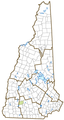
Town of Antrim
Russell McAllister, Town Administrator
66 Main Street, PO Box 517
Antrim, NH
03440
|
| Telephone |
(603) 588-6785 |
| Fax |
(603) 588-2969 |
| E-mail |
townadmin@antrimnh.gov |
| Web Site |
www.antrimnh.org
|
| Municipal Office Hours |
Town Administrator: Monday to Thursday, 8-4; Town Clerk/Tax Collector: Monday, 8-6, Tuesday, 8-12, Wednesday and Thursday, 8-12 and 1-4
|
| County |
Hillsborough |
| Labor Market Area |
Peterborough, NH LMA |
| Tourism Region |
Monadnock |
| Planning Commission |
Southwest Region |
| Regional Development |
Monadnock Economic Development Corp.
|
| Election Districts |
|
| US Congress |
District District 2 |
| Executive Council |
District District 5 |
| State Senate |
District District 8 |
| State Representative |
Hillsborough County District 30 |
| Incorporated: 1777 |
| Origin: Though settled prior to the Revolution, this community was not incorporated as Antrim until 1777. It was originally part of the Society Land, or Cumberland, named for the Duke of Cumberland, King George II's son and commander of English troops in the war with France. This large tract of land adjacent to Mount Monadnock had been set aside by the Portsmouth Proprietors for private estates. The land was later purchased by Philip Riley, who named the town for County Antrim in Ireland, his native home. Nathaniel Hawthorne College was established in Antrim in 1962; the school closed in 1988. |
| Villages and Place Names: Antrim Center, Clinton Village, Loverens Mill, North Branch
|
| Population, Year of the First Census Taken: 528 residents in 1790 |
| Population Trends: Population change for Antrim totaled 533 over 50 years, from 2,122 in 1970 to 2,655 in 2020. The 2022 Census estimate for Antrim was 2,682 residents, which ranked 119th among New Hampshire's incorporated cities and towns. |
| Population Density and Land Area, 2022 (US Census Bureau): 75.2 persons per square mile of land area. Antrim contains 35.7 square miles of land area and 0.8 square miles of inland water area. |
| Municipal Services |
| Type of Government |
Selectmen |
| Budget: Municipal Appropriations, 2021 |
$7,738,972 |
| Budget: School Appropriations, 2020-2021 |
$6,580,430 |
| Zoning Ordinance |
1974/14 |
| Master Plan |
2010 |
| Capitol Improvement Plan |
Yes |
| Industrial Plans Reviewed By |
Planning Board |
| Boards and Commissions | |
| Elected: | Selectmen; Planning; Library; Cemetery |
| Appointed: | Conservation; ZBA |
| Public Library |
James A. Tuttle |
| Emergency Services |
| Police Department |
Full-time |
| Fire Department |
Volunteer |
| Emergency Medical Service |
Volunteer |
| Nearest Hospital(s) |
Distance |
Staffed Beds |
| Monadnock Community, Peterborough |
12 miles |
25 |
|
|
|
|
|
|
| Utilities |
| Electric Supplier |
Eversource Energy |
| Natural Gas Supplier |
None |
| Water Supplier |
Antrim Water Department |
| Sanitation |
Municipal |
| Municipal Wastewater Treatment Plant |
Yes |
| Solid Waste Disposal |
| Curbside Trash Pickup | None |
| Pay-As-You-Throw Program | No |
| Recycling Program | Mandatory |
| Telephone Company |
TDS Telecom |
| Cellular Telephone Access |
Yes |
| Cable Television Access |
Yes |
| Public Access Television Station |
No |
| High Speed Internet Service: |
| Business | Yes |
| Residential | Yes |
| (NH Dept. of Revenue Administration) Property Taxes |
| 2022 Total Tax Rate (per $1,000 of value) |
$27.86 |
| 2022 Equalization Ratio |
62.5 |
| 2022 Full Value Tax Rate (per $1,000 of value) |
$17.28 |
| 2022 Percent of Local Assessed Value by Property Type |
| Residential Land and Buildings | 85.4% |
| Commercial Land and Buildings | 5.9% |
| Public Utilities, Current Use, and Other | 8.6% |
| (ACS 2017-2021) Housing |
| Total Housing Units |
1,344 |
| Single-Family Units, Detached or Attached |
1,096 |
| Units in Multiple-Family Structures: |
|
| Two to Four Units in Structure |
159 |
| Five or More Units in Structure |
70 |
| Mobile Homes and Other Housing Units |
19 |
(US Census Bureau) Population
(1-Year Estimates/Decennial) |
| Total Population |
Community |
County |
| 2022 |
2,682 |
426,594 |
| 2020 |
2,651 |
422,937 |
| 2010 |
2,637 |
400,721 |
| 2000 |
2,455 |
382,384 |
| 1990 |
2,350 |
336,549 |
| 1980 |
2,208 |
276,608 |
| |
| Demographics, American Community Survey (ACS) 2017-2021 |
| Population by Gender |
| Male: 1,402 |
|
Female: 1,253 |
| Population by Age Group |
| Under age 5 |
|
132 |
| Age 5 to 19 |
|
492 |
| Age 20 to 34 |
|
511 |
| Age 35 to 54 |
|
521 |
| Age 55 to 64 |
|
550 |
| Age 65 and over |
|
449 |
| Median Age |
|
42.5 years |
| Educational Attainment, population 25 years and over |
|
1,931 |
| High school graduate or higher |
|
96.6% |
| Bachelor's degree or higher |
|
31.5% |
| (ACS 2017-2021) Income, Inflation Adjusted $ |
| Per capita income |
$36,427 |
| Median family income |
$74,444 |
| Median household income |
$68,450 |
| Median Earnings, full-time, year-round workers |
| Male |
$58,403 |
| Female |
$51,477 |
| Individuals below the poverty level |
4.9% |
| (NHES - ELMI) Labor Force |
| Annual Average |
2012 |
2022 |
| Civilian Labor Force |
1,407 |
1,382 |
| Employed |
1,328 |
1,346 |
| Unemployed |
79 |
36 |
| Unemployment Rate |
5.6% |
2.6% |
| (NHES - ELMI) Employment & Wages |
| Annual Average Covered Employment |
2012 |
2022 |
| Goods Producing Industries |
| Average Employment |
49 |
59 |
| Average Weekly Wage |
$634 |
$890 |
| |
|
|
| Service Providing Industries |
| Average Employment |
275 |
321 |
| Average Weekly Wage |
$483 |
$891 |
| |
|
|
| Total Private Industry |
| Average Employment |
324 |
380 |
| Average Weekly Wage |
$506 |
$891 |
| |
|
|
| Government (Federal, State, and Local) |
| Average Employment |
54 |
53 |
| Average Weekly Wage |
$731 |
$888 |
| |
|
|
| Total, Private plus Government |
| Average Employment |
378 |
433 |
| Average Weekly Wage |
$538 |
$891 |
If "n" appears, data does not meet disclosure standards.
| (NH Dept. of Education) Education and Child Care |
| Schools students attend: |
Grades K-12 are part of Contoocook Valley Cooperative (Antrim, Bennington, Dublin, Francestown, Greenfield, Hancock, Peterborough, Sharon, Temple) |
SAU 1 |
| Career Technology Center(s): |
Region 14 Applied Technology Center |
| Educational Facilities (includes Charter Schools) |
Elementary |
Middle/Junior High |
High School |
Private/Parochial |
| Number of Schools |
1 |
1 |
|
1 |
| Grade Levels |
P K 1-4 |
5-8 |
|
5-12 |
| Total Enrollment |
128 |
224 |
|
7 |
| 2022 NH Licensed Child Care Facilities (Bureau of Child Care Licensing): |
Total Facilities: 1 |
Total Capacity: 24 |
| Nearest Community/Technical College: Manchester; NHTI-Concord |
| Nearest Colleges or Universities: New England; Magdalen |
| Largest Businesses |
Product/Service |
Employees |
Established |
| Robblee Tree Service |
Tree care |
6 |
2000 |
| Town of Antrim |
Municipal services |
22 |
1777 |
| Brailsford |
Manufacturer of electric meters |
25 |
2002 |
| Edmunds Hardware |
Hardware |
9 |
1955 |
| Antrim Lumber |
Lumber sales |
8 |
1960 |
| Antrim Marketplace |
Convenience store |
10 |
2003 |
| Bank of NH |
Banking services |
6 |
1990 |
| Landsite Corp |
Construction |
12 |
1997 |
| Rymes Heating Oils, Inc. |
Heating oil/propane delivery & service |
15 |
1969 |
| T-Bird Mini-Mart & Dunkin Donuts |
Convenience store & donut shop |
10 |
1985 |
Employer Information Supplied by Municipality
| (Distance estimated from city/town hall) Transportation |
| Road Access |
US Routes |
202 |
|
State Routes |
9, 31, 123 |
| Nearest Interstate, Exit |
I-89, Exit 5 |
|
Distance |
21 miles |
| Railroad |
No |
| Public Transportation |
No |
| |
| Nearest Public Use Airport, General Aviation |
| Hawthorne-Feather, Antrim | Runway | 3,260 ft. asphalt |
| Lighted? |
Yes |
Navigational Aids? |
No |
| Nearest Airport with Scheduled Service |
| Manchester-Boston Regional |
Distance |
32 miles |
| Number of Passenger Airlines Serving Airport |
4 |
| |
| Driving distance to selected cities: |
| Manchester, NH |
44 miles |
| Portland, ME |
136 miles |
| Boston, MA |
94 miles |
| New York City, NY |
245 miles |
| Montreal, Quebec |
246 miles |
| (ACS 2017-2021) Commuting to Work |
| Workers 16 years and over |
1,281 |
| Drove alone, car/truck/van |
81.5% |
| Carpooled, car/truck/van |
8.1% |
| Public transportation |
0.0% |
| Walked |
0.8% |
| Other Means |
0.8% |
| Worked at home |
8.8% |
| Mean Travel Time to Work |
34.2 minutes |
| |
| Percent of Working Residents: |
(ACS 2017-2021) |
| Working in community of residence |
20.5% |
| Commuting to another NH community |
73.3% |
| Commuting out-of-state |
6.2% |
| Recreation, Attractions, and Events |
| Municipal Parks |
| YMCA/YWCA |
| Boys Club/Girls Club |
| Golf Courses |
| Swimming: Indoor Facility |
| Swimming: Outdoor Facility |
| Tennis Courts: Indoor Facility |
| Tennis Courts: Outdoor Facility |
| Ice Skating Rink: Indoor Facility |
| Bowling Facilities |
| Museums |
| Cinemas |
| Performing Arts Facilities |
| Tourist Attractions |
| Youth Organizations (i.e., Scouts, 4-H) |
| Youth Sports: Baseball |
| Youth Sports: Soccer |
| Youth Sports: Football |
| Youth Sports: Basketball |
| Youth Sports: Hockey |
| Campgrounds |
| Fishing/Hunting |
| Boating/Marinas |
| Snowmobile Trails |
| Bicycle Trails |
| Cross Country Skiing |
| Beach or Waterfront Recreational Area |
| Overnight or Day Camps |
| |
|
|
Nearest Ski Area(s): Crotched Mountain |
| |
|
|
Other: Outdoor Ice Skating Rink; Town Hall Movies; Willard Pond Sanctuary |
Economic & Labor Market Information Bureau, NH Employment Security, October 2023. Community Response Received 6/6/23
All information regarding the communities is from sources deemed reliable and is submitted subject to errors, omissions, modifications, and withdrawals without notice. No warranty or representation is made as to the accuracy of the information contained herein. Specific questions regarding individual cities and towns should be directed to the community contact.


