 |
Community Contact |
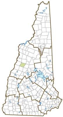
Town of Wentworth
Erin D. Ganzel, Town Administrator
7 Atwell Hill Rd., PO Box 2
Wentworth, NH
03282-0002
|
| Telephone |
(603) 764-9955 |
| Fax |
(603) 764-9362 |
| E-mail |
townofwentworth@wentworth-nh.org |
| Web Site |
www.wentworth-nh.org
|
| Municipal Office Hours |
Administrative Assistant: Tuesday, 1-5, Wednesday and Thursday, 9-1, or by appointment; Town Clerk/Tax Collector: Tuesday, 9-7, Wednesday and Thursday, 9-2
|
| County |
Grafton |
| Labor Market Area |
Plymouth, NH LMA |
| Tourism Region |
Dartmouth-Lake Sunapee |
| Planning Commission |
North Country Council |
| Regional Development |
Grafton County Economic Development Council
|
| Election Districts |
|
| US Congress |
District District 2 |
| Executive Council |
District District 2 |
| State Senate |
District District 5 |
| State Representative |
Grafton County District 6 |
| Incorporated: 1766 |
| Origin: This town was first chartered in 1766 to John Page and others, and named Wentworth, in honor of Governor Benning Wentworth. The grantees were given five years to meet the terms of the grant, and the majority were unable to do so, forfeiting their claim. In 1772, Asa Porter and others from Haverhill petitioned Governor John Wentworth, Benning's nephew, for some of the forfeited shares, which was granted. Between them the Wentworth governors issued over 150 new town charters in New Hampshire, and nearly 130 new town charters in what is now Vermont, providing homes and farms for over 30,000 families. |
| Villages and Place Names: unknown
|
| Population, Year of the First Census Taken: 241 residents in 1790 |
| Population Trends: Population change for Wentworth totaled 473 over 50 years, from 376 in 1970 to 849 in 2020. The 2022 Census estimate for Wentworth was 855 residents, which ranked 193rd among New Hampshire's incorporated cities and towns. |
| Population Density and Land Area, 2022 (US Census Bureau): 20.4 persons per square mile of land area. Wentworth contains 41.8 square miles of land area and 0.3 square miles of inland water area. |
| Municipal Services |
| Type of Government |
Selectmen |
| Budget: Municipal Appropriations, 2021 |
$1,397,916 |
| Budget: School Appropriations, 2021-2022 |
$1,794,299 |
| Zoning Ordinance |
No Board |
| Master Plan |
2023 |
| Capitol Improvement Plan |
No |
| Industrial Plans Reviewed By |
Planning Board |
| Boards and Commissions | |
| Elected: | Selectmen; Planning; Trust Funds; Cemetery; School; School Treasurer; Town Clerk/Tax Collector; Library; Moderator; Checklist; Treasurer; Fire Commissioner |
| Appointed: | Conservation |
| Public Library |
Webster Memorial |
| Emergency Services |
| Police Department |
Part-time |
| Fire Department |
Volunteer |
| Emergency Medical Service |
Private - Full-time |
| Nearest Hospital(s) |
Distance |
Staffed Beds |
| Speare Memorial, Plymouth |
16 miles |
25 |
|
|
|
|
|
|
| Utilities |
| Electric Supplier |
NH Electric Coop |
| Natural Gas Supplier |
Dead River |
| Water Supplier |
Private wells |
| Sanitation |
Private septic |
| Municipal Wastewater Treatment Plant |
No |
| Solid Waste Disposal |
| Curbside Trash Pickup | None |
| Pay-As-You-Throw Program | No |
| Recycling Program | Voluntary |
| Telephone Company |
Consolidated Communications; Time Warner |
| Cellular Telephone Access |
Limited |
| Cable Television Access |
Limited |
| Public Access Television Station |
Yes |
| High Speed Internet Service: |
| Business | Limited |
| Residential | Limited |
| (NH Dept. of Revenue Administration) Property Taxes |
| 2022 Total Tax Rate (per $1,000 of value) |
$20.22 |
| 2022 Equalization Ratio |
69.7 |
| 2022 Full Value Tax Rate (per $1,000 of value) |
$14.07 |
| 2022 Percent of Local Assessed Value by Property Type |
| Residential Land and Buildings | 84.0% |
| Commercial Land and Buildings | 8.2% |
| Public Utilities, Current Use, and Other | 7.8% |
| (ACS 2017-2021) Housing |
| Total Housing Units |
563 |
| Single-Family Units, Detached or Attached |
482 |
| Units in Multiple-Family Structures: |
|
| Two to Four Units in Structure |
38 |
| Five or More Units in Structure |
0 |
| Mobile Homes and Other Housing Units |
43 |
(US Census Bureau) Population
(1-Year Estimates/Decennial) |
| Total Population |
Community |
County |
| 2022 |
855 |
91,126 |
| 2020 |
845 |
91,118 |
| 2010 |
911 |
89,118 |
| 2000 |
797 |
81,826 |
| 1990 |
631 |
74,998 |
| 1980 |
527 |
65,806 |
| |
| Demographics, American Community Survey (ACS) 2017-2021 |
| Population by Gender |
| Male: 626 |
|
Female: 473 |
| Population by Age Group |
| Under age 5 |
|
161 |
| Age 5 to 19 |
|
100 |
| Age 20 to 34 |
|
207 |
| Age 35 to 54 |
|
193 |
| Age 55 to 64 |
|
144 |
| Age 65 and over |
|
294 |
| Median Age |
|
44.3 years |
| Educational Attainment, population 25 years and over |
|
781 |
| High school graduate or higher |
|
94.8% |
| Bachelor's degree or higher |
|
34.6% |
| (ACS 2017-2021) Income, Inflation Adjusted $ |
| Per capita income |
$39,177 |
| Median family income |
$96,607 |
| Median household income |
$79,375 |
| Median Earnings, full-time, year-round workers |
| Male |
$52,460 |
| Female |
$50,889 |
| Individuals below the poverty level |
11.7% |
| (NHES - ELMI) Labor Force |
| Annual Average |
2012 |
2022 |
| Civilian Labor Force |
455 |
506 |
| Employed |
437 |
491 |
| Unemployed |
18 |
15 |
| Unemployment Rate |
4.0% |
3.0% |
| (NHES - ELMI) Employment & Wages |
| Annual Average Covered Employment |
2012 |
2022 |
| Goods Producing Industries |
| Average Employment |
116 |
112 |
| Average Weekly Wage |
$705 |
$1,017 |
| |
|
|
| Service Providing Industries |
| Average Employment |
39 |
35 |
| Average Weekly Wage |
$462 |
$574 |
| |
|
|
| Total Private Industry |
| Average Employment |
155 |
148 |
| Average Weekly Wage |
$644 |
$911 |
| |
|
|
| Government (Federal, State, and Local) |
| Average Employment |
41 |
40 |
| Average Weekly Wage |
$496 |
$625 |
| |
|
|
| Total, Private plus Government |
| Average Employment |
196 |
188 |
| Average Weekly Wage |
$613 |
$849 |
If "n" appears, data does not meet disclosure standards.
| (NH Dept. of Education) Education and Child Care |
| Schools students attend: |
Wentworth operates grades K-8; grades 9-12 are part of Pemi-Baker Cooperative (Ashland, Campton, Holderness, Plymouth, Rumney, Thornton, Wentworth) |
SAU 48 |
| Career Technology Center(s): |
Plymouth Applied Technology Center |
| Educational Facilities (includes Charter Schools) |
Elementary |
Middle/Junior High |
High School |
Private/Parochial |
| Number of Schools |
1 |
|
|
|
| Grade Levels |
K 1-8 |
|
|
|
| Total Enrollment |
68 |
|
|
|
| 2022 NH Licensed Child Care Facilities (Bureau of Child Care Licensing): |
Total Facilities: 0 |
Total Capacity: 0 |
| Nearest Community/Technical College: Lakes Region |
| Nearest Colleges or Universities: Plymouth State |
| Largest Businesses |
Product/Service |
Employees |
Established |
| King Forest Lumber Co. |
Wood, lumber products |
141 |
1994 |
| Precision Lumber |
Wood, lumber |
45 |
1994 |
| Shawnee's |
Grocery store |
5 |
2008 |
| Dollar General |
Discount store |
6 |
2019 |
|
|
|
|
|
|
|
|
|
|
|
|
|
|
|
|
|
|
|
|
|
|
|
|
Employer Information Supplied by Municipality
| (Distance estimated from city/town hall) Transportation |
| Road Access |
US Routes |
|
|
State Routes |
25, 25A, 118 |
| Nearest Interstate, Exit |
I-93, Exit 26 |
|
Distance |
20 miles |
| Railroad |
No |
| Public Transportation |
No |
| |
| Nearest Public Use Airport, General Aviation |
| Plymouth Regional | Runway | 2,380 ft. turf |
| Lighted? |
No |
Navigational Aids? |
No |
| Nearest Airport with Scheduled Service |
| Lebanon Municipal |
Distance |
40 miles |
| Number of Passenger Airlines Serving Airport |
1 |
| |
| Driving distance to selected cities: |
| Manchester, NH |
77 miles |
| Portland, ME |
110 miles |
| Boston, MA |
128 miles |
| New York City, NY |
300 miles |
| Montreal, Quebec |
196 miles |
| (ACS 2017-2021) Commuting to Work |
| Workers 16 years and over |
467 |
| Drove alone, car/truck/van |
80.5% |
| Carpooled, car/truck/van |
8.8% |
| Public transportation |
0.0% |
| Walked |
3.4% |
| Other Means |
3.9% |
| Worked at home |
3.4% |
| Mean Travel Time to Work |
22.2 minutes |
| |
| Percent of Working Residents: |
(ACS 2017-2021) |
| Working in community of residence |
29.8% |
| Commuting to another NH community |
59.9% |
| Commuting out-of-state |
10.3% |
| Recreation, Attractions, and Events |
| Municipal Parks |
| YMCA/YWCA |
| Boys Club/Girls Club |
| Golf Courses |
| Swimming: Indoor Facility |
| Swimming: Outdoor Facility |
| Tennis Courts: Indoor Facility |
| Tennis Courts: Outdoor Facility |
| Ice Skating Rink: Indoor Facility |
| Bowling Facilities |
| Museums |
| Cinemas |
| Performing Arts Facilities |
| Tourist Attractions |
| Youth Organizations (i.e., Scouts, 4-H) |
| Youth Sports: Baseball |
| Youth Sports: Soccer |
| Youth Sports: Football |
| Youth Sports: Basketball |
| Youth Sports: Hockey |
| Campgrounds |
| Fishing/Hunting |
| Boating/Marinas |
| Snowmobile Trails |
| Bicycle Trails |
| Cross Country Skiing |
| Beach or Waterfront Recreational Area |
| Overnight or Day Camps |
| |
|
|
Nearest Ski Area(s): Loon Mtn, Waterville Valley |
| |
|
|
Other: Plummer Ledge Natural Area; Market Day; Summer Concerts; Volleyball Court; Covered Bridge; Veterans' Memorial |
Economic & Labor Market Information Bureau, NH Employment Security, October 2023. Community Response Received 6/11/23
All information regarding the communities is from sources deemed reliable and is submitted subject to errors, omissions, modifications, and withdrawals without notice. No warranty or representation is made as to the accuracy of the information contained herein. Specific questions regarding individual cities and towns should be directed to the community contact.


