 |
Community Contact |
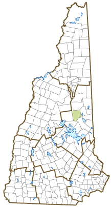
Town of Tamworth
Keats Myer, Town Administrator
84 Main Street
Tamworth, NH
03886
|
| Telephone |
(603) 323-7525 |
| Fax |
Not Available |
| E-mail |
admin@tamworthnh.org |
| Web Site |
www.tamworthnh.org
|
| Municipal Office Hours |
Selectmen: Tuesday to Friday, 9-12 and 1-4; Town Clerk/Tax Collector: Tuesday, Wednesday, and Friday, 9-12 and 1-4, Thursday, 9-12 and 1-6; closed Mondays
|
| County |
Carroll |
| Labor Market Area |
Conway, NH-ME LMA, NH part |
| Tourism Region |
Lakes |
| Planning Commission |
Lakes Region |
| Regional Development |
Mount Washington Valley Economic Council
|
| Election Districts |
|
| US Congress |
District District 1 |
| Executive Council |
District District 1 |
| State Senate |
District District 3 |
| State Representative |
Carroll County District 3 |
| Incorporated: 1766 |
| Origin: This town was granted in 1766 to John Webster and others, and named in honor of Admiral Washington Shirley, Viscount Tamworth, a close friend of Governor Benning Wentworth. There was considerable controversy regarding the boundaries of the town. A legislative committee was appointed in 1796 to fix the line between Tamworth and Burton (Albany), and between Tamworth and Eaton (Madison was not a separate town at that time.) Though the decision was to be final, another committee was appointed in 1808 to further fix town lines between Tamworth, Eaton, Sandwich, and Burton. |
| Villages and Place Names: Chocorua, South Tamworth, Wonalancet
|
| Population, Year of the First Census Taken: 266 residents in 1790 |
| Population Trends: Population change for Tamworth totaled 1,770 over 50 years, from 1,054 in 1970 to 2,824 in 2020. The 2022 Census estimate for Tamworth was 2,897 residents, which ranked 113th among New Hampshire's incorporated cities and towns. |
| Population Density and Land Area, 2022 (US Census Bureau): 48.4 persons per square mile of land area. Tamworth contains 59.8 square miles of land area and 0.8 square miles of inland water area. |
| Municipal Services |
| Type of Government |
Selectmen |
| Budget: Municipal Appropriations, 2021 |
$5,493,784 |
| Budget: School Appropriations, 2020-2021 |
$7,476,667 |
| Zoning Ordinance |
No Ordinance |
| Master Plan |
2008 |
| Capitol Improvement Plan |
Yes |
| Industrial Plans Reviewed By |
Planning Board |
| Boards and Commissions | |
| Elected: | Selectmen; Planning; Library; Trust Funds; Checklist; Cemetery; Fireward |
| Appointed: | Conservation; Energy, LURC; Economic Dev; ZBA; CIP |
| Public Library |
Chocorua Public; Cook Memorial |
| Emergency Services |
| Police Department |
Full-time |
| Fire Department |
Full-time Chief & part-time |
| Emergency Medical Service |
Private |
| Nearest Hospital(s) |
Distance |
Staffed Beds |
| Memorial Hospital, North Conway |
20 miles |
25 |
|
|
|
|
|
|
| Utilities |
| Electric Supplier |
Eversource Energy; NH Electric Coop |
| Natural Gas Supplier |
None |
| Water Supplier |
LR Water Company; Private wells |
| Sanitation |
Tamworth Village Assoc. & private septic |
| Municipal Wastewater Treatment Plant |
No |
| Solid Waste Disposal |
| Curbside Trash Pickup | None |
| Pay-As-You-Throw Program | No |
| Recycling Program | Voluntary |
| Telephone Company |
Consolidated Communications |
| Cellular Telephone Access |
Yes |
| Cable Television Access |
Limited |
| Public Access Television Station |
No |
| High Speed Internet Service: |
| Business | Limited |
| Residential | Limited |
| (NH Dept. of Revenue Administration) Property Taxes |
| 2022 Total Tax Rate (per $1,000 of value) |
$23.77 |
| 2022 Equalization Ratio |
60.9 |
| 2022 Full Value Tax Rate (per $1,000 of value) |
$14.39 |
| 2022 Percent of Local Assessed Value by Property Type |
| Residential Land and Buildings | 82.2% |
| Commercial Land and Buildings | 14.9% |
| Public Utilities, Current Use, and Other | 2.9% |
| (ACS 2017-2021) Housing |
| Total Housing Units |
1,592 |
| Single-Family Units, Detached or Attached |
1,325 |
| Units in Multiple-Family Structures: |
|
| Two to Four Units in Structure |
10 |
| Five or More Units in Structure |
139 |
| Mobile Homes and Other Housing Units |
118 |
(US Census Bureau) Population
(1-Year Estimates/Decennial) |
| Total Population |
Community |
County |
| 2022 |
2,897 |
52,199 |
| 2020 |
2,812 |
50,107 |
| 2010 |
2,856 |
47,818 |
| 2000 |
2,515 |
43,918 |
| 1990 |
2,172 |
35,526 |
| 1980 |
1,672 |
27,929 |
| |
| Demographics, American Community Survey (ACS) 2017-2021 |
| Population by Gender |
| Male: 1,391 |
|
Female: 1,443 |
| Population by Age Group |
| Under age 5 |
|
56 |
| Age 5 to 19 |
|
700 |
| Age 20 to 34 |
|
421 |
| Age 35 to 54 |
|
643 |
| Age 55 to 64 |
|
468 |
| Age 65 and over |
|
546 |
| Median Age |
|
40.9 years |
| Educational Attainment, population 25 years and over |
|
1,959 |
| High school graduate or higher |
|
90.5% |
| Bachelor's degree or higher |
|
32.9% |
| (ACS 2017-2021) Income, Inflation Adjusted $ |
| Per capita income |
$27,687 |
| Median family income |
$70,021 |
| Median household income |
$56,700 |
| Median Earnings, full-time, year-round workers |
| Male |
$61,597 |
| Female |
$35,284 |
| Individuals below the poverty level |
6.4% |
| (NHES - ELMI) Labor Force |
| Annual Average |
2012 |
2022 |
| Civilian Labor Force |
1,515 |
1,475 |
| Employed |
1,430 |
1,436 |
| Unemployed |
85 |
39 |
| Unemployment Rate |
5.6% |
2.6% |
| (NHES - ELMI) Employment & Wages |
| Annual Average Covered Employment |
2012 |
2022 |
| Goods Producing Industries |
| Average Employment |
96 |
138 |
| Average Weekly Wage |
$703 |
$1,007 |
| |
|
|
| Service Providing Industries |
| Average Employment |
386 |
344 |
| Average Weekly Wage |
$502 |
$881 |
| |
|
|
| Total Private Industry |
| Average Employment |
482 |
482 |
| Average Weekly Wage |
$542 |
$917 |
| |
|
|
| Government (Federal, State, and Local) |
| Average Employment |
119 |
153 |
| Average Weekly Wage |
$681 |
$1,013 |
| |
|
|
| Total, Private plus Government |
| Average Employment |
601 |
636 |
| Average Weekly Wage |
$570 |
$940 |
If "n" appears, data does not meet disclosure standards.
| (NH Dept. of Education) Education and Child Care |
| Schools students attend: |
Tamworth operates grades K-8; grades 9-12 are tuitioned to Conway |
SAU 13 |
| Career Technology Center(s): |
Mount Washington Valley CTC (Conway) |
| Educational Facilities (includes Charter Schools) |
Elementary |
Middle/Junior High |
High School |
Private/Parochial |
| Number of Schools |
1 |
|
|
1 |
| Grade Levels |
K 1-8 |
|
|
9-12 |
| Total Enrollment |
184 |
|
|
|
| 2022 NH Licensed Child Care Facilities (Bureau of Child Care Licensing): |
Total Facilities: 3 |
Total Capacity: 137 |
| Nearest Community/Technical College: Lakes Region |
| Nearest Colleges or Universities: Plymouth State |
| Largest Businesses |
Product/Service |
Employees |
Established |
| Kenneth A. Brett School |
Education (K-8) |
47 |
|
| Steam electrical generation |
Renewable Power |
|
|
| Eversource |
Electric services |
|
|
|
|
|
|
|
|
|
|
|
|
|
|
|
|
|
|
|
|
|
|
|
|
|
|
|
|
|
|
Employer Information Supplied by Municipality
| (Distance estimated from city/town hall) Transportation |
| Road Access |
US Routes |
|
|
State Routes |
16, 25, 113, 113A |
| Nearest Interstate, Exit |
I-93, Exit 24 |
|
Distance |
29 miles |
| Railroad |
No |
| Public Transportation |
No |
| |
| Nearest Public Use Airport, General Aviation |
| Moultonborough Airport | Runway | 3,475 ft. asphalt |
| Lighted? |
Yes |
Navigational Aids? |
No |
| Nearest Airport with Scheduled Service |
| Portland (ME) International |
Distance |
61 miles |
| Number of Passenger Airlines Serving Airport |
8 |
| |
| Driving distance to selected cities: |
| Manchester, NH |
79 miles |
| Portland, ME |
64 miles |
| Boston, MA |
119 miles |
| New York City, NY |
327 miles |
| Montreal, Quebec |
242 miles |
| (ACS 2017-2021) Commuting to Work |
| Workers 16 years and over |
1,404 |
| Drove alone, car/truck/van |
83.7% |
| Carpooled, car/truck/van |
13.2% |
| Public transportation |
0.0% |
| Walked |
0.7% |
| Other Means |
0.0% |
| Worked at home |
2.4% |
| Mean Travel Time to Work |
23.6 minutes |
| |
| Percent of Working Residents: |
(ACS 2017-2021) |
| Working in community of residence |
25.5% |
| Commuting to another NH community |
73.4% |
| Commuting out-of-state |
1.1% |
| Recreation, Attractions, and Events |
| Municipal Parks |
| YMCA/YWCA |
| Boys Club/Girls Club |
| Golf Courses |
| Swimming: Indoor Facility |
| Swimming: Outdoor Facility |
| Tennis Courts: Indoor Facility |
| Tennis Courts: Outdoor Facility |
| Ice Skating Rink: Indoor Facility |
| Bowling Facilities |
| Museums |
| Cinemas |
| Performing Arts Facilities |
| Tourist Attractions |
| Youth Organizations (i.e., Scouts, 4-H) |
| Youth Sports: Baseball |
| Youth Sports: Soccer |
| Youth Sports: Football |
| Youth Sports: Basketball |
| Youth Sports: Hockey |
| Campgrounds |
| Fishing/Hunting |
| Boating/Marinas |
| Snowmobile Trails |
| Bicycle Trails |
| Cross Country Skiing |
| Beach or Waterfront Recreational Area |
| Overnight or Day Camps |
| |
|
|
Nearest Ski Area(s): King Pine |
| |
|
|
Other: Barnstormers Summer Theatre; White Lake State Park; Remick Country Doctor Museum and Farm; The Other Bakery; Tamworth Distillery |
Economic & Labor Market Information Bureau, NH Employment Security, October 2023. Community Response Received 6/1/23
All information regarding the communities is from sources deemed reliable and is submitted subject to errors, omissions, modifications, and withdrawals without notice. No warranty or representation is made as to the accuracy of the information contained herein. Specific questions regarding individual cities and towns should be directed to the community contact.


