 |
Community Contact |
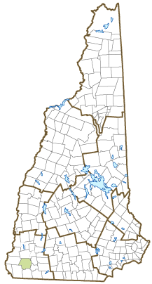
Town of Swanzey
Michael Branley, Town Administrator
Town Hall, PO Box 10009
Swanzey, NH
03446-0009
|
| Telephone |
(603) 352-7411 |
| Fax |
(603) 355-8099 |
| E-mail |
mbranley@swanzeynh.gov |
| Web Site |
www.swanzeynh.gov
|
| Municipal Office Hours |
Town Hall and Town Clerk: Monday, 9:30-6, Tuesday to Thursday, 8:30-5, Friday, 7:30-4; Tax Collector: until 2 daily
|
| County |
Cheshire |
| Labor Market Area |
Keene, NH Micropolitan NECTA |
| Tourism Region |
Monadnock |
| Planning Commission |
Southwest Region |
| Regional Development |
Monadnock Economic Development Corp.
|
| Election Districts |
|
| US Congress |
District District 2 |
| Executive Council |
District District 5 |
| State Senate |
District District 10 |
| State Representative |
Cheshire County Districts 10, 17 |
| Incorporated: 1753 |
| Origin: This town was one of the fort towns established by Governor Belcher of Massachusetts, and was first granted in 1734 as Lower Ashuelot to Captain Nathaniel Hammond and Ephraim Jones. In 1753, residents petitioned Governor Benning Wentworth for a grant under authority of the New Hampshire government, since they had settled and been making improvements for over 18 years. The town was chartered that year as Swanzey, the name being suggested by Governor Brenton of Rhode Island, who owned land at Brenton's Farm (Litchfield), and Swansea, Massachusetts. There are four covered bridges located in Swanzey: Carleton, Thompson, Slate, and Cresson. |
| Villages and Place Names: East Swanzey, West Swanzey, Westport, North Swanzey, Swanzey Center
|
| Population, Year of the First Census Taken: 1,157 residents in 1790 |
| Population Trends: Population change for Swanzey totaled 3,041 over 50 years, from 4,254 in 1970 to 7,295 in 2020. The 2022 Census estimate for Swanzey was 7,427 residents, which ranked 45th among New Hampshire's incorporated cities and towns. |
| Population Density and Land Area, 2022 (US Census Bureau): 165.3 persons per square mile of land area. Swanzey contains 44.9 square miles of land area and 0.4 square miles of inland water area. |
| Municipal Services |
| Type of Government |
Selectmen |
| Budget: Municipal Appropriations, 2021 |
$6,716,500 |
| Budget: School Appropriations, 2020-2021 |
$16,031,117 |
| Zoning Ordinance |
1947/13 |
| Master Plan |
2006 |
| Capitol Improvement Plan |
Yes |
| Industrial Plans Reviewed By |
Planning Board |
| Boards and Commissions | |
| Elected: | Selectmen; Planning; Zoning; Sewer; Library; Trustee of Trust Funds; Supervisor of Checklist |
| Appointed: | Conservation; Swanzey Revenue; Economic Dev; Old Home Day; Recreation; Capital Improvement; Rail Trails Advisory Committee |
| Public Library |
Mt. Caesar Union; Stratton Free |
| Emergency Services |
| Police Department |
Full-time |
| Fire Department |
Full-time & On-Call |
| Emergency Medical Service |
On-Call |
| Nearest Hospital(s) |
Distance |
Staffed Beds |
| Cheshire Medical Center, Keene |
6 miles |
94 |
|
|
|
|
|
|
| Utilities |
| Electric Supplier |
Eversource Energy |
| Natural Gas Supplier |
None |
| Water Supplier |
North Swanzey Fire Precinct; West Swanzey Water Co. |
| Sanitation |
Private septic & municipal |
| Municipal Wastewater Treatment Plant |
Yes |
| Solid Waste Disposal |
| Curbside Trash Pickup | Private |
| Pay-As-You-Throw Program | No |
| Recycling Program | Mandatory |
| Telephone Company |
Consolidated Communications |
| Cellular Telephone Access |
Yes |
| Cable Television Access |
Yes |
| Public Access Television Station |
Yes |
| High Speed Internet Service: |
| Business | Yes |
| Residential | Yes |
| (NH Dept. of Revenue Administration) Property Taxes |
| 2022 Total Tax Rate (per $1,000 of value) |
$25.00 |
| 2022 Equalization Ratio |
66.3 |
| 2022 Full Value Tax Rate (per $1,000 of value) |
$16.34 |
| 2022 Percent of Local Assessed Value by Property Type |
| Residential Land and Buildings | 81.6% |
| Commercial Land and Buildings | 15.3% |
| Public Utilities, Current Use, and Other | 3.1% |
| (ACS 2017-2021) Housing |
| Total Housing Units |
3,386 |
| Single-Family Units, Detached or Attached |
2,263 |
| Units in Multiple-Family Structures: |
|
| Two to Four Units in Structure |
204 |
| Five or More Units in Structure |
639 |
| Mobile Homes and Other Housing Units |
280 |
(US Census Bureau) Population
(1-Year Estimates/Decennial) |
| Total Population |
Community |
County |
| 2022 |
7,427 |
77,350 |
| 2020 |
7,270 |
76,458 |
| 2010 |
7,230 |
77,117 |
| 2000 |
6,814 |
73,993 |
| 1990 |
5,864 |
70,223 |
| 1980 |
5,183 |
62,116 |
| |
| Demographics, American Community Survey (ACS) 2017-2021 |
| Population by Gender |
| Male: 3,602 |
|
Female: 3,691 |
| Population by Age Group |
| Under age 5 |
|
246 |
| Age 5 to 19 |
|
1,049 |
| Age 20 to 34 |
|
957 |
| Age 35 to 54 |
|
1,576 |
| Age 55 to 64 |
|
1,699 |
| Age 65 and over |
|
1,766 |
| Median Age |
|
52.6 years |
| Educational Attainment, population 25 years and over |
|
5,744 |
| High school graduate or higher |
|
95.0% |
| Bachelor's degree or higher |
|
25.9% |
| (ACS 2017-2021) Income, Inflation Adjusted $ |
| Per capita income |
$34,931 |
| Median family income |
$91,709 |
| Median household income |
$66,392 |
| Median Earnings, full-time, year-round workers |
| Male |
$52,735 |
| Female |
$45,337 |
| Individuals below the poverty level |
8.8% |
| (NHES - ELMI) Labor Force |
| Annual Average |
2012 |
2022 |
| Civilian Labor Force |
4,283 |
3,900 |
| Employed |
4,081 |
3,812 |
| Unemployed |
202 |
88 |
| Unemployment Rate |
4.7% |
2.3% |
| (NHES - ELMI) Employment & Wages |
| Annual Average Covered Employment |
2012 |
2022 |
| Goods Producing Industries |
| Average Employment |
270 |
444 |
| Average Weekly Wage |
$904 |
$1,258 |
| |
|
|
| Service Providing Industries |
| Average Employment |
1,180 |
1,212 |
| Average Weekly Wage |
$607 |
$852 |
| |
|
|
| Total Private Industry |
| Average Employment |
1,450 |
1,656 |
| Average Weekly Wage |
$662 |
$961 |
| |
|
|
| Government (Federal, State, and Local) |
| Average Employment |
718 |
609 |
| Average Weekly Wage |
$690 |
$863 |
| |
|
|
| Total, Private plus Government |
| Average Employment |
2,168 |
2,265 |
| Average Weekly Wage |
$671 |
$934 |
If "n" appears, data does not meet disclosure standards.
| (NH Dept. of Education) Education and Child Care |
| Schools students attend: |
Grades K-12 are part of Monadnock Regional (Fitzwilliam, Gilsum, Richmond, Roxbury, Swanzey, Troy) |
SAU 93 |
| Career Technology Center(s): |
Cheshire Career Center (Keene); Fall Mountain RHS - CTE |
| Educational Facilities (includes Charter Schools) |
Elementary |
Middle/Junior High |
High School |
Private/Parochial |
| Number of Schools |
2 |
1 |
1 |
|
| Grade Levels |
P K 1-6 |
7-8 |
9-12 |
9-12 |
| Total Enrollment |
563 |
254 |
451 |
|
| 2022 NH Licensed Child Care Facilities (Bureau of Child Care Licensing): |
Total Facilities: 3 |
Total Capacity: 94 |
| Nearest Community/Technical College: River Valley |
| Nearest Colleges or Universities: Keene State; Franklin Pierce; Antioch New England |
| Largest Businesses |
Product/Service |
Employees |
Established |
| Monadnock Regional School District |
Education |
410 FT/336 PT |
1962 |
| Fenton Family Dealerships |
Automobile dealership |
130 FT/34 PT |
1985 |
| Market Basket |
Supermarket |
55 FT/300 PT |
2010 |
| Nanotech |
Ultra-precision machining systems |
55 |
1997 |
| Town of Swanzey |
Municipal services |
35 FT/136 PT |
1753 |
| Powers Generator Service, LLC |
Generator sales, service, installation |
22 |
1995 |
| First Student |
Bus transportation |
7 FT/75 PT |
2000 |
| Keene Gas/Titan Propane |
Propane sales, service |
18 FT/1 PT |
1860 |
| Port-O-Lite |
Millwork |
15 |
1952 |
| Mold Pro |
Thermoplastic injection molding |
40 |
2003 |
Employer Information Supplied by Municipality
| (Distance estimated from city/town hall) Transportation |
| Road Access |
US Routes |
|
|
State Routes |
10, 12, 32 |
| Nearest Interstate, Exit |
I-91 (VT), Exit 3 |
|
Distance |
20 miles |
| Railroad |
No |
| Public Transportation |
No |
| |
| Nearest Public Use Airport, General Aviation |
| Dillant-Hopkins, Swanzey | Runway | 6,201 ft. asphalt |
| Lighted? |
Yes |
Navigational Aids? |
Yes |
| Nearest Airport with Scheduled Service |
| Manchester-Boston Regional |
Distance |
60 miles |
| Number of Passenger Airlines Serving Airport |
4 |
| |
| Driving distance to selected cities: |
| Manchester, NH |
70 miles |
| Portland, ME |
162 miles |
| Boston, MA |
98 miles |
| New York City, NY |
210 miles |
| Montreal, Quebec |
247 miles |
| (ACS 2017-2021) Commuting to Work |
| Workers 16 years and over |
4,063 |
| Drove alone, car/truck/van |
84.9% |
| Carpooled, car/truck/van |
7.4% |
| Public transportation |
0.0% |
| Walked |
1.6% |
| Other Means |
1.5% |
| Worked at home |
4.6% |
| Mean Travel Time to Work |
19.3 minutes |
| |
| Percent of Working Residents: |
(ACS 2017-2021) |
| Working in community of residence |
21.8% |
| Commuting to another NH community |
71.4% |
| Commuting out-of-state |
6.8% |
| Recreation, Attractions, and Events |
| Municipal Parks |
| YMCA/YWCA |
| Boys Club/Girls Club |
| Golf Courses |
| Swimming: Indoor Facility |
| Swimming: Outdoor Facility |
| Tennis Courts: Indoor Facility |
| Tennis Courts: Outdoor Facility |
| Ice Skating Rink: Indoor Facility |
| Bowling Facilities |
| Museums |
| Cinemas |
| Performing Arts Facilities |
| Tourist Attractions |
| Youth Organizations (i.e., Scouts, 4-H) |
| Youth Sports: Baseball |
| Youth Sports: Soccer |
| Youth Sports: Football |
| Youth Sports: Basketball |
| Youth Sports: Hockey |
| Campgrounds |
| Fishing/Hunting |
| Boating/Marinas |
| Snowmobile Trails |
| Bicycle Trails |
| Cross Country Skiing |
| Beach or Waterfront Recreational Area |
| Overnight or Day Camps |
| |
|
|
Nearest Ski Area(s): Granite Gorge |
| |
|
|
Other: Cheshire Fair; Covered Bridges; Old Home Day; Hiking trails; Summer Theatre; Band Concert Series; Mini golf |
Economic & Labor Market Information Bureau, NH Employment Security, October 2023. Community Response Received 6/1/23
All information regarding the communities is from sources deemed reliable and is submitted subject to errors, omissions, modifications, and withdrawals without notice. No warranty or representation is made as to the accuracy of the information contained herein. Specific questions regarding individual cities and towns should be directed to the community contact.


