 |
Community Contact |
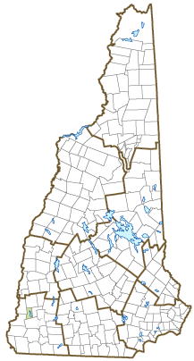
Town of Surry
Board of Selectmen
1 Village Road, Town Hall
Surry, NH
03431
|
| Telephone |
(603) 352-3075 |
| Fax |
(603) 357-4890 |
| E-mail |
selectmen@surry.nh.gov |
| Web Site |
Surry.nh.gov
|
| Municipal Office Hours |
Selectmen: Monday, 7-9; Town Clerk: Monday, 3-6, Thursday, 5-7; Tax Collector: first and third Thursday each month, 5-7
|
| County |
Cheshire |
| Labor Market Area |
Keene, NH Micropolitan NECTA |
| Tourism Region |
Monadnock |
| Planning Commission |
Southwest Region |
| Regional Development |
Monadnock Economic Development Corp.
|
| Election Districts |
|
| US Congress |
District District 2 |
| Executive Council |
District District 2 |
| State Senate |
District District 10 |
| State Representative |
Cheshire County Districts 5, 15 |
| Incorporated: 1769 |
| Origin: This town was chartered in 1769 from portions of Gilsum and Westmoreland. The portion of Westmoreland added to Surry was known as Westmoreland Leg. Surry was named for Charles Howard, Earl of Surrey, Duke of Norfolk, and hereditary Earl Marshal of England. The county of Surrey in England was known for manufacture of pleasure carriages called surreys, introduced to America in 1872. Surry was one of the towns in the western part of the state that attempted to join the State of Vermont in 1781. Surry is an excellent geological area, containing quantities of quartz bearing veins of gold, silver, copper, and lead. |
| Villages and Place Names: Shaws Corner
|
| Population, Year of the First Census Taken: 448 residents in 1790 |
| Population Trends: Population change for Surry totaled 314 over 50 years, from 507 in 1970 to 821 in 2020. The 2022 Census estimate for Surry was 854 residents, which ranked 194th among New Hampshire's incorporated cities and towns. |
| Population Density and Land Area, 2022 (US Census Bureau): 54.4 persons per square mile of land area. Surry contains 15.7 square miles of land area and 0.3 square miles of inland water area. |
| Municipal Services |
| Type of Government |
Selectmen |
| Budget: Municipal Appropriations, 2023 |
$1,033,792 |
| Budget: School Appropriations, 2023-2024 |
$2,403,084 |
| Zoning Ordinance |
1951/23 |
| Master Plan |
1983 |
| Capitol Improvement Plan |
No |
| Industrial Plans Reviewed By |
Planning Board |
| Boards and Commissions | |
| Elected: | Selectmen; Planning; Trust Funds; Cemetery Trustees; Budget |
| Appointed: | Conservation; Library; Zoning |
| Public Library |
Reed Free |
| Emergency Services |
| Police Department |
State Police |
| Fire Department |
Volunteer |
| Emergency Medical Service |
Volunteer |
| Nearest Hospital(s) |
Distance |
Staffed Beds |
| Cheshire Medical Center, Keene |
5 miles |
94 |
|
|
|
|
|
|
| Utilities |
| Electric Supplier |
Eversource Energy; Liberty |
| Natural Gas Supplier |
None |
| Water Supplier |
Private wells; Surry Village Water |
| Sanitation |
Private septic |
| Municipal Wastewater Treatment Plant |
No |
| Solid Waste Disposal |
| Curbside Trash Pickup | Private |
| Pay-As-You-Throw Program | No |
| Recycling Program | Voluntary |
| Telephone Company |
Spectrum; Consolidated Communications |
| Cellular Telephone Access |
Yes |
| Cable Television Access |
Yes |
| Public Access Television Station |
No |
| High Speed Internet Service: |
| Business | Limited |
| Residential | Limited |
| (NH Dept. of Revenue Administration) Property Taxes |
| 2022 Total Tax Rate (per $1,000 of value) |
$16.06 |
| 2022 Equalization Ratio |
109.5 |
| 2022 Full Value Tax Rate (per $1,000 of value) |
$17.54 |
| 2022 Percent of Local Assessed Value by Property Type |
| Residential Land and Buildings | 93.1% |
| Commercial Land and Buildings | 2.8% |
| Public Utilities, Current Use, and Other | 4.1% |
| (ACS 2017-2021) Housing |
| Total Housing Units |
354 |
| Single-Family Units, Detached or Attached |
348 |
| Units in Multiple-Family Structures: |
|
| Two to Four Units in Structure |
4 |
| Five or More Units in Structure |
0 |
| Mobile Homes and Other Housing Units |
2 |
(US Census Bureau) Population
(1-Year Estimates/Decennial) |
| Total Population |
Community |
County |
| 2022 |
854 |
77,350 |
| 2020 |
820 |
76,458 |
| 2010 |
732 |
77,117 |
| 2000 |
673 |
73,993 |
| 1990 |
631 |
70,223 |
| 1980 |
656 |
62,116 |
| |
| Demographics, American Community Survey (ACS) 2017-2021 |
| Population by Gender |
| Male: 366 |
|
Female: 576 |
| Population by Age Group |
| Under age 5 |
|
88 |
| Age 5 to 19 |
|
133 |
| Age 20 to 34 |
|
155 |
| Age 35 to 54 |
|
244 |
| Age 55 to 64 |
|
122 |
| Age 65 and over |
|
200 |
| Median Age |
|
44.2 years |
| Educational Attainment, population 25 years and over |
|
691 |
| High school graduate or higher |
|
96.2% |
| Bachelor's degree or higher |
|
32.1% |
| (ACS 2017-2021) Income, Inflation Adjusted $ |
| Per capita income |
$45,541 |
| Median family income |
$102,083 |
| Median household income |
$89,464 |
| Median Earnings, full-time, year-round workers |
| Male |
$73,214 |
| Female |
$50,132 |
| Individuals below the poverty level |
2.5% |
| (NHES - ELMI) Labor Force |
| Annual Average |
2012 |
2022 |
| Civilian Labor Force |
512 |
477 |
| Employed |
492 |
467 |
| Unemployed |
20 |
10 |
| Unemployment Rate |
3.9% |
2.1% |
| (NHES - ELMI) Employment & Wages |
| Annual Average Covered Employment |
2012 |
2022 |
| Goods Producing Industries |
| Average Employment |
23 |
42 |
| Average Weekly Wage |
$1,113 |
$1,628 |
| |
|
|
| Service Providing Industries |
| Average Employment |
44 |
42 |
| Average Weekly Wage |
$316 |
$587 |
| |
|
|
| Total Private Industry |
| Average Employment |
67 |
84 |
| Average Weekly Wage |
$591 |
$1,109 |
| |
|
|
| Government (Federal, State, and Local) |
| Average Employment |
6 |
8 |
| Average Weekly Wage |
$347 |
$258 |
| |
|
|
| Total, Private plus Government |
| Average Employment |
73 |
92 |
| Average Weekly Wage |
$571 |
$1,039 |
If "n" appears, data does not meet disclosure standards.
| (NH Dept. of Education) Education and Child Care |
| Schools students attend: |
Surry operates grades K-8; grades 9-12 are tuitioned to Keene |
SAU 91 |
| Career Technology Center(s): |
Cheshire Career Center (Keene); Fall Mountain RHS - CTE |
| Educational Facilities (includes Charter Schools) |
Elementary |
Middle/Junior High |
High School |
Private/Parochial |
| Number of Schools |
1 |
|
|
|
| Grade Levels |
K 1-8 |
|
|
9-12 |
| Total Enrollment |
94 |
|
|
|
| 2022 NH Licensed Child Care Facilities (Bureau of Child Care Licensing): |
Total Facilities: 0 |
Total Capacity: 0 |
| Nearest Community/Technical College: River Valley |
| Nearest Colleges or Universities: Keene State; Franklin Pierce; Antioch New England |
| Largest Businesses |
Product/Service |
Employees |
Established |
| LG Cushing & Sons, Inc. |
Well drilling |
15 |
|
| Woodard's Sugarhouse |
Maple Products |
2 |
|
| Brooks Construction |
Construction Services |
2 |
|
| Frank Lucius Construction |
Excavation |
4 |
|
| Inspections by Eric, LLC |
Septic inspections |
1 |
2016 |
| GT's Auto |
Used Vehicle Sales |
2 |
|
| Cresceno Acres Farm |
Alpaca Products |
2 |
|
| Richardson Home Inspection |
Home inspection services |
1 |
|
| Gunseth's 4x4 Center |
Auto Parts, Repairs |
2 |
|
| Kona Ice |
Retail shaved ice |
2 |
2009 |
Employer Information Supplied by Municipality
| (Distance estimated from city/town hall) Transportation |
| Road Access |
US Routes |
|
|
State Routes |
12, 12A |
| Nearest Interstate, Exit |
I-91 (VT), Exit 5 |
|
Distance |
16 miles |
| Railroad |
No |
| Public Transportation |
No |
| |
| Nearest Public Use Airport, General Aviation |
| Dillant-Hopkins, Swanzey | Runway | 6,201 ft. asphalt |
| Lighted? |
Yes |
Navigational Aids? |
Yes |
| Nearest Airport with Scheduled Service |
| Manchester-Boston Regional |
Distance |
60 miles |
| Number of Passenger Airlines Serving Airport |
4 |
| |
| Driving distance to selected cities: |
| Manchester, NH |
70 miles |
| Portland, ME |
163 miles |
| Boston, MA |
105 miles |
| New York City, NY |
223 miles |
| Montreal, Quebec |
233 miles |
| (ACS 2017-2021) Commuting to Work |
| Workers 16 years and over |
462 |
| Drove alone, car/truck/van |
79.7% |
| Carpooled, car/truck/van |
3.9% |
| Public transportation |
0.0% |
| Walked |
4.8% |
| Other Means |
0.0% |
| Worked at home |
11.7% |
| Mean Travel Time to Work |
21.9 minutes |
| |
| Percent of Working Residents: |
(ACS 2017-2021) |
| Working in community of residence |
17.7% |
| Commuting to another NH community |
74.9% |
| Commuting out-of-state |
7.4% |
| Recreation, Attractions, and Events |
| Municipal Parks |
| YMCA/YWCA |
| Boys Club/Girls Club |
| Golf Courses |
| Swimming: Indoor Facility |
| Swimming: Outdoor Facility |
| Tennis Courts: Indoor Facility |
| Tennis Courts: Outdoor Facility |
| Ice Skating Rink: Indoor Facility |
| Bowling Facilities |
| Museums |
| Cinemas |
| Performing Arts Facilities |
| Tourist Attractions |
| Youth Organizations (i.e., Scouts, 4-H) |
| Youth Sports: Baseball |
| Youth Sports: Soccer |
| Youth Sports: Football |
| Youth Sports: Basketball |
| Youth Sports: Hockey |
| Campgrounds |
| Fishing/Hunting |
| Boating/Marinas |
| Snowmobile Trails |
| Bicycle Trails |
| Cross Country Skiing |
| Beach or Waterfront Recreational Area |
| Overnight or Day Camps |
| |
|
|
Nearest Ski Area(s): Mount Ascutney (VT) |
| |
|
|
Other: Surry Mountain Recreation Area |
Economic & Labor Market Information Bureau, NH Employment Security, October 2023. Community Response Received 6/15/23
All information regarding the communities is from sources deemed reliable and is submitted subject to errors, omissions, modifications, and withdrawals without notice. No warranty or representation is made as to the accuracy of the information contained herein. Specific questions regarding individual cities and towns should be directed to the community contact.


