 |
Community Contact |
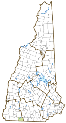
Town of Rindge
Lori Rautiola, Town Administrator
30 Payson Hill Road
Rindge, NH
03461
|
| Telephone |
(603) 899-5181 x101 |
| Fax |
(603) 899-2101 |
| E-mail |
townadmin@rindgenh.org |
| Web Site |
www.rindgenh.org
|
| Municipal Office Hours |
Selectmen: Monday to Thursday, 9-1 and 2-4, meet every other Wednesday at 6 pm; Town Clerk: Monday and Wednesday, 8-1 and 1:30-4, Tuesday, 12-6:30, Thursday, 7-1 and 1:30-3:30; Tax Collector: Monday to Thursday, 9-1 and 2-4
|
| County |
Cheshire |
| Labor Market Area |
Peterborough, NH LMA |
| Tourism Region |
Monadnock |
| Planning Commission |
Southwest Region |
| Regional Development |
Monadnock Economic Development Corp.
|
| Election Districts |
|
| US Congress |
District District 2 |
| Executive Council |
District District 5 |
| State Senate |
District District 12 |
| State Representative |
Cheshire County Districts 14, 18 |
| Incorporated: 1768 |
| Origin: This territory was first granted by the Massachusetts government in 1736. The grantees were soldiers from Rowley, Massachusetts, returning from the war in Canada, and the settlement was known as Rowley-Canada. Following establishment of New Hampshire as a separate province, the Masonian Proprietors regranted the territory, and it was renamed Monadnock Number 1, or South Monadnock, in 1749. The town was incorporated as Rindge in 1768, in honor of Captain Daniel Rindge, one of the original grant holders who was related by marriage to Governor Benning Wentworth. |
| Villages and Place Names: Converseville, Cutter Hill, East Rindge, Jones Corner, Rand, Thomas, West Rindge, Woodmere
|
| Population, Year of the First Census Taken: 1,143 residents in 1790 |
| Population Trends: Population change for Rindge, including resident students, totaled 4,250 over 50 years, from 2,175 in 1970 to 6,425 in 2020. The 2022 Census estimate for Rindge was 6,524 residents, which ranked 52nd among New Hampshire's incorporated cities and towns. |
| Population Density and Land Area, 2022 (US Census Bureau): 176.0 persons per square mile of land area. Rindge contains 37.1 square miles of land area and 2.7 square miles of inland water area. |
| Municipal Services |
| Type of Government |
Selectmen/Town Administrator |
| Budget: Municipal Appropriations, 2021 |
$4,948,770 |
| Budget: School Appropriations, 2020-2021 |
$12,034,855 |
| Zoning Ordinance |
1961/23 |
| Master Plan |
2011 |
| Capitol Improvement Plan |
Yes |
| Industrial Plans Reviewed By |
Planning Board |
| Boards and Commissions | |
| Elected: | Selectmen; Planning; Zoning; Library |
| Appointed: | Conservation |
| Public Library |
Ingalls Memorial |
| Emergency Services |
| Police Department |
Full-time |
| Fire Department |
Full-time & volunteer |
| Emergency Medical Service |
Full-time & volunteer |
| Nearest Hospital(s) |
Distance |
Staffed Beds |
| Monadnock Community, Peterborough |
14 miles |
25 |
| Heywood Hospital, Gardner MA |
14 miles |
134 |
|
|
|
| Utilities |
| Electric Supplier |
Eversource Energy |
| Natural Gas Supplier |
None |
| Water Supplier |
Private wells |
| Sanitation |
Private septic |
| Municipal Wastewater Treatment Plant |
No |
| Solid Waste Disposal |
| Curbside Trash Pickup | Private |
| Pay-As-You-Throw Program | No |
| Recycling Program | Mandatory |
| Telephone Company |
Consolidated Communications |
| Cellular Telephone Access |
Limited |
| Cable Television Access |
Limited |
| Public Access Television Station |
No |
| High Speed Internet Service: |
| Business | Limited |
| Residential | Limited |
| (NH Dept. of Revenue Administration) Property Taxes |
| 2022 Total Tax Rate (per $1,000 of value) |
$23.03 |
| 2022 Equalization Ratio |
64.0 |
| 2022 Full Value Tax Rate (per $1,000 of value) |
$14.46 |
| 2022 Percent of Local Assessed Value by Property Type |
| Residential Land and Buildings | 84.2% |
| Commercial Land and Buildings | 13.3% |
| Public Utilities, Current Use, and Other | 2.5% |
| (ACS 2017-2021) Housing |
| Total Housing Units |
2,368 |
| Single-Family Units, Detached or Attached |
2,017 |
| Units in Multiple-Family Structures: |
|
| Two to Four Units in Structure |
87 |
| Five or More Units in Structure |
147 |
| Mobile Homes and Other Housing Units |
117 |
(US Census Bureau) Population
(1-Year Estimates/Decennial) |
| Total Population |
Community |
County |
| 2022 |
6,524 |
77,350 |
| 2020 |
6,476 |
76,458 |
| 2010 |
6,014 |
77,117 |
| 2000 |
5,475 |
73,993 |
| 1990 |
4,938 |
70,223 |
| 1980 |
3,375 |
62,116 |
| |
| Demographics, American Community Survey (ACS) 2017-2021 |
| Population by Gender |
| Male: 3,124 |
|
Female: 3,259 |
| Population by Age Group |
| Under age 5 |
|
309 |
| Age 5 to 19 |
|
1,562 |
| Age 20 to 34 |
|
1,351 |
| Age 35 to 54 |
|
1,180 |
| Age 55 to 64 |
|
829 |
| Age 65 and over |
|
1,152 |
| Median Age |
|
34.6 years |
| Educational Attainment, population 25 years and over |
|
3,838 |
| High school graduate or higher |
|
95.8% |
| Bachelor's degree or higher |
|
28.8% |
| (ACS 2017-2021) Income, Inflation Adjusted $ |
| Per capita income |
$31,217 |
| Median family income |
$103,159 |
| Median household income |
$84,861 |
| Median Earnings, full-time, year-round workers |
| Male |
$59,808 |
| Female |
$42,713 |
| Individuals below the poverty level |
8.9% |
| (NHES - ELMI) Labor Force |
| Annual Average |
2012 |
2022 |
| Civilian Labor Force |
2,783 |
2,775 |
| Employed |
2,590 |
2,673 |
| Unemployed |
193 |
102 |
| Unemployment Rate |
6.9% |
3.7% |
| (NHES - ELMI) Employment & Wages |
| Annual Average Covered Employment |
2012 |
2022 |
| Goods Producing Industries |
| Average Employment |
207 |
325 |
| Average Weekly Wage |
$821 |
$1,389 |
| |
|
|
| Service Providing Industries |
| Average Employment |
1,385 |
1,358 |
| Average Weekly Wage |
$517 |
$778 |
| |
|
|
| Total Private Industry |
| Average Employment |
1,592 |
1,682 |
| Average Weekly Wage |
$556 |
$896 |
| |
|
|
| Government (Federal, State, and Local) |
| Average Employment |
74 |
85 |
| Average Weekly Wage |
$552 |
$651 |
| |
|
|
| Total, Private plus Government |
| Average Employment |
1,666 |
1,767 |
| Average Weekly Wage |
$556 |
$884 |
If "n" appears, data does not meet disclosure standards.
| (NH Dept. of Education) Education and Child Care |
| Schools students attend: |
Grades K-12 are part of Jaffrey-Rindge Cooperative (Jaffrey, Rindge) |
SAU 47 |
| Career Technology Center(s): |
Region 14 Applied Technology Center |
| Educational Facilities (includes Charter Schools) |
Elementary |
Middle/Junior High |
High School |
Private/Parochial |
| Number of Schools |
1 |
|
|
2 |
| Grade Levels |
P K 1-5 |
|
|
9-12 |
| Total Enrollment |
323 |
|
|
112 |
| 2022 NH Licensed Child Care Facilities (Bureau of Child Care Licensing): |
Total Facilities: 1 |
Total Capacity: 9 |
| Nearest Community/Technical College: Nashua |
| Nearest Colleges or Universities: Franklin Pierce; Keene State; Antioch New England |
| Largest Businesses |
Product/Service |
Employees |
Established |
| Franklin Pierce University (Rindge campus) |
Education |
300 |
1962 |
| Market Basket |
Supermarket |
275 |
1991 |
| Wal-Mart |
Retail store |
200 |
1993 |
| Hannaford Brothers |
Supermarket |
114 |
1998 |
| Woodbound Inn |
Restaurant, inn |
40 |
|
| Hometown Irving |
Gas, convenience store, deli |
30 |
|
| Allen & Matthewson Oil |
Fuel |
30 |
|
| Tractor Supply Co |
Farm Supplies |
|
|
| Marshall's Department Store |
Department Store |
|
|
| Boss Contractors |
Construction |
|
|
Employer Information Supplied by Municipality
| (Distance estimated from city/town hall) Transportation |
| Road Access |
US Routes |
202 |
|
State Routes |
119 |
| Nearest Interstate, Exit |
I-91, Exit 28 (MA) or Exit 2 (VT) |
|
Distance |
34 miles; 36 miles |
| Railroad |
No |
| Public Transportation |
No |
| |
| Nearest Public Use Airport, General Aviation |
| Jaffrey - Silver Ranch | Runway | 2,982 ft. asphalt |
| Lighted? |
Yes |
Navigational Aids? |
Yes |
| Nearest Airport with Scheduled Service |
| Manchester-Boston Regional |
Distance |
50 miles |
| Number of Passenger Airlines Serving Airport |
4 |
| |
| Driving distance to selected cities: |
| Manchester, NH |
44 miles |
| Portland, ME |
138 miles |
| Boston, MA |
75 miles |
| New York City, NY |
222 miles |
| Montreal, Quebec |
263 miles |
| (ACS 2017-2021) Commuting to Work |
| Workers 16 years and over |
2,968 |
| Drove alone, car/truck/van |
69.6% |
| Carpooled, car/truck/van |
4.5% |
| Public transportation |
0.5% |
| Walked |
2.2% |
| Other Means |
1.2% |
| Worked at home |
21.9% |
| Mean Travel Time to Work |
30.0 minutes |
| |
| Percent of Working Residents: |
(ACS 2017-2021) |
| Working in community of residence |
42.5% |
| Commuting to another NH community |
38.4% |
| Commuting out-of-state |
19.1% |
| Recreation, Attractions, and Events |
| Municipal Parks |
| YMCA/YWCA |
| Boys Club/Girls Club |
| Golf Courses |
| Swimming: Indoor Facility |
| Swimming: Outdoor Facility |
| Tennis Courts: Indoor Facility |
| Tennis Courts: Outdoor Facility |
| Ice Skating Rink: Indoor Facility |
| Bowling Facilities |
| Museums |
| Cinemas |
| Performing Arts Facilities |
| Tourist Attractions |
| Youth Organizations (i.e., Scouts, 4-H) |
| Youth Sports: Baseball |
| Youth Sports: Soccer |
| Youth Sports: Football |
| Youth Sports: Basketball |
| Youth Sports: Hockey |
| Campgrounds |
| Fishing/Hunting |
| Boating/Marinas |
| Snowmobile Trails |
| Bicycle Trails |
| Cross Country Skiing |
| Beach or Waterfront Recreational Area |
| Overnight or Day Camps |
| |
|
|
Nearest Ski Area(s): Crotched Mountain, Pat's Peak, Wachusett (MA) |
| |
|
|
Other: Cathedral of the Pines; Harvet Fair; Rail Trails |
Economic & Labor Market Information Bureau, NH Employment Security, October 2023. Community Response Received 6/6/23
All information regarding the communities is from sources deemed reliable and is submitted subject to errors, omissions, modifications, and withdrawals without notice. No warranty or representation is made as to the accuracy of the information contained herein. Specific questions regarding individual cities and towns should be directed to the community contact.


