 |
Community Contact |
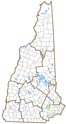
Town of Raymond
Paul Hammond, Senior Staff
4 Epping Street
Raymond, NH
03077
|
| Telephone |
(603) 895-7007 |
| Fax |
(603) 895-7064 |
| E-mail |
phammond@raymondnh.gov |
| Web Site |
www.raymondnh.gov
|
| Municipal Office Hours |
Town Hall, Town Manager: Monday to Friday, 8-4:30; Town Clerk/Tax Collector: Monday, Tuesday, Wednesday, Friday, 8-12:30 and 1:30-4:15, Thursday, 1-6
|
| County |
Rockingham |
| Labor Market Area |
Raymond, NH LMA |
| Tourism Region |
Merrimack Valley |
| Planning Commission |
Rockingham |
| Regional Development |
Regional Economic Development Corp.
|
| Election Districts |
|
| US Congress |
District District 1 |
| Executive Council |
District District 3 |
| State Senate |
District District 16 |
| State Representative |
Rockingham County District 4 |
| Incorporated: 1764 |
| Origin: According the NH State Papers, this territory was originally purchased in 1717 from an Indian by Colonel Stephen Dudley. The town was first settled by families from Exeter as a parish of Chester. It was known as Freetown because the tall pine trees, which were reserved for the King's use, were usually taken by the local settlers, therefore it was a free town. The town was set off from Chester and incorporated in 1764 by Colonial Governor Benning Wentworth. According to Joseph Fullonton, in his History of Raymond, published 1875, the name was chosen as a new and classical one. Fullonton fancied the name meant Shining World. |
| Villages and Place Names: Onway Lake
|
| Population, Year of the First Census Taken: 727 residents in 1790 |
| Population Trends: Population change for Raymond totaled 7,687 over 50 years, from 3,003 in 1970 to 10,690 in 2020. The 2022 Census estimate for Raymond was 10,989 residents, which ranked 27th among New Hampshire's incorporated cities and towns. |
| Population Density and Land Area, 2022 (US Census Bureau): 381.4 persons per square mile of land area. Raymond contains 28.8 square miles of land area and 0.8 square miles of inland water area. |
| Municipal Services |
| Type of Government |
Selectmen/Town Manager |
| Budget: Municipal Appropriations, 2021 |
$12,696,770 |
| Budget: School Appropriations, 2021-2022 |
$26,938,010 |
| Zoning Ordinance |
1970/13 |
| Master Plan |
2009 |
| Capitol Improvement Plan |
Yes |
| Industrial Plans Reviewed By |
Planning Board |
| Boards and Commissions | |
| Elected: | Selectmen; School; Budget; Planning; Library; Ethics |
| Appointed: | Please visit www.raymondnh.gov for a list of boards & committees to which citizens may be appointed. |
| Public Library |
Dudley-Tucker |
| Emergency Services |
| Police Department |
Full-time |
| Fire Department |
Full-time & volunteer |
| Emergency Medical Service |
Private |
| Nearest Hospital(s) |
Distance |
Staffed Beds |
| Exeter Hospital, Exeter |
14 miles |
99 |
| Elliot Hospital, Manchester |
16 miles |
292 |
| Parkland Medical Center, Derry |
16 miles |
50 |
| Utilities |
| Electric Supplier |
Eversource Energy; NH Electric Coop |
| Natural Gas Supplier |
None |
| Water Supplier |
Pennichuck; Raymond Water Department |
| Sanitation |
Private septic |
| Municipal Wastewater Treatment Plant |
No |
| Solid Waste Disposal |
| Curbside Trash Pickup | Private |
| Pay-As-You-Throw Program | No |
| Recycling Program | Voluntary |
| Telephone Company |
Bay Ring; Consolidated |
| Cellular Telephone Access |
Yes |
| Cable Television Access |
Yes |
| Public Access Television Station |
Yes |
| High Speed Internet Service: |
| Business | Yes |
| Residential | Yes |
| (NH Dept. of Revenue Administration) Property Taxes |
| 2022 Total Tax Rate (per $1,000 of value) |
$18.29 |
| 2022 Equalization Ratio |
79.5 |
| 2022 Full Value Tax Rate (per $1,000 of value) |
$14.34 |
| 2022 Percent of Local Assessed Value by Property Type |
| Residential Land and Buildings | 86.7% |
| Commercial Land and Buildings | 11.2% |
| Public Utilities, Current Use, and Other | 2.2% |
| (ACS 2017-2021) Housing |
| Total Housing Units |
4,362 |
| Single-Family Units, Detached or Attached |
3,189 |
| Units in Multiple-Family Structures: |
|
| Two to Four Units in Structure |
333 |
| Five or More Units in Structure |
414 |
| Mobile Homes and Other Housing Units |
426 |
(US Census Bureau) Population
(1-Year Estimates/Decennial) |
| Total Population |
Community |
County |
| 2022 |
10,989 |
319,424 |
| 2020 |
10,684 |
314,176 |
| 2010 |
10,138 |
295,223 |
| 2000 |
9,697 |
278,748 |
| 1990 |
8,854 |
246,744 |
| 1980 |
5,453 |
190,345 |
| |
| Demographics, American Community Survey (ACS) 2017-2021 |
| Population by Gender |
| Male: 5,353 |
|
Female: 5,317 |
| Population by Age Group |
| Under age 5 |
|
683 |
| Age 5 to 19 |
|
1,967 |
| Age 20 to 34 |
|
1,927 |
| Age 35 to 54 |
|
2,508 |
| Age 55 to 64 |
|
2,015 |
| Age 65 and over |
|
1,570 |
| Median Age |
|
40.8 years |
| Educational Attainment, population 25 years and over |
|
7,559 |
| High school graduate or higher |
|
93.0% |
| Bachelor's degree or higher |
|
20.9% |
| (ACS 2017-2021) Income, Inflation Adjusted $ |
| Per capita income |
$35,806 |
| Median family income |
$96,316 |
| Median household income |
$82,521 |
| Median Earnings, full-time, year-round workers |
| Male |
$55,467 |
| Female |
$51,059 |
| Individuals below the poverty level |
7.8% |
| (NHES - ELMI) Labor Force |
| Annual Average |
2012 |
2022 |
| Civilian Labor Force |
5,787 |
6,390 |
| Employed |
5,440 |
6,225 |
| Unemployed |
347 |
165 |
| Unemployment Rate |
6.0% |
2.6% |
| (NHES - ELMI) Employment & Wages |
| Annual Average Covered Employment |
2012 |
2022 |
| Goods Producing Industries |
| Average Employment |
332 |
416 |
| Average Weekly Wage |
$1,402 |
$1,813 |
| |
|
|
| Service Providing Industries |
| Average Employment |
1,986 |
2,576 |
| Average Weekly Wage |
$716 |
$971 |
| |
|
|
| Total Private Industry |
| Average Employment |
2,318 |
2,992 |
| Average Weekly Wage |
$814 |
$1,088 |
| |
|
|
| Government (Federal, State, and Local) |
| Average Employment |
423 |
303 |
| Average Weekly Wage |
$711 |
$1,098 |
| |
|
|
| Total, Private plus Government |
| Average Employment |
2,741 |
3,294 |
| Average Weekly Wage |
$798 |
$1,089 |
If "n" appears, data does not meet disclosure standards.
| (NH Dept. of Education) Education and Child Care |
| Schools students attend: |
Raymond operates grades K-12 |
SAU 33 |
| Career Technology Center(s): |
Seacoast School of Technology |
| Educational Facilities (includes Charter Schools) |
Elementary |
Middle/Junior High |
High School |
Private/Parochial |
| Number of Schools |
2 |
1 |
1 |
|
| Grade Levels |
P K 1-3 |
4-8 |
9-12 |
9-12 |
| Total Enrollment |
409 |
416 |
346 |
|
| 2022 NH Licensed Child Care Facilities (Bureau of Child Care Licensing): |
Total Facilities: 3 |
Total Capacity: 182 |
| Nearest Community/Technical College: Manchester; Great Bay |
| Nearest Colleges or Universities: Southern NH University; UNH-Manchester; MCPHS; Franklin Pierce-Manchester; St. Anselm |
| Largest Businesses |
Product/Service |
Employees |
Established |
| Wal-Mart |
Distribution center |
800 |
1995 |
| Hannaford Brothers |
Supermarket |
150 |
1989 |
| Ben Franklin/Ace Hardware |
Retail store |
46 |
1975 |
| Gemini Valve |
Ball valves |
55 |
1970 |
| J.C.R. Construction |
Electric utility installations & maintenance |
77 |
1975 |
| Tuckaway Tavern & Butchery |
Award winning restaurant |
75 |
2012 |
| I.C.R. Construction |
Electric utility installations & maintenance |
40 |
1960 |
| Aggregate Industries |
Mining, construction aggregate |
25 |
1986 |
| Fisher Auto Parts |
Auto parts distribution & retail |
58 |
2010 |
| Jackson Lumber & Millwork |
Lumber & custom millwork |
27 |
2003 |
Employer Information Supplied by Municipality
| (Distance estimated from city/town hall) Transportation |
| Road Access |
US Routes |
|
|
State Routes |
27, 101, 102, 107, 156 |
| Nearest Interstate, Exit |
I-93, Exit 7 |
|
Distance |
15 miles |
| Railroad |
No |
| Public Transportation |
No |
| |
| Nearest Public Use Airport, General Aviation |
| Manchester-Boston Regional | Runway | 9,250 ft. asphalt |
| Lighted? |
Yes |
Navigational Aids? |
Yes |
| Nearest Airport with Scheduled Service |
| Manchester-Boston Regional |
Distance |
21 miles |
| Number of Passenger Airlines Serving Airport |
4 |
| |
| Driving distance to selected cities: |
| Manchester, NH |
17 miles |
| Portland, ME |
80 miles |
| Boston, MA |
64 miles |
| New York City, NY |
267 miles |
| Montreal, Quebec |
272 miles |
| (ACS 2017-2021) Commuting to Work |
| Workers 16 years and over |
6,034 |
| Drove alone, car/truck/van |
79.9% |
| Carpooled, car/truck/van |
10.6% |
| Public transportation |
0.0% |
| Walked |
0.0% |
| Other Means |
0.9% |
| Worked at home |
8.7% |
| Mean Travel Time to Work |
30.8 minutes |
| |
| Percent of Working Residents: |
(ACS 2017-2021) |
| Working in community of residence |
19.6% |
| Commuting to another NH community |
69.8% |
| Commuting out-of-state |
10.6% |
| Recreation, Attractions, and Events |
| Municipal Parks |
| YMCA/YWCA |
| Boys Club/Girls Club |
| Golf Courses |
| Swimming: Indoor Facility |
| Swimming: Outdoor Facility |
| Tennis Courts: Indoor Facility |
| Tennis Courts: Outdoor Facility |
| Ice Skating Rink: Indoor Facility |
| Bowling Facilities |
| Museums |
| Cinemas |
| Performing Arts Facilities |
| Tourist Attractions |
| Youth Organizations (i.e., Scouts, 4-H) |
| Youth Sports: Baseball |
| Youth Sports: Soccer |
| Youth Sports: Football |
| Youth Sports: Basketball |
| Youth Sports: Hockey |
| Campgrounds |
| Fishing/Hunting |
| Boating/Marinas |
| Snowmobile Trails |
| Bicycle Trails |
| Cross Country Skiing |
| Beach or Waterfront Recreational Area |
| Overnight or Day Camps |
| |
|
|
Nearest Ski Area(s): McIntyre |
| |
|
|
Other: Pawtuckaway State Park |
Economic & Labor Market Information Bureau, NH Employment Security, October 2023. Community Response Received 7/11/23
All information regarding the communities is from sources deemed reliable and is submitted subject to errors, omissions, modifications, and withdrawals without notice. No warranty or representation is made as to the accuracy of the information contained herein. Specific questions regarding individual cities and towns should be directed to the community contact.


