 |
Community Contact |
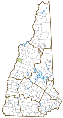
Town of Piermont
Sarah Tucker, Administrative Assistant
130 Route 10
Piermont, NH
03779
|
| Telephone |
(603) 272-9181 |
| Fax |
(603) 272-9182 |
| E-mail |
sarah.tucker@townofpiermontnh.org |
| Web Site |
http://townofpiermontnh.org
|
| Municipal Office Hours |
Administrative Assistant: Monday, Tuesday, Thursday, Friday, 9-3, closed W; Tax Collector: Thursday, 2-6; Town Clerk: Tuesday, 3-6, Wednesday, 10-3
|
| County |
Grafton |
| Labor Market Area |
Lebanon, NH-VT Micropolitan NECTA, NH part |
| Tourism Region |
White Mountains |
| Planning Commission |
Upper Valley Lake Sunapee |
| Regional Development |
Grafton County Economic Development Council
|
| Election Districts |
|
| US Congress |
District District 2 |
| Executive Council |
District District 2 |
| State Senate |
District District 1 |
| State Representative |
Grafton County District 5 |
| Incorporated: 1764 |
| Origin: Situated on the Connecticut River just west of the White Mountain National Forest, this town was named for Piedmont in the Italian Alps. The majority of those named in the charter were titled Honorable or Esquire, or had a military title. Though the charter was issued in 1764, the first settlements were not made until about 1768. Lake Tarleton, on the town's eastern border, was once on the property of Colonel William Tarleton, a tavernkeeper who was a delegate to the Constitutional Convention of 1791, and member of the presidential Electoral College in 1804. |
| Villages and Place Names: unknown
|
| Population, Year of the First Census Taken: 426 residents in 1790 |
| Population Trends: Population change for Piermont totaled 311 over 50 years, from 462 in 1970 to 773 in 2020. The 2022 Census estimate for Piermont was 777 residents, which ranked 204th among New Hampshire's incorporated cities and towns. |
| Population Density and Land Area, 2022 (US Census Bureau): 20.1 persons per square mile of land area. Piermont contains 38.6 square miles of land area and 1.4 square miles of inland water area. |
| Municipal Services |
| Type of Government |
Selectmen |
| Budget: Municipal Appropriations, 2021 |
$1,652,954 |
| Budget: School Appropriations, 2021-2022 |
$2,136,470 |
| Zoning Ordinance |
1971/15 |
| Master Plan |
1996 |
| Capitol Improvement Plan |
Yes |
| Industrial Plans Reviewed By |
Zoning Board |
| Boards and Commissions | |
| Elected: | Selectmen; Library |
| Appointed: | Planning; Zoning; Conservation; CIP |
| Public Library |
Piermont Public |
| Emergency Services |
| Police Department |
Full-time |
| Fire Department |
Volunteer |
| Emergency Medical Service |
Volunteer |
| Nearest Hospital(s) |
Distance |
Staffed Beds |
| Cottage Hospital, Woodsville |
14 miles |
35 |
|
|
|
|
|
|
| Utilities |
| Electric Supplier |
Eversource Energy; NH Electric Coop |
| Natural Gas Supplier |
None |
| Water Supplier |
Private wells |
| Sanitation |
Private septic & municipal |
| Municipal Wastewater Treatment Plant |
Yes |
| Solid Waste Disposal |
| Curbside Trash Pickup | Private |
| Pay-As-You-Throw Program | Yes |
| Recycling Program | Voluntary |
| Telephone Company |
Consolidated Communications |
| Cellular Telephone Access |
Limited |
| Cable Television Access |
Limited |
| Public Access Television Station |
No |
| High Speed Internet Service: |
| Business | Limited |
| Residential | Limited |
| (NH Dept. of Revenue Administration) Property Taxes |
| 2022 Total Tax Rate (per $1,000 of value) |
$19.99 |
| 2022 Equalization Ratio |
90.2 |
| 2022 Full Value Tax Rate (per $1,000 of value) |
$17.99 |
| 2022 Percent of Local Assessed Value by Property Type |
| Residential Land and Buildings | 94.5% |
| Commercial Land and Buildings | 2.2% |
| Public Utilities, Current Use, and Other | 3.3% |
| (ACS 2017-2021) Housing |
| Total Housing Units |
405 |
| Single-Family Units, Detached or Attached |
359 |
| Units in Multiple-Family Structures: |
|
| Two to Four Units in Structure |
16 |
| Five or More Units in Structure |
17 |
| Mobile Homes and Other Housing Units |
13 |
(US Census Bureau) Population
(1-Year Estimates/Decennial) |
| Total Population |
Community |
County |
| 2022 |
777 |
91,126 |
| 2020 |
769 |
91,118 |
| 2010 |
790 |
89,118 |
| 2000 |
708 |
81,826 |
| 1990 |
625 |
74,998 |
| 1980 |
507 |
65,806 |
| |
| Demographics, American Community Survey (ACS) 2017-2021 |
| Population by Gender |
| Male: 366 |
|
Female: 348 |
| Population by Age Group |
| Under age 5 |
|
15 |
| Age 5 to 19 |
|
141 |
| Age 20 to 34 |
|
107 |
| Age 35 to 54 |
|
197 |
| Age 55 to 64 |
|
122 |
| Age 65 and over |
|
132 |
| Median Age |
|
45.6 years |
| Educational Attainment, population 25 years and over |
|
536 |
| High school graduate or higher |
|
96.3% |
| Bachelor's degree or higher |
|
46.5% |
| (ACS 2017-2021) Income, Inflation Adjusted $ |
| Per capita income |
$50,871 |
| Median family income |
$94,375 |
| Median household income |
$75,625 |
| Median Earnings, full-time, year-round workers |
| Male |
$58,958 |
| Female |
$55,781 |
| Individuals below the poverty level |
3.9% |
| (NHES - ELMI) Labor Force |
| Annual Average |
2012 |
2022 |
| Civilian Labor Force |
409 |
421 |
| Employed |
394 |
406 |
| Unemployed |
15 |
15 |
| Unemployment Rate |
3.7% |
3.6% |
| (NHES - ELMI) Employment & Wages |
| Annual Average Covered Employment |
2012 |
2022 |
| Goods Producing Industries |
| Average Employment |
n |
3 |
| Average Weekly Wage |
n |
$623 |
| |
|
|
| Service Providing Industries |
| Average Employment |
n |
22 |
| Average Weekly Wage |
n |
$825 |
| |
|
|
| Total Private Industry |
| Average Employment |
33 |
25 |
| Average Weekly Wage |
$551 |
$802 |
| |
|
|
| Government (Federal, State, and Local) |
| Average Employment |
37 |
14 |
| Average Weekly Wage |
$454 |
$387 |
| |
|
|
| Total, Private plus Government |
| Average Employment |
69 |
39 |
| Average Weekly Wage |
$500 |
$649 |
If "n" appears, data does not meet disclosure standards.
| (NH Dept. of Education) Education and Child Care |
| Schools students attend: |
Piermont operates grades K-8; grades 9-12 are tuitioned to Haverhill Cooperative (Bath, Denton, Haverhill, Piermont, Warren) |
SAU 23 |
| Career Technology Center(s): |
Hartford Area Career & Technology Center (VT); River Bend Career & Technical Center (VT) |
| Educational Facilities (includes Charter Schools) |
Elementary |
Middle/Junior High |
High School |
Private/Parochial |
| Number of Schools |
1 |
|
|
|
| Grade Levels |
P K 1-8 |
|
|
9-12 |
| Total Enrollment |
53 |
|
|
|
| 2022 NH Licensed Child Care Facilities (Bureau of Child Care Licensing): |
Total Facilities: 0 |
Total Capacity: 0 |
| Nearest Community/Technical College: Lakes Region; River Valley |
| Nearest Colleges or Universities: Plymouth State |
| Largest Businesses |
Product/Service |
Employees |
Established |
| Camp Walt Whitman |
Summer camp |
200 |
1940 |
| Camp Kingswood |
Summer camp |
75 |
|
| Woodsville Guaranty Bank |
Banking services |
7 |
|
| JEM Enterprises |
Garden center/Nursery |
9 |
|
| Four Corners Gas Station |
Convenience store, gas |
8 |
|
| Piermont Plant Pantry |
Garden center |
12 |
|
| Piermont Village School |
Education |
25 |
|
|
|
|
|
|
|
|
|
|
|
|
|
Employer Information Supplied by Municipality
| (Distance estimated from city/town hall) Transportation |
| Road Access |
US Routes |
|
|
State Routes |
10, 25, 25C |
| Nearest Interstate, Exit |
I-91 (VT), Exit 16 |
|
Distance |
3 miles |
| Railroad |
No |
| Public Transportation |
No |
| |
| Nearest Public Use Airport, General Aviation |
| Dean Memorial, Haverhill | Runway | 2,500 ft. asphalt |
| Lighted? |
Yes |
Navigational Aids? |
No |
| Nearest Airport with Scheduled Service |
| Lebanon Municipal |
Distance |
30 miles |
| Number of Passenger Airlines Serving Airport |
1 |
| |
| Driving distance to selected cities: |
| Manchester, NH |
93 miles |
| Portland, ME |
125 miles |
| Boston, MA |
143 miles |
| New York City, NY |
292 miles |
| Montreal, Quebec |
182 miles |
| (ACS 2017-2021) Commuting to Work |
| Workers 16 years and over |
384 |
| Drove alone, car/truck/van |
72.7% |
| Carpooled, car/truck/van |
10.2% |
| Public transportation |
1.8% |
| Walked |
2.6% |
| Other Means |
2.3% |
| Worked at home |
10.4% |
| Mean Travel Time to Work |
31.6 minutes |
| |
| Percent of Working Residents: |
(ACS 2017-2021) |
| Working in community of residence |
25.8% |
| Commuting to another NH community |
52.3% |
| Commuting out-of-state |
21.9% |
| Recreation, Attractions, and Events |
| Municipal Parks |
| YMCA/YWCA |
| Boys Club/Girls Club |
| Golf Courses |
| Swimming: Indoor Facility |
| Swimming: Outdoor Facility |
| Tennis Courts: Indoor Facility |
| Tennis Courts: Outdoor Facility |
| Ice Skating Rink: Indoor Facility |
| Bowling Facilities |
| Museums |
| Cinemas |
| Performing Arts Facilities |
| Tourist Attractions |
| Youth Organizations (i.e., Scouts, 4-H) |
| Youth Sports: Baseball |
| Youth Sports: Soccer |
| Youth Sports: Football |
| Youth Sports: Basketball |
| Youth Sports: Hockey |
| Campgrounds |
| Fishing/Hunting |
| Boating/Marinas |
| Snowmobile Trails |
| Bicycle Trails |
| Cross Country Skiing |
| Beach or Waterfront Recreational Area |
| Overnight or Day Camps |
| |
|
|
Nearest Ski Area(s): Dartmouth Skiway |
| |
|
|
Other: |
Economic & Labor Market Information Bureau, NH Employment Security, October 2023. Community Response Received 6/16/22
All information regarding the communities is from sources deemed reliable and is submitted subject to errors, omissions, modifications, and withdrawals without notice. No warranty or representation is made as to the accuracy of the information contained herein. Specific questions regarding individual cities and towns should be directed to the community contact.


