 |
Community Contact |
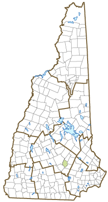
Town of Pembroke
David Jodoin, Town Administrator
311 Pembroke Street
Pembroke, NH
03275
|
| Telephone |
(603) 485-4747 |
| Fax |
(603) 485-3967 |
| E-mail |
Townhall@Pembroke-NH.com |
| Web Site |
www.pembroke-nh.com/
|
| Municipal Office Hours |
Town Administrator, Tax Collector: Monday to Friday, 8-4:30; Town Clerk: Monday to Friday, 8-4:30, first and last Thursday each month, 5-7
|
| County |
Merrimack |
| Labor Market Area |
Manchester, NH Metropolitan NECTA |
| Tourism Region |
Merrimack Valley |
| Planning Commission |
Central NH Regional |
| Regional Development |
Capital Regional Development Council
|
| Election Districts |
|
| US Congress |
District District 2 |
| Executive Council |
District District 4 |
| State Senate |
District District 17 |
| State Representative |
Merrimack County District 12 |
| Incorporated: 1759 |
| Origin: This township was first granted in 1728 to the heirs of Captain John Lovewell and members of his company or their heirs, and given the name Lovewell's Town. Captain Lovewell built the fort at Ossipee and was killed fighting the Indians at Pequawket. The township was more commonly called Suncook, after the river, and another settlement was known as Buckstreet. When the town was incorporated in 1759, it included Suncook, Buckstreet, and portions of Bow that were east of the Merrimack River. It was given the name Pembroke in honor of Henry Herbert, ninth Earl of Pembroke in southern Wales. |
| Villages and Place Names: North Pembroke, Suncook Village
|
| Population, Year of the First Census Taken: 956 residents in 1790 |
| Population Trends: Population change for Pembroke totaled 3,028 over 50 years, from 4,261 in 1970 to 7,289 in 2020. The 2022 Census estimate for Pembroke was 7,480 residents, which ranked 43rd among New Hampshire's incorporated cities and towns. |
| Population Density and Land Area, 2022 (US Census Bureau): 330.4 persons per square mile of land area. Pembroke contains 22.6 square miles of land area and 0.2 square miles of inland water area. |
| Municipal Services |
| Type of Government |
Selectmen |
| Budget: Municipal Appropriations, 2021 |
$12,183,383 |
| Budget: School Appropriations, 2021-2022 |
$30,779,250 |
| Zoning Ordinance |
1974/23 |
| Master Plan |
2021 |
| Capitol Improvement Plan |
Yes |
| Industrial Plans Reviewed By |
Planning Board |
| Boards and Commissions | |
| Elected: | Selectmen; Library; Water; Sewer |
| Appointed: | Planning; Zoning; Cemetery; Conservation; Recreation; Budget; CIP |
| Public Library |
Pembroke Town |
| Emergency Services |
| Police Department |
Full-time |
| Fire Department |
Call force |
| Emergency Medical Service |
Intermunicipal |
| Nearest Hospital(s) |
Distance |
Staffed Beds |
| Concord Hospital, Concord |
7 miles |
236 |
|
|
|
|
|
|
| Utilities |
| Electric Supplier |
NH Electric Coop; Eversource Energy; Unitil |
| Natural Gas Supplier |
Liberty Utilities |
| Water Supplier |
Pembroke Water Works |
| Sanitation |
Private septic & municipal |
| Municipal Wastewater Treatment Plant |
Yes |
| Solid Waste Disposal |
| Curbside Trash Pickup | Municipal |
| Pay-As-You-Throw Program | No |
| Recycling Program | Mandatory |
| Telephone Company |
Consolidated Communications |
| Cellular Telephone Access |
Yes |
| Cable Television Access |
Yes |
| Public Access Television Station |
No |
| High Speed Internet Service: |
| Business | Yes |
| Residential | Yes |
| (NH Dept. of Revenue Administration) Property Taxes |
| 2022 Total Tax Rate (per $1,000 of value) |
$24.90 |
| 2022 Equalization Ratio |
67.1 |
| 2022 Full Value Tax Rate (per $1,000 of value) |
$16.67 |
| 2022 Percent of Local Assessed Value by Property Type |
| Residential Land and Buildings | 77.7% |
| Commercial Land and Buildings | 19.0% |
| Public Utilities, Current Use, and Other | 3.3% |
| (ACS 2017-2021) Housing |
| Total Housing Units |
2,806 |
| Single-Family Units, Detached or Attached |
1,836 |
| Units in Multiple-Family Structures: |
|
| Two to Four Units in Structure |
590 |
| Five or More Units in Structure |
158 |
| Mobile Homes and Other Housing Units |
222 |
(US Census Bureau) Population
(1-Year Estimates/Decennial) |
| Total Population |
Community |
County |
| 2022 |
7,480 |
156,020 |
| 2020 |
7,207 |
153,808 |
| 2010 |
7,115 |
146,445 |
| 2000 |
6,917 |
136,716 |
| 1990 |
6,581 |
120,618 |
| 1980 |
4,861 |
98,302 |
| |
| Demographics, American Community Survey (ACS) 2017-2021 |
| Population by Gender |
| Male: 3,676 |
|
Female: 3,622 |
| Population by Age Group |
| Under age 5 |
|
386 |
| Age 5 to 19 |
|
1,342 |
| Age 20 to 34 |
|
1,574 |
| Age 35 to 54 |
|
2,029 |
| Age 55 to 64 |
|
1,096 |
| Age 65 and over |
|
871 |
| Median Age |
|
39.0 years |
| Educational Attainment, population 25 years and over |
|
5,048 |
| High school graduate or higher |
|
93.0% |
| Bachelor's degree or higher |
|
26.4% |
| (ACS 2017-2021) Income, Inflation Adjusted $ |
| Per capita income |
$38,369 |
| Median family income |
$110,313 |
| Median household income |
$90,288 |
| Median Earnings, full-time, year-round workers |
| Male |
$46,801 |
| Female |
$65,465 |
| Individuals below the poverty level |
5.3% |
| (NHES - ELMI) Labor Force |
| Annual Average |
2012 |
2022 |
| Civilian Labor Force |
4,222 |
4,450 |
| Employed |
3,991 |
4,347 |
| Unemployed |
231 |
103 |
| Unemployment Rate |
5.5% |
2.3% |
| (NHES - ELMI) Employment & Wages |
| Annual Average Covered Employment |
2012 |
2022 |
| Goods Producing Industries |
| Average Employment |
354 |
389 |
| Average Weekly Wage |
$926 |
$1,340 |
| |
|
|
| Service Providing Industries |
| Average Employment |
1,358 |
1,618 |
| Average Weekly Wage |
$843 |
$1,198 |
| |
|
|
| Total Private Industry |
| Average Employment |
1,712 |
2,008 |
| Average Weekly Wage |
$860 |
$1,226 |
| |
|
|
| Government (Federal, State, and Local) |
| Average Employment |
554 |
519 |
| Average Weekly Wage |
$747 |
$976 |
| |
|
|
| Total, Private plus Government |
| Average Employment |
2,267 |
2,527 |
| Average Weekly Wage |
$833 |
$1,175 |
If "n" appears, data does not meet disclosure standards.
| (NH Dept. of Education) Education and Child Care |
| Schools students attend: |
Pembroke operates grades K-12 |
SAU 53 |
| Career Technology Center(s): |
Concord Regional Technical Center |
| Educational Facilities (includes Charter Schools) |
Elementary |
Middle/Junior High |
High School |
Private/Parochial |
| Number of Schools |
2 |
1 |
1 |
1 |
| Grade Levels |
K 1-8 |
5-8 |
9-12 |
9-12 |
| Total Enrollment |
618 |
316 |
783 |
73 |
| 2022 NH Licensed Child Care Facilities (Bureau of Child Care Licensing): |
Total Facilities: 5 |
Total Capacity: 193 |
| Nearest Community/Technical College: NHTI-Concord |
| Nearest Colleges or Universities: UNH School of Law; Granite State; Southern NH University;UNH-Manchester; MCPHS; Franklin Pierce-Manchester |
| Largest Businesses |
Product/Service |
Employees |
Established |
| Associated Grocers of New England, Inc. |
Wholesale distribution center |
325 |
2006 |
| Town of Pembroke |
Municipal services |
47 |
1759 |
| Heat and Control |
Food processing equipment |
42 |
|
| Nortrax |
Equipment sales, service |
15 |
|
| A & B Lumber/Belletetes |
Lumber sales, service |
20 |
|
| Airgas |
Industry supplies |
9 |
|
| Pembroke School District |
Education |
235 |
|
| Pitco |
Food processing equipment |
26 |
2014 |
|
|
|
|
|
|
|
|
Employer Information Supplied by Municipality
| (Distance estimated from city/town hall) Transportation |
| Road Access |
US Routes |
3, 4, 202 |
|
State Routes |
9, 28, 106 |
| Nearest Interstate, Exit |
I-93, Exit 13 |
|
Distance |
5 miles |
| Railroad |
No |
| Public Transportation |
No |
| |
| Nearest Public Use Airport, General Aviation |
| Concord Municipal | Runway | 6,005 ft. asphalt |
| Lighted? |
Yes |
Navigational Aids? |
Yes |
| Nearest Airport with Scheduled Service |
| Manchester-Boston Regional |
Distance |
17 miles |
| Number of Passenger Airlines Serving Airport |
4 |
| |
| Driving distance to selected cities: |
| Manchester, NH |
4 miles |
| Portland, ME |
101 miles |
| Boston, MA |
64 miles |
| New York City, NY |
264 miles |
| Montreal, Quebec |
250 miles |
| (ACS 2017-2021) Commuting to Work |
| Workers 16 years and over |
4,066 |
| Drove alone, car/truck/van |
80.6% |
| Carpooled, car/truck/van |
8.7% |
| Public transportation |
0.0% |
| Walked |
2.0% |
| Other Means |
0.8% |
| Worked at home |
7.9% |
| Mean Travel Time to Work |
27.8 minutes |
| |
| Percent of Working Residents: |
(ACS 2017-2021) |
| Working in community of residence |
19.2% |
| Commuting to another NH community |
76.7% |
| Commuting out-of-state |
4.1% |
| Recreation, Attractions, and Events |
| Municipal Parks |
| YMCA/YWCA |
| Boys Club/Girls Club |
| Golf Courses |
| Swimming: Indoor Facility |
| Swimming: Outdoor Facility |
| Tennis Courts: Indoor Facility |
| Tennis Courts: Outdoor Facility |
| Ice Skating Rink: Indoor Facility |
| Bowling Facilities |
| Museums |
| Cinemas |
| Performing Arts Facilities |
| Tourist Attractions |
| Youth Organizations (i.e., Scouts, 4-H) |
| Youth Sports: Baseball |
| Youth Sports: Soccer |
| Youth Sports: Football |
| Youth Sports: Basketball |
| Youth Sports: Hockey |
| Campgrounds |
| Fishing/Hunting |
| Boating/Marinas |
| Snowmobile Trails |
| Bicycle Trails |
| Cross Country Skiing |
| Beach or Waterfront Recreational Area |
| Overnight or Day Camps |
| |
|
|
Nearest Ski Area(s): Pat's Peak, Mount Sunapee |
| |
|
|
Other: White Sands Conservation Area |
Economic & Labor Market Information Bureau, NH Employment Security, October 2023. Community Response Received 5/31/23
All information regarding the communities is from sources deemed reliable and is submitted subject to errors, omissions, modifications, and withdrawals without notice. No warranty or representation is made as to the accuracy of the information contained herein. Specific questions regarding individual cities and towns should be directed to the community contact.


