 |
Community Contact |
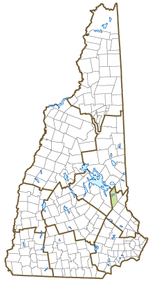
Town of New Durham
Nicole Zoltko, Town Administrator
4 Main Street, PO Box 207
New Durham, NH
03855
|
| Telephone |
(603) 859-2091 |
| Fax |
(603) 859-6644 |
| E-mail |
ndadmin@newdurhamnh.us |
| Web Site |
www.newdurhamnh.us
|
| Municipal Office Hours |
Town Administrator: by appointment; Town Clerk/Tax Collector: Monday to Thursday, 8-4, last Thursday of each month, 8-6:30; Transfer Station: Friday to Monday, 8-4:45, closed Tuesday to Thursday
|
| County |
Strafford |
| Labor Market Area |
Dover-Durham, NH-ME Metropolitan NECTA |
| Tourism Region |
Lakes |
| Planning Commission |
Strafford Regional |
| Regional Development |
Wentworth Economic Development Corp.
|
| Election Districts |
|
| US Congress |
District District 1 |
| Executive Council |
District District 1 |
| State Senate |
District District 6 |
| State Representative |
Strafford County District 3, 18 |
| Incorporated: 1762 |
| Origin: Granted in 1749 as Cocheco, New Durham was first settled almost entirely by colonists from Durham, New Hampshire. Colonel Thomas Tash, who had fought in England's Seven Years War against France and was granted land in reward for his service, was appointed proprietor's clerk and called the first town meeting. The town was incorporated as New Durham in 1762. An early minister in the town, Reverend Benjamin Randall, founded a new religious denomination called the Free-Will Baptists, later known as Free Baptists. |
| Villages and Place Names: Copplecrown Village District
|
| Population, Year of the First Census Taken: 554 residents in 1790 |
| Population Trends: Population change for New Durham totaled 2,112 over 50 years, from 583 in 1970 to 2,695 in 2020. The 2022 Census estimate for New Durham was 2,757 residents, which ranked 116th among New Hampshire's incorporated cities and towns. |
| Population Density and Land Area, 2022 (US Census Bureau): 66.6 persons per square mile of land area. New Durham contains 41.4 square miles of land area and 2.5 square miles of inland water area. |
| Municipal Services |
| Type of Government |
Selectmen |
| Budget: Municipal Appropriations, 2020 |
$3,552,150 |
| Budget: School Appropriations, 2020-2021 |
$6,559,477 |
| Zoning Ordinance |
1971/20 |
| Master Plan |
2017 |
| Capitol Improvement Plan |
Yes |
| Industrial Plans Reviewed By |
Regional Planning Commission |
| Boards and Commissions | |
| Elected: | Selectmen; Library; Cemetery; Trust Funds; Planning; Zoning; Budget |
| Appointed: | Conservation; Parks & Recreation; Ethics; Milfoil; 1772 Meetinghouse; CIP; Boodey House |
| Public Library |
New Durham Public |
| Emergency Services |
| Police Department |
Full-time |
| Fire Department |
Part-time |
| Emergency Medical Service |
Part-time |
| Nearest Hospital(s) |
Distance |
Staffed Beds |
| Frisbie Memorial, Rochester |
15 miles |
27 |
|
|
|
|
|
|
| Utilities |
| Electric Supplier |
Eversource Energy; NH Electric Coop |
| Natural Gas Supplier |
None |
| Water Supplier |
Private wells |
| Sanitation |
Private septic |
| Municipal Wastewater Treatment Plant |
No |
| Solid Waste Disposal |
| Curbside Trash Pickup | Private |
| Pay-As-You-Throw Program | No |
| Recycling Program | Mandatory |
| Telephone Company |
Consolidated Communications; TDS |
| Cellular Telephone Access |
Yes |
| Cable Television Access |
Yes |
| Public Access Television Station |
Yes |
| High Speed Internet Service: |
| Business | Yes |
| Residential | Yes |
| (NH Dept. of Revenue Administration) Property Taxes |
| 2022 Total Tax Rate (per $1,000 of value) |
$17.92 |
| 2022 Equalization Ratio |
71.8 |
| 2022 Full Value Tax Rate (per $1,000 of value) |
$12.83 |
| 2022 Percent of Local Assessed Value by Property Type |
| Residential Land and Buildings | 96.4% |
| Commercial Land and Buildings | 2.6% |
| Public Utilities, Current Use, and Other | 1.1% |
| (ACS 2017-2021) Housing |
| Total Housing Units |
1,570 |
| Single-Family Units, Detached or Attached |
1,466 |
| Units in Multiple-Family Structures: |
|
| Two to Four Units in Structure |
18 |
| Five or More Units in Structure |
0 |
| Mobile Homes and Other Housing Units |
86 |
(US Census Bureau) Population
(1-Year Estimates/Decennial) |
| Total Population |
Community |
County |
| 2022 |
2,757 |
132,275 |
| 2020 |
2,693 |
130,889 |
| 2010 |
2,638 |
123,143 |
| 2000 |
2,236 |
112,676 |
| 1990 |
1,948 |
104,348 |
| 1980 |
1,183 |
85,324 |
| |
| Demographics, American Community Survey (ACS) 2017-2021 |
| Population by Gender |
| Male: 1,442 |
|
Female: 1,256 |
| Population by Age Group |
| Under age 5 |
|
183 |
| Age 5 to 19 |
|
414 |
| Age 20 to 34 |
|
357 |
| Age 35 to 54 |
|
889 |
| Age 55 to 64 |
|
376 |
| Age 65 and over |
|
479 |
| Median Age |
|
45.9 years |
| Educational Attainment, population 25 years and over |
|
2,012 |
| High school graduate or higher |
|
93.8% |
| Bachelor's degree or higher |
|
31.9% |
| (ACS 2017-2021) Income, Inflation Adjusted $ |
| Per capita income |
$39,620 |
| Median family income |
$111,607 |
| Median household income |
$89,150 |
| Median Earnings, full-time, year-round workers |
| Male |
$66,069 |
| Female |
$59,438 |
| Individuals below the poverty level |
6.4% |
| (NHES - ELMI) Labor Force |
| Annual Average |
2012 |
2022 |
| Civilian Labor Force |
1,517 |
1,538 |
| Employed |
1,415 |
1,504 |
| Unemployed |
102 |
34 |
| Unemployment Rate |
6.7% |
2.2% |
| (NHES - ELMI) Employment & Wages |
| Annual Average Covered Employment |
2012 |
2022 |
| Goods Producing Industries |
| Average Employment |
n |
20 |
| Average Weekly Wage |
n |
$1,009 |
| |
|
|
| Service Providing Industries |
| Average Employment |
n |
178 |
| Average Weekly Wage |
n |
$954 |
| |
|
|
| Total Private Industry |
| Average Employment |
182 |
198 |
| Average Weekly Wage |
$510 |
$960 |
| |
|
|
| Government (Federal, State, and Local) |
| Average Employment |
108 |
97 |
| Average Weekly Wage |
$555 |
$819 |
| |
|
|
| Total, Private plus Government |
| Average Employment |
290 |
295 |
| Average Weekly Wage |
$527 |
$913 |
If "n" appears, data does not meet disclosure standards.
| (NH Dept. of Education) Education and Child Care |
| Schools students attend: |
Grades K-12 are part of Governor Wentworth Regional (Brookfield, Effingham, Middleton, New Durham, Ossipee, Tuftonboro, Wolfeboro) |
SAU 49 |
| Career Technology Center(s): |
Lakes Region Technology Center (Wolfeboro) |
| Educational Facilities (includes Charter Schools) |
Elementary |
Middle/Junior High |
High School |
Private/Parochial |
| Number of Schools |
1 |
|
|
|
| Grade Levels |
P K 1-6 |
|
|
9-12 |
| Total Enrollment |
159 |
|
|
|
| 2022 NH Licensed Child Care Facilities (Bureau of Child Care Licensing): |
Total Facilities: 1 |
Total Capacity: 39 |
| Nearest Community/Technical College: Lakes Region |
| Nearest Colleges or Universities: University of NH |
| Largest Businesses |
Product/Service |
Employees |
Established |
| Town of New Durham |
Municipal services |
48 |
|
| New Durham School |
Education |
19 |
|
| State of New Hampshire |
Fish hatchery |
12 |
|
| Johnson's Dairy Bar |
Restaurant |
|
2005 |
|
|
|
|
|
|
|
|
|
|
|
|
|
|
|
|
|
|
|
|
|
|
|
|
Employer Information Supplied by Municipality
| (Distance estimated from city/town hall) Transportation |
| Road Access |
US Routes |
|
|
State Routes |
11 |
| Nearest Interstate, Exit |
Spaulding Tpk., Exit 17; I-93, Exit 15 |
|
Distance |
12 miles; 30 miles |
| Railroad |
No |
| Public Transportation |
No |
| |
| Nearest Public Use Airport, General Aviation |
| Skyhaven, Rochester | Runway | 4,200 ft. asphalt |
| Lighted? |
Yes |
Navigational Aids? |
Yes |
| Nearest Airport with Scheduled Service |
| Manchester-Boston Regional |
Distance |
46 miles |
| Number of Passenger Airlines Serving Airport |
4 |
| |
| Driving distance to selected cities: |
| Manchester, NH |
46 miles |
| Portland, ME |
63 miles |
| Boston, MA |
88 miles |
| New York City, NY |
298 miles |
| Montreal, Quebec |
259 miles |
| (ACS 2017-2021) Commuting to Work |
| Workers 16 years and over |
1,382 |
| Drove alone, car/truck/van |
83.9% |
| Carpooled, car/truck/van |
8.0% |
| Public transportation |
0.0% |
| Walked |
0.7% |
| Other Means |
0.3% |
| Worked at home |
7.0% |
| Mean Travel Time to Work |
38.1 minutes |
| |
| Percent of Working Residents: |
(ACS 2017-2021) |
| Working in community of residence |
12.0% |
| Commuting to another NH community |
79.4% |
| Commuting out-of-state |
8.6% |
| Recreation, Attractions, and Events |
| Municipal Parks |
| YMCA/YWCA |
| Boys Club/Girls Club |
| Golf Courses |
| Swimming: Indoor Facility |
| Swimming: Outdoor Facility |
| Tennis Courts: Indoor Facility |
| Tennis Courts: Outdoor Facility |
| Ice Skating Rink: Indoor Facility |
| Bowling Facilities |
| Museums |
| Cinemas |
| Performing Arts Facilities |
| Tourist Attractions |
| Youth Organizations (i.e., Scouts, 4-H) |
| Youth Sports: Baseball |
| Youth Sports: Soccer |
| Youth Sports: Football |
| Youth Sports: Basketball |
| Youth Sports: Hockey |
| Campgrounds |
| Fishing/Hunting |
| Boating/Marinas |
| Snowmobile Trails |
| Bicycle Trails |
| Cross Country Skiing |
| Beach or Waterfront Recreational Area |
| Overnight or Day Camps |
| |
|
|
Nearest Ski Area(s): Gunstock |
| |
|
|
Other: Merrymeeting Lake; Hiking |
Economic & Labor Market Information Bureau, NH Employment Security, October 2023. Community Response Received 7/7/25
All information regarding the communities is from sources deemed reliable and is submitted subject to errors, omissions, modifications, and withdrawals without notice. No warranty or representation is made as to the accuracy of the information contained herein. Specific questions regarding individual cities and towns should be directed to the community contact.


