 |
Community Contact |
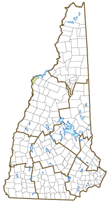
Town of Monroe
Board of Selectmen
152 Woodsville Road
Monroe, NH
03771
|
| Telephone |
(603) 638-2644 |
| Fax |
(603) 638-2021 |
| E-mail |
monroeselectmen@monroenh.org |
| Web Site |
www.monroenh.org
|
| Municipal Office Hours |
Selectmen: Monday to Friday, 8-4, meet Tuesday, 6-9; Town Clerk: Monday and Friday, 8:30-12, Tuesday, 5-8, Wednesday and Thursday, 2-6; Tax Collector: Tuesday, 6-8 or by appointment
|
| County |
Grafton |
| Labor Market Area |
Haverhill, NH LMA |
| Tourism Region |
White Mountains |
| Planning Commission |
North Country Council |
| Regional Development |
Grafton County Economic Development Council
|
| Election Districts |
|
| US Congress |
District District 2 |
| Executive Council |
District District 2 |
| State Senate |
District District 1 |
| State Representative |
Grafton County District 1 |
| Incorporated: 1854 |
| Origin: This territory was first known as Hurd's Location or West Lyman. In 1769, James Hurd was granted five islands in the Connecticut River between Lyman and Barnet, Vermont by Governor John Wentworth. Descendents of James Hurd wanted to name the town after him when it was separated from Lyman in 1854, but lost out to the name Monroe. President James Monroe, for whom a mountain in the Presidential Range had been recently named, toured the region during his presidency. Monroe contains part of the Ammonoosuc Gold Fields, extensive mineral deposits that have never been successfully mined. |
| Villages and Place Names: unknown
|
| Population, Year of the First Census Taken: 619 residents in 1860 |
| Population Trends: Population change for Monroe totaled 482 over 50 years, from 385 in 1970 to 867 in 2020. The 2022 Census estimate for Monroe was 877 residents, which ranked 192nd among New Hampshire's incorporated cities and towns. |
| Population Density and Land Area, 2022 (US Census Bureau): 39.1 persons per square mile of land area. Monroe contains 22.4 square miles of land area and 1.4 square miles of inland water area. |
| Municipal Services |
| Type of Government |
Selectmen |
| Budget: Municipal Appropriations, 2021 |
$1,702,867 |
| Budget: School Appropriations, 2020-2021 |
$3,841,630 |
| Zoning Ordinance |
1941/17/22 |
| Master Plan |
2005 |
| Capitol Improvement Plan |
No |
| Industrial Plans Reviewed By |
Planning Board |
| Boards and Commissions | |
| Elected: | Selectmen; Planning; Zoning; Library; Board of Adjustment |
| Appointed: | |
| Public Library |
Monroe Public |
| Emergency Services |
| Police Department |
Covered by State |
| Fire Department |
Volunteer |
| Emergency Medical Service |
Volunteer |
| Nearest Hospital(s) |
Distance |
Staffed Beds |
| Cottage Hospital, Woodsville |
11 miles |
35 |
| Northeastern VT, St. Johnsbury VT |
15 miles |
25 |
|
|
|
| Utilities |
| Electric Supplier |
Liberty Utilities; NH Electric Coop |
| Natural Gas Supplier |
None |
| Water Supplier |
Monroe Water Department |
| Sanitation |
Private septic |
| Municipal Wastewater Treatment Plant |
No |
| Solid Waste Disposal |
| Curbside Trash Pickup | Municipal |
| Pay-As-You-Throw Program | No |
| Recycling Program | Voluntary |
| Telephone Company |
Consolidated communications |
| Cellular Telephone Access |
Yes |
| Cable Television Access |
Yes |
| Public Access Television Station |
No |
| High Speed Internet Service: |
| Business | Yes |
| Residential | Yes |
| (NH Dept. of Revenue Administration) Property Taxes |
| 2022 Total Tax Rate (per $1,000 of value) |
$12.19 |
| 2022 Equalization Ratio |
58.4 |
| 2022 Full Value Tax Rate (per $1,000 of value) |
$6.49 |
| 2022 Percent of Local Assessed Value by Property Type |
| Residential Land and Buildings | 18.4% |
| Commercial Land and Buildings | 1.7% |
| Public Utilities, Current Use, and Other | 79.9% |
| (ACS 2017-2021) Housing |
| Total Housing Units |
358 |
| Single-Family Units, Detached or Attached |
304 |
| Units in Multiple-Family Structures: |
|
| Two to Four Units in Structure |
3 |
| Five or More Units in Structure |
16 |
| Mobile Homes and Other Housing Units |
35 |
(US Census Bureau) Population
(1-Year Estimates/Decennial) |
| Total Population |
Community |
County |
| 2022 |
877 |
91,126 |
| 2020 |
864 |
91,118 |
| 2010 |
788 |
89,118 |
| 2000 |
765 |
81,826 |
| 1990 |
734 |
74,998 |
| 1980 |
619 |
65,806 |
| |
| Demographics, American Community Survey (ACS) 2017-2021 |
| Population by Gender |
| Male: 516 |
|
Female: 321 |
| Population by Age Group |
| Under age 5 |
|
30 |
| Age 5 to 19 |
|
163 |
| Age 20 to 34 |
|
131 |
| Age 35 to 54 |
|
146 |
| Age 55 to 64 |
|
154 |
| Age 65 and over |
|
213 |
| Median Age |
|
50.6 years |
| Educational Attainment, population 25 years and over |
|
616 |
| High school graduate or higher |
|
84.4% |
| Bachelor's degree or higher |
|
24.7% |
| (ACS 2017-2021) Income, Inflation Adjusted $ |
| Per capita income |
$35,114 |
| Median family income |
$78,594 |
| Median household income |
$74,063 |
| Median Earnings, full-time, year-round workers |
| Male |
$63,750 |
| Female |
$36,875 |
| Individuals below the poverty level |
3.7% |
| (NHES - ELMI) Labor Force |
| Annual Average |
2012 |
2022 |
| Civilian Labor Force |
382 |
377 |
| Employed |
364 |
363 |
| Unemployed |
18 |
14 |
| Unemployment Rate |
4.7% |
3.7% |
| (NHES - ELMI) Employment & Wages |
| Annual Average Covered Employment |
2012 |
2022 |
| Goods Producing Industries |
| Average Employment |
103 |
133 |
| Average Weekly Wage |
$1,078 |
$1,604 |
| |
|
|
| Service Providing Industries |
| Average Employment |
58 |
48 |
| Average Weekly Wage |
$1,339 |
$793 |
| |
|
|
| Total Private Industry |
| Average Employment |
161 |
181 |
| Average Weekly Wage |
$1,171 |
$1,388 |
| |
|
|
| Government (Federal, State, and Local) |
| Average Employment |
12 |
15 |
| Average Weekly Wage |
$319 |
$384 |
| |
|
|
| Total, Private plus Government |
| Average Employment |
173 |
197 |
| Average Weekly Wage |
$1,112 |
$1,309 |
If "n" appears, data does not meet disclosure standards.
| (NH Dept. of Education) Education and Child Care |
| Schools students attend: |
Monroe operates grades K-8; grades 9-12 are tuitioned to the State of Vermont (St. Johnsbury Academy) |
SAU 77 |
| Career Technology Center(s): |
River Bend Career & Technical Center (VT) |
| Educational Facilities (includes Charter Schools) |
Elementary |
Middle/Junior High |
High School |
Private/Parochial |
| Number of Schools |
1 |
|
|
|
| Grade Levels |
P K 1-8 |
|
|
9-12 |
| Total Enrollment |
92 |
|
|
|
| 2022 NH Licensed Child Care Facilities (Bureau of Child Care Licensing): |
Total Facilities: 0 |
Total Capacity: 0 |
| Nearest Community/Technical College: White Mountains |
| Nearest Colleges or Universities: Plymouth State; Lyndon State (VT) |
| Largest Businesses |
Product/Service |
Employees |
Established |
| Monroe Consolidated School |
Education |
43 |
|
| Pete & Gerry's |
Egg processing, poultry |
96 |
1970 |
|
|
|
|
|
|
|
|
|
|
|
|
|
|
|
|
|
|
|
|
|
|
|
|
|
|
|
|
|
|
|
|
Employer Information Supplied by Municipality
| (Distance estimated from city/town hall) Transportation |
| Road Access |
US Routes |
|
|
State Routes |
135 |
| Nearest Interstate, Exit |
I-91 (VT), Exit 18 |
|
Distance |
3 miles |
| Railroad |
No |
| Public Transportation |
No |
| |
| Nearest Public Use Airport, General Aviation |
| Dean Memorial, Haverhill | Runway | 2,500 ft. asphalt |
| Lighted? |
Yes |
Navigational Aids? |
No |
| Nearest Airport with Scheduled Service |
| Lebanon Municipal |
Distance |
56 miles |
| Number of Passenger Airlines Serving Airport |
1 |
| |
| Driving distance to selected cities: |
| Manchester, NH |
123 miles |
| Portland, ME |
131 miles |
| Boston, MA |
173 miles |
| New York City, NY |
318 miles |
| Montreal, Quebec |
159 miles |
| (ACS 2017-2021) Commuting to Work |
| Workers 16 years and over |
366 |
| Drove alone, car/truck/van |
86.6% |
| Carpooled, car/truck/van |
6.8% |
| Public transportation |
0.0% |
| Walked |
1.6% |
| Other Means |
1.9% |
| Worked at home |
3.0% |
| Mean Travel Time to Work |
27.6 minutes |
| |
| Percent of Working Residents: |
(ACS 2017-2021) |
| Working in community of residence |
19.9% |
| Commuting to another NH community |
52.0% |
| Commuting out-of-state |
28.1% |
| Recreation, Attractions, and Events |
| Municipal Parks |
| YMCA/YWCA |
| Boys Club/Girls Club |
| Golf Courses |
| Swimming: Indoor Facility |
| Swimming: Outdoor Facility |
| Tennis Courts: Indoor Facility |
| Tennis Courts: Outdoor Facility |
| Ice Skating Rink: Indoor Facility |
| Bowling Facilities |
| Museums |
| Cinemas |
| Performing Arts Facilities |
| Tourist Attractions |
| Youth Organizations (i.e., Scouts, 4-H) |
| Youth Sports: Baseball |
| Youth Sports: Soccer |
| Youth Sports: Football |
| Youth Sports: Basketball |
| Youth Sports: Hockey |
| Campgrounds |
| Fishing/Hunting |
| Boating/Marinas |
| Snowmobile Trails |
| Bicycle Trails |
| Cross Country Skiing |
| Beach or Waterfront Recreational Area |
| Overnight or Day Camps |
| |
|
|
Nearest Ski Area(s): Loon & Burke Mountains |
| |
|
|
Other: Outdoor Skating Rink |
Economic & Labor Market Information Bureau, NH Employment Security, October 2023. Community Response Received 5/13/22
All information regarding the communities is from sources deemed reliable and is submitted subject to errors, omissions, modifications, and withdrawals without notice. No warranty or representation is made as to the accuracy of the information contained herein. Specific questions regarding individual cities and towns should be directed to the community contact.


