 |
Community Contact |
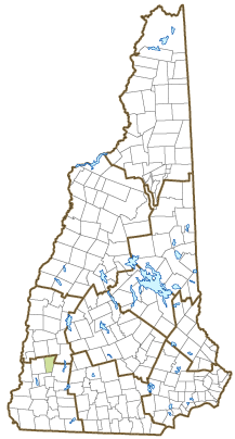
Town of Marlow
Jacqui Fay, Executive Administrator
167 NH Route 123, Town Office
Marlow, NH
03456-0184
|
| Telephone |
(603) 446-2245 x1 |
| Fax |
(603) 446-3806 |
| E-mail |
marlowtownoffice@marlownh.gov |
| Web Site |
www.marlownh.gov
|
| Municipal Office Hours |
Selectmen: meet Monday, 6:30-10 pm; Town Office: Tuesday, Thursday, and Friday, 10-1 and 2-3:30; Town Clerk: Wednesday, 4:30-7, Thursday, 10-12:30; Tax Collector: Tuesday, 5-7
|
| County |
Cheshire |
| Labor Market Area |
Keene, NH Micropolitan NECTA |
| Tourism Region |
Monadnock |
| Planning Commission |
Southwest Region |
| Regional Development |
Monadnock Economic Development Corp.
|
| Election Districts |
|
| US Congress |
District District 2 |
| Executive Council |
District District 2 |
| State Senate |
District District 8 |
| State Representative |
Cheshire County Districts 9, 16 |
| Incorporated: 1761 |
| Origin: This territory was first chartered in 1753 as Addison, after Joseph Addison, Secretary of State for England, who signed the appointment papers making John Wentworth Lieutenant Governor of New Hampshire under the jurisdiction of Massachusetts in 1717. As a result of the French and Indian War, few original grantees settled there under the terms of the charter. The town was regranted in 1761 as Marlow, and the charter renewed in 1772. In some references, the name was in honor of Christopher Marlowe, the famed author and playwright; others indicate it was taken from the English town of the same name. Marlow was one of the towns that joined Vermont during the boundary dispute, but returned to New Hampshire in 1781. |
| Villages and Place Names: unknown
|
| Population, Year of the First Census Taken: 313 residents in 1790 |
| Population Trends: Population change for Marlow totaled 357 over 50 years, from 390 in 1970 to 747 in 2020. The 2022 Census estimate for Marlow was 759 residents, which ranked 206th among New Hampshire's incorporated cities and towns. |
| Population Density and Land Area, 2022 (US Census Bureau): 29.2 persons per square mile of land area. Marlow contains 26.0 square miles of land area and 0.4 square miles of inland water area. |
| Municipal Services |
| Type of Government |
Selectmen |
| Budget: Municipal Appropriations, 2021 |
$2,299,494 |
| Budget: School Appropriations, 2021-2022 |
$2,334,561 |
| Zoning Ordinance |
1986/19 |
| Master Plan |
2003 |
| Capitol Improvement Plan |
No |
| Industrial Plans Reviewed By |
Planning Board |
| Boards and Commissions | |
| Elected: | Selectboard; Library; Cemetery; Budget; Checklist; Trust Funds; Road |
| Appointed: | Planning; Zoning; Conservation; Agricultural; Parks & Recreation; Joint Loss Mngmnt. |
| Public Library |
Marlow Town |
| Emergency Services |
| Police Department |
Part-time |
| Fire Department |
Volunteer |
| Emergency Medical Service |
Volunteer |
| Nearest Hospital(s) |
Distance |
Staffed Beds |
| Cheshire Medical Center, Keene |
17 miles |
94 |
|
|
|
|
|
|
| Utilities |
| Electric Supplier |
Liberty Utilities; Eversource; NH Electric Coop |
| Natural Gas Supplier |
None |
| Water Supplier |
Private wells |
| Sanitation |
Private septic |
| Municipal Wastewater Treatment Plant |
No |
| Solid Waste Disposal |
| Curbside Trash Pickup | None |
| Pay-As-You-Throw Program | No |
| Recycling Program | Mandatory |
| Telephone Company |
Consolidated Communications |
| Cellular Telephone Access |
Yes |
| Cable Television Access |
Limited |
| Public Access Television Station |
No |
| High Speed Internet Service: |
| Business | Yes |
| Residential | Yes |
| (NH Dept. of Revenue Administration) Property Taxes |
| 2022 Total Tax Rate (per $1,000 of value) |
$25.83 |
| 2022 Equalization Ratio |
62.1 |
| 2022 Full Value Tax Rate (per $1,000 of value) |
$16.05 |
| 2022 Percent of Local Assessed Value by Property Type |
| Residential Land and Buildings | 92.4% |
| Commercial Land and Buildings | 3.8% |
| Public Utilities, Current Use, and Other | 3.9% |
| (ACS 2017-2021) Housing |
| Total Housing Units |
406 |
| Single-Family Units, Detached or Attached |
387 |
| Units in Multiple-Family Structures: |
|
| Two to Four Units in Structure |
3 |
| Five or More Units in Structure |
0 |
| Mobile Homes and Other Housing Units |
16 |
(US Census Bureau) Population
(1-Year Estimates/Decennial) |
| Total Population |
Community |
County |
| 2022 |
759 |
77,350 |
| 2020 |
749 |
76,458 |
| 2010 |
742 |
77,117 |
| 2000 |
750 |
73,993 |
| 1990 |
651 |
70,223 |
| 1980 |
542 |
62,116 |
| |
| Demographics, American Community Survey (ACS) 2017-2021 |
| Population by Gender |
| Male: 345 |
|
Female: 446 |
| Population by Age Group |
| Under age 5 |
|
68 |
| Age 5 to 19 |
|
128 |
| Age 20 to 34 |
|
126 |
| Age 35 to 54 |
|
123 |
| Age 55 to 64 |
|
150 |
| Age 65 and over |
|
196 |
| Median Age |
|
49.2 years |
| Educational Attainment, population 25 years and over |
|
573 |
| High school graduate or higher |
|
96.5% |
| Bachelor's degree or higher |
|
24.6% |
| (ACS 2017-2021) Income, Inflation Adjusted $ |
| Per capita income |
$35,048 |
| Median family income |
$105,750 |
| Median household income |
$90,568 |
| Median Earnings, full-time, year-round workers |
| Male |
$67,857 |
| Female |
$37,125 |
| Individuals below the poverty level |
12.9% |
| (NHES - ELMI) Labor Force |
| Annual Average |
2012 |
2022 |
| Civilian Labor Force |
390 |
347 |
| Employed |
368 |
338 |
| Unemployed |
22 |
9 |
| Unemployment Rate |
5.6% |
2.6% |
| (NHES - ELMI) Employment & Wages |
| Annual Average Covered Employment |
2012 |
2022 |
| Goods Producing Industries |
| Average Employment |
n |
n |
| Average Weekly Wage |
n |
n |
| |
|
|
| Service Providing Industries |
| Average Employment |
n |
n |
| Average Weekly Wage |
n |
n |
| |
|
|
| Total Private Industry |
| Average Employment |
48 |
53 |
| Average Weekly Wage |
$678 |
$702 |
| |
|
|
| Government (Federal, State, and Local) |
| Average Employment |
48 |
42 |
| Average Weekly Wage |
$368 |
$540 |
| |
|
|
| Total, Private plus Government |
| Average Employment |
95 |
96 |
| Average Weekly Wage |
$523 |
$630 |
If "n" appears, data does not meet disclosure standards.
| (NH Dept. of Education) Education and Child Care |
| Schools students attend: |
Marlow operates grades K-6; grades 7-12 are tuitioned to Keene |
SAU 29 |
| Career Technology Center(s): |
Cheshire Career Center (Keene); Fall Mountain RHS - CTE |
| Educational Facilities (includes Charter Schools) |
Elementary |
Middle/Junior High |
High School |
Private/Parochial |
| Number of Schools |
1 |
|
|
1 |
| Grade Levels |
P K 1-6 |
|
|
9-12 |
| Total Enrollment |
57 |
|
|
13 |
| 2022 NH Licensed Child Care Facilities (Bureau of Child Care Licensing): |
Total Facilities: 0 |
Total Capacity: 0 |
| Nearest Community/Technical College: River Valley |
| Nearest Colleges or Universities: Keene State; New England; Antioch New England |
| Largest Businesses |
Product/Service |
Employees |
Established |
| Audio Accessories, Inc. |
Audio cables, patch cords, & patch boards |
30 |
1966 |
| Aaron's Specialty Shop |
Seasonal ice cream & cafe |
9 |
2018 |
| Kroka Expeditions |
Wilderness expedition school |
72 |
2008 |
| Town of Marlow |
Municipal services |
50 |
1761 |
| John D Perkins Elementary School |
Education |
12 |
1973 |
| Ironwood Restoration |
Small building restoration |
13 |
2001 |
|
|
|
|
|
|
|
|
|
|
|
|
|
|
|
|
Employer Information Supplied by Municipality
| (Distance estimated from city/town hall) Transportation |
| Road Access |
US Routes |
|
|
State Routes |
10, 123, 123A |
| Nearest Interstate, Exit |
I-91 (VT), Exit 5 |
|
Distance |
20 miles |
| Railroad |
No |
| Public Transportation |
No |
| |
| Nearest Public Use Airport, General Aviation |
| Dillant-Hopkins, Swanzey | Runway | 6,201 ft. asphalt |
| Lighted? |
Yes |
Navigational Aids? |
Yes |
| Nearest Airport with Scheduled Service |
| Lebanon Municipal |
Distance |
49 miles |
| Number of Passenger Airlines Serving Airport |
1 |
| |
| Driving distance to selected cities: |
| Manchester, NH |
58 miles |
| Portland, ME |
150 miles |
| Boston, MA |
108 miles |
| New York City, NY |
237 miles |
| Montreal, Quebec |
231 miles |
| (ACS 2017-2021) Commuting to Work |
| Workers 16 years and over |
332 |
| Drove alone, car/truck/van |
85.2% |
| Carpooled, car/truck/van |
6.0% |
| Public transportation |
0.0% |
| Walked |
0.9% |
| Other Means |
1.5% |
| Worked at home |
6.3% |
| Mean Travel Time to Work |
36.4 minutes |
| |
| Percent of Working Residents: |
(ACS 2017-2021) |
| Working in community of residence |
13.9% |
| Commuting to another NH community |
80.1% |
| Commuting out-of-state |
6.0% |
| Recreation, Attractions, and Events |
| Municipal Parks |
| YMCA/YWCA |
| Boys Club/Girls Club |
| Golf Courses |
| Swimming: Indoor Facility |
| Swimming: Outdoor Facility |
| Tennis Courts: Indoor Facility |
| Tennis Courts: Outdoor Facility |
| Ice Skating Rink: Indoor Facility |
| Bowling Facilities |
| Museums |
| Cinemas |
| Performing Arts Facilities |
| Tourist Attractions |
| Youth Organizations (i.e., Scouts, 4-H) |
| Youth Sports: Baseball |
| Youth Sports: Soccer |
| Youth Sports: Football |
| Youth Sports: Basketball |
| Youth Sports: Hockey |
| Campgrounds |
| Fishing/Hunting |
| Boating/Marinas |
| Snowmobile Trails |
| Bicycle Trails |
| Cross Country Skiing |
| Beach or Waterfront Recreational Area |
| Overnight or Day Camps |
| |
|
|
Nearest Ski Area(s): Mount Sunapee |
| |
|
|
Other: Rock Climbing |
Economic & Labor Market Information Bureau, NH Employment Security, October 2023. Community Response Received 6/5/23
All information regarding the communities is from sources deemed reliable and is submitted subject to errors, omissions, modifications, and withdrawals without notice. No warranty or representation is made as to the accuracy of the information contained herein. Specific questions regarding individual cities and towns should be directed to the community contact.


