 |
Community Contact |
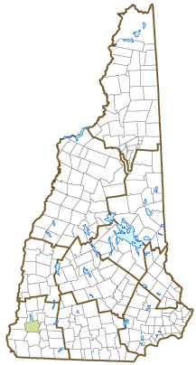
City of Keene
Helen Mattson, Administrative Assistant to the City Manager
3 Washington Street
Keene, NH
03431-3191
|
| Telephone |
(603) 357-9804 |
| Fax |
(603) 283-5650 |
| E-mail |
hmattson@keenenh.gov |
| Web Site |
`
|
| Municipal Office Hours |
City Hall, City Manager, and City Clerk: Monday to Friday, 8-4:30; Tax Collector: Monday to Friday, 8-4
|
| County |
Cheshire |
| Labor Market Area |
Keene, NH Micropolitan NECTA |
| Tourism Region |
Monadnock |
| Planning Commission |
Southwest Region |
| Regional Development |
Monadnock Economic Development Corp.
|
| Election Districts |
|
| US Congress |
District District 2 (All Wards) |
| Executive Council |
District District 2 |
| State Senate |
District District 10 (All Wards) |
| State Representative |
Cheshire County Districts 1 (Ward 1), 2 (Ward 3), 3 (Ward 5), 4 (Ward 4), 7 (Ward 2), 15 (Wards 1, 3-5), 16 (Ward 2) |
| Incorporated: 1753 |
| Origin: This territory was first granted in 1735 as Upper Ashuelot to soldiers in the wars against Canada, and intended to be a fort town. Establishment of the Massachusetts-New Hampshire boundary in 1753 made it one of the largest towns in New England. Under regrant by the New Hampshire governor, the town was named in honor of Sir Benjamin Keene of England, an associate of Governor Wentworth in the Spanish West Indies trade. Keene was incorporated as a city in 1873. The Keene Normal School, now Keene State College, was founded here in 1909. The annual Keene Pumpkin Festival has set eight world records for the largest number of lit jack-o-lanterns, reaching 30,581 in 2013. |
| Villages and Place Names: North Swanzey, South Keene, Marlborough
|
| Population, Year of the First Census Taken: 1,314 residents in 1790 |
| Population Trends: Population change for Keene, including resident students, totaled 2,476 over 50 years, from 20,467 in 1970 to 22,943 in 2021. The 2022 Census estimate for Keene was 22,774 residents, which ranked 12th among New Hampshire's incorporated cities and towns. |
| Population Density and Land Area, 2022 (US Census Bureau): 614.7 persons per square mile of land area. Keene contains 37.0 square miles of land area and 0.2 square miles of inland water area. |
| Municipal Services |
| Type of Government |
Mayor, Council, & Manager |
| Budget: Municipal Appropriations, 2022-2023 |
$74,980,029 |
| Budget: School Appropriations, 2022-2023 |
$36,902,208 |
| Zoning Ordinance |
1927/07 |
| Master Plan |
2010 |
| Capitol Improvement Plan |
Yes |
| Industrial Plans Reviewed By |
Planning Board |
| Boards and Commissions | |
| Elected: | City Council |
| Appointed: | Planning; Zoning; Library; Conservation; Cemetery |
| Public Library |
Keene Public |
| Emergency Services |
| Police Department |
Full-time |
| Fire Department |
Municipal |
| Emergency Medical Service |
Municipal |
| Nearest Hospital(s) |
Distance |
Staffed Beds |
| Cheshire Medical Center, Keene |
Local |
94 |
|
|
|
|
|
|
| Utilities |
| Electric Supplier |
Eversource Energy |
| Natural Gas Supplier |
Keene Gas Corp |
| Water Supplier |
Keene Water Department |
| Sanitation |
Municipal |
| Municipal Wastewater Treatment Plant |
Yes |
| Solid Waste Disposal |
| Curbside Trash Pickup | None |
| Pay-As-You-Throw Program | No |
| Recycling Program | Mandatory |
| Telephone Company |
Consolidated Communications |
| Cellular Telephone Access |
Yes |
| Cable Television Access |
Yes |
| Public Access Television Station |
Yes |
| High Speed Internet Service: |
| Business | Yes |
| Residential | Yes |
| (NH Dept. of Revenue Administration) Property Taxes |
| 2022 Total Tax Rate (per $1,000 of value) |
$31.03 |
| 2022 Equalization Ratio |
81.3 |
| 2022 Full Value Tax Rate (per $1,000 of value) |
$24.61 |
| 2022 Percent of Local Assessed Value by Property Type |
| Residential Land and Buildings | 60.6% |
| Commercial Land and Buildings | 34.1% |
| Public Utilities, Current Use, and Other | 5.3% |
| (ACS 2017-2021) Housing |
| Total Housing Units |
10,228 |
| Single-Family Units, Detached or Attached |
5,613 |
| Units in Multiple-Family Structures: |
|
| Two to Four Units in Structure |
1,663 |
| Five or More Units in Structure |
2,556 |
| Mobile Homes and Other Housing Units |
396 |
(US Census Bureau) Population
(1-Year Estimates/Decennial) |
| Total Population |
Community |
County |
| 2022 |
22,774 |
77,350 |
| 2020 |
23,047 |
76,458 |
| 2010 |
23,409 |
77,117 |
| 2000 |
22,589 |
73,993 |
| 1990 |
23,081 |
70,223 |
| 1980 |
21,449 |
62,116 |
| |
| Demographics, American Community Survey (ACS) 2017-2021 |
| Population by Gender |
| Male: 11,399 |
|
Female: 11,570 |
| Population by Age Group |
| Under age 5 |
|
689 |
| Age 5 to 19 |
|
4,511 |
| Age 20 to 34 |
|
5,899 |
| Age 35 to 54 |
|
5,224 |
| Age 55 to 64 |
|
2,499 |
| Age 65 and over |
|
4,147 |
| Median Age |
|
36.9 years |
| Educational Attainment, population 25 years and over |
|
14,878 |
| High school graduate or higher |
|
92.9% |
| Bachelor's degree or higher |
|
42.0% |
| (ACS 2017-2021) Income, Inflation Adjusted $ |
| Per capita income |
$33,958 |
| Median family income |
$86,992 |
| Median household income |
$63,490 |
| Median Earnings, full-time, year-round workers |
| Male |
$56,649 |
| Female |
$45,785 |
| Individuals below the poverty level |
11.6% |
| (NHES - ELMI) Labor Force |
| Annual Average |
2012 |
2022 |
| Civilian Labor Force |
12,547 |
11,107 |
| Employed |
11,921 |
10,802 |
| Unemployed |
626 |
305 |
| Unemployment Rate |
5.0% |
2.7% |
| (NHES - ELMI) Employment & Wages |
| Annual Average Covered Employment |
2012 |
2022 |
| Goods Producing Industries |
| Average Employment |
2,693 |
2,167 |
| Average Weekly Wage |
$1,032 |
$1,288 |
| |
|
|
| Service Providing Industries |
| Average Employment |
13,565 |
11,981 |
| Average Weekly Wage |
$807 |
$1,116 |
| |
|
|
| Total Private Industry |
| Average Employment |
16,258 |
14,148 |
| Average Weekly Wage |
$845 |
$1,143 |
| |
|
|
| Government (Federal, State, and Local) |
| Average Employment |
2,566 |
2,223 |
| Average Weekly Wage |
$882 |
$1,108 |
| |
|
|
| Total, Private plus Government |
| Average Employment |
18,824 |
16,371 |
| Average Weekly Wage |
$850 |
$1,138 |
If "n" appears, data does not meet disclosure standards.
| (NH Dept. of Education) Education and Child Care |
| Schools students attend: |
Keene operates grades K-12 |
SAU 29 |
| Career Technology Center(s): |
Cheshire Career Center (Keene); Fall Mountain RHS - CTE |
| Educational Facilities (includes Charter Schools) |
Elementary |
Middle/Junior High |
High School |
Private/Parochial |
| Number of Schools |
5 |
1 |
2 |
5 |
| Grade Levels |
P K 1-5 |
6-8 |
9-12 |
9-12 |
| Total Enrollment |
1,126 |
627 |
1,292 |
489 |
| 2022 NH Licensed Child Care Facilities (Bureau of Child Care Licensing): |
Total Facilities: 13 |
Total Capacity: 1,013 |
| Nearest Community/Technical College: River Valley |
| Nearest Colleges or Universities: Keene State; Antioch New England; Franklin Pierce |
| Largest Businesses |
Product/Service |
Employees |
Established |
| Timken Super Precision |
Mini & precision bearings |
267 |
1941 |
| Cheshire Medical Center/Dartmouth Hitchcock Clinic-Keene |
Health care services |
1,531 |
1892 |
| Imaje Corporation |
Industrial marking equipment |
400 |
1911 |
| National Grange Mutual Insurance |
Insurance services |
311 |
1923 |
| Keene State College |
Education |
687 |
1909 |
| Smith Industrial Medical Systems |
Hospital supplies |
350 |
1971 |
| Keene School District |
Education |
846 |
|
| C & S Wholesale Grocers |
Wholesale foods |
1,200 |
2004 |
| Janos Technologies |
Precision infared optics |
75 |
1970 |
| Samson Manufacturing |
Firearms manufacturer |
55 |
2013 |
Employer Information Supplied by Municipality
| (Distance estimated from city/town hall) Transportation |
| Road Access |
US Routes |
|
|
State Routes |
9, 10, 12, 12A, 32, 101 |
| Nearest Interstate, Exit |
I-91 (VT), Exit 3 |
|
Distance |
17 miles |
| Railroad |
No |
| Public Transportation |
City Express |
| |
| Nearest Public Use Airport, General Aviation |
| Dillant-Hopkins, Swanzey | Runway | 6,201 ft. asphalt |
| Lighted? |
Yes |
Navigational Aids? |
Yes |
| Nearest Airport with Scheduled Service |
| Manchester-Boston Regional |
Distance |
57 miles |
| Number of Passenger Airlines Serving Airport |
4 |
| |
| Driving distance to selected cities: |
| Manchester, NH |
65 miles |
| Portland, ME |
157 miles |
| Boston, MA |
98 miles |
| New York City, NY |
223 miles |
| Montreal, Quebec |
243 miles |
| (ACS 2017-2021) Commuting to Work |
| Workers 16 years and over |
11,695 |
| Drove alone, car/truck/van |
68.1% |
| Carpooled, car/truck/van |
10.7% |
| Public transportation |
0.2% |
| Walked |
5.7% |
| Other Means |
2.9% |
| Worked at home |
12.4% |
| Mean Travel Time to Work |
16.3 minutes |
| |
| Percent of Working Residents: |
(ACS 2017-2021) |
| Working in community of residence |
74.2% |
| Commuting to another NH community |
20.3% |
| Commuting out-of-state |
5.5% |
| Recreation, Attractions, and Events |
| Municipal Parks |
| YMCA/YWCA |
| Boys Club/Girls Club |
| Golf Courses |
| Swimming: Indoor Facility |
| Swimming: Outdoor Facility |
| Tennis Courts: Indoor Facility |
| Tennis Courts: Outdoor Facility |
| Ice Skating Rink: Indoor Facility |
| Bowling Facilities |
| Museums |
| Cinemas |
| Performing Arts Facilities |
| Tourist Attractions |
| Youth Organizations (i.e., Scouts, 4-H) |
| Youth Sports: Baseball |
| Youth Sports: Soccer |
| Youth Sports: Football |
| Youth Sports: Basketball |
| Youth Sports: Hockey |
| Campgrounds |
| Fishing/Hunting |
| Boating/Marinas |
| Snowmobile Trails |
| Bicycle Trails |
| Cross Country Skiing |
| Beach or Waterfront Recreational Area |
| Overnight or Day Camps |
| |
|
|
Nearest Ski Area(s): Mount Ascutney (VT) |
| |
|
|
Other: Hiking |
Economic & Labor Market Information Bureau, NH Employment Security, October 2023. Community Response Received 7/12/23
All information regarding the communities is from sources deemed reliable and is submitted subject to errors, omissions, modifications, and withdrawals without notice. No warranty or representation is made as to the accuracy of the information contained herein. Specific questions regarding individual cities and towns should be directed to the community contact.


