 |
Community Contact |
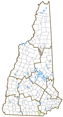
Town of Hudson
Stephen A. Malizia, Town Administrator
12 School Street
Hudson, NH
03051
|
| Telephone |
(603) 886-6024 |
| Fax |
(603) 598-6481 |
| E-mail |
smalizia@hudsonnh.gov |
| Web Site |
www.hudsonnh.gov
|
| Municipal Office Hours |
Town Hall, Administrator, Town Clerk/Tax Collector: Monday to Friday, 8-4:30
|
| County |
Hillsborough |
| Labor Market Area |
Nashua, NH-MA NECTA Division |
| Tourism Region |
Merrimack Valley |
| Planning Commission |
Nashua Regional |
| Regional Development |
Regional Economic Development Corp.
|
| Election Districts |
|
| US Congress |
District District 2 |
| Executive Council |
District District 5 |
| State Senate |
District District 14 |
| State Representative |
Hillsborough County Districts 13, 38 |
| Incorporated: 1746 |
| Origin: This area was first a part of the 1673 Massachusetts Dunstable grant. In 1732, portions of Dunstable that were east of the Merrimack River and not annexed to Londonderry became Nottingham, Massachusetts. In 1741, following the establishment of New Hampshire-Massachusetts border, the town was incorporated as Nottingham West. Owing to confusion with the town of Nottingham in the north, voters petitioned to have the town renamed in 1830. The name Hudson was chosen because of its position near the point where the Merrimack River, once thought to flow east from the Hudson River, was found to come from the north. |
| Villages and Place Names: Hudson Center, Potash Corner
|
| Population, Year of the First Census Taken: 1,064 residents in 1790 |
| Population Trends: Population change for Hudson totaled 14,798 over 50 years, from 10,638 in 1970 to 25,436 in 2020. The 2022 Census estimate for Hudson was 25,570 residents, which ranked tenth among New Hampshire's incorporated cities and towns. |
| Population Density and Land Area, 2022 (US Census Bureau): 896.2 persons per square mile of land area. Hudson contains 28.5 square miles of land area and 0.8 square miles of inland water area. |
| Municipal Services |
| Type of Government |
Selectmen |
| Budget: Municipal Appropriations, 2021-2022 |
$36,348,010 |
| Budget: School Appropriations, 2021-2022 |
$57,210,449 |
| Zoning Ordinance |
1942/20 |
| Master Plan |
2006 |
| Capitol Improvement Plan |
Yes |
| Industrial Plans Reviewed By |
Planning Board |
| Boards and Commissions | |
| Elected: | Selectmen; Library; Cemetery; Budget; Planning |
| Appointed: | Conservation; ZBA |
| Public Library |
Rodgers Memorial |
| Emergency Services |
| Police Department |
Full-time |
| Fire Department |
Full-time |
| Emergency Medical Service |
Full-time |
| Nearest Hospital(s) |
Distance |
Staffed Beds |
| Southern NH Medical Center, Nashua |
1 mile |
163 |
| St. Joseph Hospital, Nashua |
3 miles |
159 |
|
|
|
| Utilities |
| Electric Supplier |
Eversource Energy |
| Natural Gas Supplier |
Liberty Utilities |
| Water Supplier |
Hudson Water Department |
| Sanitation |
Private septic & municipal |
| Municipal Wastewater Treatment Plant |
No |
| Solid Waste Disposal |
| Curbside Trash Pickup | Municipal |
| Pay-As-You-Throw Program | No |
| Recycling Program | Voluntary |
| Telephone Company |
Consolidated Communications |
| Cellular Telephone Access |
Yes |
| Cable Television Access |
Yes |
| Public Access Television Station |
Yes |
| High Speed Internet Service: |
| Business | Yes |
| Residential | Yes |
| (NH Dept. of Revenue Administration) Property Taxes |
| 2022 Total Tax Rate (per $1,000 of value) |
$14.69 |
| 2022 Equalization Ratio |
93.8 |
| 2022 Full Value Tax Rate (per $1,000 of value) |
$13.65 |
| 2022 Percent of Local Assessed Value by Property Type |
| Residential Land and Buildings | 78.7% |
| Commercial Land and Buildings | 17.4% |
| Public Utilities, Current Use, and Other | 3.9% |
| (ACS 2017-2021) Housing |
| Total Housing Units |
9,881 |
| Single-Family Units, Detached or Attached |
7,812 |
| Units in Multiple-Family Structures: |
|
| Two to Four Units in Structure |
851 |
| Five or More Units in Structure |
1,076 |
| Mobile Homes and Other Housing Units |
142 |
(US Census Bureau) Population
(1-Year Estimates/Decennial) |
| Total Population |
Community |
County |
| 2022 |
25,570 |
426,594 |
| 2020 |
25,394 |
422,937 |
| 2010 |
24,467 |
400,721 |
| 2000 |
22,985 |
382,384 |
| 1990 |
19,663 |
336,549 |
| 1980 |
14,022 |
276,608 |
| |
| Demographics, American Community Survey (ACS) 2017-2021 |
| Population by Gender |
| Male: 12,883 |
|
Female: 12,431 |
| Population by Age Group |
| Under age 5 |
|
905 |
| Age 5 to 19 |
|
4,366 |
| Age 20 to 34 |
|
4,230 |
| Age 35 to 54 |
|
7,459 |
| Age 55 to 64 |
|
3,789 |
| Age 65 and over |
|
4,565 |
| Median Age |
|
45.2 years |
| Educational Attainment, population 25 years and over |
|
18,384 |
| High school graduate or higher |
|
95.5% |
| Bachelor's degree or higher |
|
33.4% |
| (ACS 2017-2021) Income, Inflation Adjusted $ |
| Per capita income |
$51,705 |
| Median family income |
$136,557 |
| Median household income |
$112,285 |
| Median Earnings, full-time, year-round workers |
| Male |
$76,171 |
| Female |
$58,875 |
| Individuals below the poverty level |
3.7% |
| (NHES - ELMI) Labor Force |
| Annual Average |
2012 |
2022 |
| Civilian Labor Force |
14,312 |
15,149 |
| Employed |
13,398 |
14,715 |
| Unemployed |
914 |
434 |
| Unemployment Rate |
6.4% |
2.9% |
| (NHES - ELMI) Employment & Wages |
| Annual Average Covered Employment |
2012 |
2022 |
| Goods Producing Industries |
| Average Employment |
3,845 |
4,755 |
| Average Weekly Wage |
$1,307 |
$1,875 |
| |
|
|
| Service Providing Industries |
| Average Employment |
5,002 |
6,734 |
| Average Weekly Wage |
$729 |
$1,175 |
| |
|
|
| Total Private Industry |
| Average Employment |
8,847 |
11,489 |
| Average Weekly Wage |
$980 |
$1,465 |
| |
|
|
| Government (Federal, State, and Local) |
| Average Employment |
889 |
957 |
| Average Weekly Wage |
$959 |
$1,128 |
| |
|
|
| Total, Private plus Government |
| Average Employment |
9,737 |
12,446 |
| Average Weekly Wage |
$978 |
$1,439 |
If "n" appears, data does not meet disclosure standards.
| (NH Dept. of Education) Education and Child Care |
| Schools students attend: |
Hudson operates grades K-12 |
SAU 81 |
| Career Technology Center(s): |
Milford HS & Applied Technology Center; Wilbur H. Palmer Career & Tech Ed Center (Hudson); Nashua Technology Center |
| Educational Facilities (includes Charter Schools) |
Elementary |
Middle/Junior High |
High School |
Private/Parochial |
| Number of Schools |
4 |
1 |
1 |
1 |
| Grade Levels |
P K 1-5 |
6-8 |
9-12 |
9-12 |
| Total Enrollment |
1,326 |
692 |
1,037 |
445 |
| 2022 NH Licensed Child Care Facilities (Bureau of Child Care Licensing): |
Total Facilities: 15 |
Total Capacity: 794 |
| Nearest Community/Technical College: Nashua |
| Nearest Colleges or Universities: Rivier; Thomas More |
| Largest Businesses |
Product/Service |
Employees |
Established |
| BAE Systems |
Signal analysis & jamming technology |
678 |
|
| Hudson School District |
Education |
571 |
|
| APW Enclosures |
Sheet metal fabrication & integration |
300 |
|
| Integra BioScience |
Research |
190 |
|
| Town of Hudson |
Municipal services |
180 |
|
| Hudson Mills |
Apparel, textile |
100 |
|
| Mercury Systems |
Defense electronics |
200 |
|
| Comcast |
Cable television call center |
250 |
|
|
|
|
|
|
|
|
|
Employer Information Supplied by Municipality
| (Distance estimated from city/town hall) Transportation |
| Road Access |
US Routes |
|
|
State Routes |
3A, 101A, 102, 111 |
| Nearest Interstate, Exit |
Everett Tpk., Exit 7; I-93, Exit 3 |
|
Distance |
3 miles; 10 miles |
| Railroad |
No |
| Public Transportation |
No |
| |
| Nearest Public Use Airport, General Aviation |
| Boire Field, Nashua | Runway | 6,000 ft. asphalt |
| Lighted? |
Yes |
Navigational Aids? |
Yes |
| Nearest Airport with Scheduled Service |
| Manchester-Boston Regional |
Distance |
19 miles |
| Number of Passenger Airlines Serving Airport |
4 |
| |
| Driving distance to selected cities: |
| Manchester, NH |
19 miles |
| Portland, ME |
105 miles |
| Boston, MA |
44 miles |
| New York City, NY |
233 miles |
| Montreal, Quebec |
276 miles |
| (ACS 2017-2021) Commuting to Work |
| Workers 16 years and over |
15,237 |
| Drove alone, car/truck/van |
82.4% |
| Carpooled, car/truck/van |
5.3% |
| Public transportation |
1.0% |
| Walked |
0.1% |
| Other Means |
0.8% |
| Worked at home |
10.4% |
| Mean Travel Time to Work |
31.6 minutes |
| |
| Percent of Working Residents: |
(ACS 2017-2021) |
| Working in community of residence |
22.8% |
| Commuting to another NH community |
46.3% |
| Commuting out-of-state |
30.9% |
| Recreation, Attractions, and Events |
| Municipal Parks |
| YMCA/YWCA |
| Boys Club/Girls Club |
| Golf Courses |
| Swimming: Indoor Facility |
| Swimming: Outdoor Facility |
| Tennis Courts: Indoor Facility |
| Tennis Courts: Outdoor Facility |
| Ice Skating Rink: Indoor Facility |
| Bowling Facilities |
| Museums |
| Cinemas |
| Performing Arts Facilities |
| Tourist Attractions |
| Youth Organizations (i.e., Scouts, 4-H) |
| Youth Sports: Baseball |
| Youth Sports: Soccer |
| Youth Sports: Football |
| Youth Sports: Basketball |
| Youth Sports: Hockey |
| Campgrounds |
| Fishing/Hunting |
| Boating/Marinas |
| Snowmobile Trails |
| Bicycle Trails |
| Cross Country Skiing |
| Beach or Waterfront Recreational Area |
| Overnight or Day Camps |
| |
|
|
Nearest Ski Area(s): McIntyre |
| |
|
|
Other: Musquash Conservation Land |
Economic & Labor Market Information Bureau, NH Employment Security, October 2023. Community Response Received 6/5/23
All information regarding the communities is from sources deemed reliable and is submitted subject to errors, omissions, modifications, and withdrawals without notice. No warranty or representation is made as to the accuracy of the information contained herein. Specific questions regarding individual cities and towns should be directed to the community contact.


