 |
Community Contact |
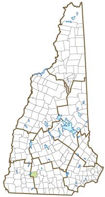
Town of Hancock
Jonathan Coyne, Town Administrator
50 Main Street, PO Box 6
Hancock, NH
03449
|
| Telephone |
(603) 525-4441 |
| Fax |
Not Available |
| E-mail |
select@hancocknh.org |
| Web Site |
www.hancocknh.org
|
| Municipal Office Hours |
Administration: Monday to Thursday, 8-4; Town Clerk: Monday, 5-8, Wednesday, 3-6; Tax Collector: Tuesdays by appointment, Thursday, 2-5:30
|
| County |
Hillsborough |
| Labor Market Area |
Peterborough, NH LMA |
| Tourism Region |
Monadnock |
| Planning Commission |
Southwest Region |
| Regional Development |
Monadnock Economic Development Corp.
|
| Election Districts |
|
| US Congress |
District District 2 |
| Executive Council |
District District 2 |
| State Senate |
District District 10 |
| State Representative |
Hillsborough County District 31 |
| Incorporated: 1779 |
| Origin: Hancock started as an unidentified settlement on the Contoocook River, in territory known as Society Land or Cumberland, which had been reserved for the Proprietors. Cumberland included what is now Antrim, Bennington, Francestown, Deering, Greenfield, and Hancock. First settled in 1764, the town was incorporated as Hancock in 1779 in honor of John Hancock, first governor of Massachusetts, president of the Continental Congress, and signer of the Declaration of Independence. Mr. Hancock was a landowner in this region, but there is no record of his ever having been in the town named for him. |
| Villages and Place Names: Elmwood
|
| Population, Year of the First Census Taken: 634 residents in 1790 |
| Population Trends: Population change for Hancock totaled 827 over 50 years, from 909 in 1970 to 1,736 in 2020. The 2022 Census estimate for Hancock was 1,748 residents, which ranked 151st among New Hampshire's incorporated cities and towns. |
| Population Density and Land Area, 2022 (US Census Bureau): 58.3 persons per square mile of land area. Hancock contains 30.0 square miles of land area and 1.3 square miles of inland water area. |
| Municipal Services |
| Type of Government |
Selectmen |
| Budget: Municipal Appropriations, 2022 |
$3,540,430 |
| Budget: School Appropriations, 2021-2022 |
$3,723,398 |
| Zoning Ordinance |
1962/17 |
| Master Plan |
2020 |
| Capitol Improvement Plan |
Yes |
| Industrial Plans Reviewed By |
Planning Board |
| Boards and Commissions | |
| Elected: | Selectmen; Library; Trust Funds; Common; Water; Cemetery; Checklist |
| Appointed: | Planning; Zoning; Conservation; Historic Distric |
| Public Library |
Hancock Town |
| Emergency Services |
| Police Department |
Full-time |
| Fire Department |
Volunteer |
| Emergency Medical Service |
Volunteer |
| Nearest Hospital(s) |
Distance |
Staffed Beds |
| Monadnock Community, Peterborough |
7 miles |
25 |
|
|
|
|
|
|
| Utilities |
| Electric Supplier |
Eversource Energy |
| Natural Gas Supplier |
None |
| Water Supplier |
Hancock Water Works |
| Sanitation |
Private septic |
| Municipal Wastewater Treatment Plant |
No |
| Solid Waste Disposal |
| Curbside Trash Pickup | None |
| Pay-As-You-Throw Program | No |
| Recycling Program | Mandatory |
| Telephone Company |
Consolidated Communications |
| Cellular Telephone Access |
Yes |
| Cable Television Access |
Yes |
| Public Access Television Station |
No |
| High Speed Internet Service: |
| Business | Yes |
| Residential | Yes |
| (NH Dept. of Revenue Administration) Property Taxes |
| 2022 Total Tax Rate (per $1,000 of value) |
$21.81 |
| 2022 Equalization Ratio |
71.9 |
| 2022 Full Value Tax Rate (per $1,000 of value) |
$15.61 |
| 2022 Percent of Local Assessed Value by Property Type |
| Residential Land and Buildings | 95.2% |
| Commercial Land and Buildings | 1.8% |
| Public Utilities, Current Use, and Other | 3.1% |
| (ACS 2017-2021) Housing |
| Total Housing Units |
905 |
| Single-Family Units, Detached or Attached |
827 |
| Units in Multiple-Family Structures: |
|
| Two to Four Units in Structure |
57 |
| Five or More Units in Structure |
5 |
| Mobile Homes and Other Housing Units |
16 |
(US Census Bureau) Population
(1-Year Estimates/Decennial) |
| Total Population |
Community |
County |
| 2022 |
1,748 |
426,594 |
| 2020 |
1,731 |
422,937 |
| 2010 |
1,654 |
400,721 |
| 2000 |
1,744 |
382,384 |
| 1990 |
1,623 |
336,549 |
| 1980 |
1,193 |
276,608 |
| |
| Demographics, American Community Survey (ACS) 2017-2021 |
| Population by Gender |
| Male: 821 |
|
Female: 886 |
| Population by Age Group |
| Under age 5 |
|
34 |
| Age 5 to 19 |
|
207 |
| Age 20 to 34 |
|
145 |
| Age 35 to 54 |
|
390 |
| Age 55 to 64 |
|
370 |
| Age 65 and over |
|
561 |
| Median Age |
|
55.7 years |
| Educational Attainment, population 25 years and over |
|
1,359 |
| High school graduate or higher |
|
96.4% |
| Bachelor's degree or higher |
|
55.9% |
| (ACS 2017-2021) Income, Inflation Adjusted $ |
| Per capita income |
$47,221 |
| Median family income |
$99,209 |
| Median household income |
$76,484 |
| Median Earnings, full-time, year-round workers |
| Male |
$52,475 |
| Female |
$55,156 |
| Individuals below the poverty level |
3.5% |
| (NHES - ELMI) Labor Force |
| Annual Average |
2012 |
2022 |
| Civilian Labor Force |
930 |
918 |
| Employed |
896 |
894 |
| Unemployed |
34 |
24 |
| Unemployment Rate |
3.7% |
2.6% |
| (NHES - ELMI) Employment & Wages |
| Annual Average Covered Employment |
2012 |
2022 |
| Goods Producing Industries |
| Average Employment |
n |
30 |
| Average Weekly Wage |
n |
$1,030 |
| |
|
|
| Service Providing Industries |
| Average Employment |
n |
170 |
| Average Weekly Wage |
n |
$1,476 |
| |
|
|
| Total Private Industry |
| Average Employment |
147 |
200 |
| Average Weekly Wage |
$905 |
$1,408 |
| |
|
|
| Government (Federal, State, and Local) |
| Average Employment |
29 |
30 |
| Average Weekly Wage |
$700 |
$824 |
| |
|
|
| Total, Private plus Government |
| Average Employment |
176 |
230 |
| Average Weekly Wage |
$871 |
$1,333 |
If "n" appears, data does not meet disclosure standards.
| (NH Dept. of Education) Education and Child Care |
| Schools students attend: |
Grades K-12 are part of Contoocook Valley Cooperative (Antrim, Bennington, Dublin, Francestown, Greenfield, Hancock, Peterborough, Sharon, Temple) |
SAU 1 |
| Career Technology Center(s): |
Region 14 Applied Technology Center |
| Educational Facilities (includes Charter Schools) |
Elementary |
Middle/Junior High |
High School |
Private/Parochial |
| Number of Schools |
1 |
|
|
|
| Grade Levels |
K 1-4 |
|
|
9-12 |
| Total Enrollment |
69 |
|
|
|
| 2022 NH Licensed Child Care Facilities (Bureau of Child Care Licensing): |
Total Facilities: 1 |
Total Capacity: 16 |
| Nearest Community/Technical College: Manchester; Nashua; NHTI-Concord |
| Nearest Colleges or Universities: Keene State; New England; Franklin Pierce; Antioch New England |
| Largest Businesses |
Product/Service |
Employees |
Established |
| John Hancock Inn |
Restaurant, inn |
|
|
| Hancock Market |
Convenience store |
|
|
|
Restaurant |
|
|
| Harris Center for Conservation Education |
Conservation education |
|
|
| Nature's classroom at Sargent Center |
Outdoor education and camp |
|
|
| Our Town Landscaping, Inc. |
Landscaping services and materials |
|
|
| Mathewson Co., Inc. |
Septic svcs., dam & road construction, excavation, land clearing, helical piles, winter maintenance |
|
|
| Sarah's Hat Boxes |
Custom handmade fabric boxes |
|
|
|
|
|
|
|
|
|
|
Employer Information Supplied by Municipality
| (Distance estimated from city/town hall) Transportation |
| Road Access |
US Routes |
202 |
|
State Routes |
123, 137 |
| Nearest Interstate, Exit |
I-89, Exit 6 |
|
Distance |
27 miles |
| Railroad |
No |
| Public Transportation |
No |
| |
| Nearest Public Use Airport, General Aviation |
| Hawthorne-Feather, Antrim | Runway | 3,260 ft. asphalt |
| Lighted? |
Yes |
Navigational Aids? |
No |
| Nearest Airport with Scheduled Service |
| Manchester-Boston Regional |
Distance |
34 miles |
| Number of Passenger Airlines Serving Airport |
4 |
| |
| Driving distance to selected cities: |
| Manchester, NH |
34 miles |
| Portland, ME |
130 miles |
| Boston, MA |
77 miles |
| New York City, NY |
243 miles |
| Montreal, Quebec |
253 miles |
| (ACS 2017-2021) Commuting to Work |
| Workers 16 years and over |
928 |
| Drove alone, car/truck/van |
71.8% |
| Carpooled, car/truck/van |
7.3% |
| Public transportation |
0.1% |
| Walked |
2.2% |
| Other Means |
2.3% |
| Worked at home |
16.3% |
| Mean Travel Time to Work |
28.8 minutes |
| |
| Percent of Working Residents: |
(ACS 2017-2021) |
| Working in community of residence |
25.8% |
| Commuting to another NH community |
69.4% |
| Commuting out-of-state |
4.8% |
| Recreation, Attractions, and Events |
| Municipal Parks |
| YMCA/YWCA |
| Boys Club/Girls Club |
| Golf Courses |
| Swimming: Indoor Facility |
| Swimming: Outdoor Facility |
| Tennis Courts: Indoor Facility |
| Tennis Courts: Outdoor Facility |
| Ice Skating Rink: Indoor Facility |
| Bowling Facilities |
| Museums |
| Cinemas |
| Performing Arts Facilities |
| Tourist Attractions |
| Youth Organizations (i.e., Scouts, 4-H) |
| Youth Sports: Baseball |
| Youth Sports: Soccer |
| Youth Sports: Football |
| Youth Sports: Basketball |
| Youth Sports: Hockey |
| Campgrounds |
| Fishing/Hunting |
| Boating/Marinas |
| Snowmobile Trails |
| Bicycle Trails |
| Cross Country Skiing |
| Beach or Waterfront Recreational Area |
| Overnight or Day Camps |
| |
|
|
Nearest Ski Area(s): Pat's Peak, Crotched Mtn |
| |
|
|
Other: Harris Center for Conservation Education; Nature's Classroom |
Economic & Labor Market Information Bureau, NH Employment Security, October 2023. Community Response Received 7/26/23
All information regarding the communities is from sources deemed reliable and is submitted subject to errors, omissions, modifications, and withdrawals without notice. No warranty or representation is made as to the accuracy of the information contained herein. Specific questions regarding individual cities and towns should be directed to the community contact.


