 |
Community Contact |
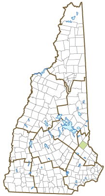
Town of Farmington
Rebecca Dickie, Town Clerk/Tax Collector
356 Main Street, Municipal Offices
Farmington, NH
03835
|
| Telephone |
(603) 755-3657 |
| Fax |
(603) 755-9128 |
| E-mail |
rdickie@farmington.nh.us |
| Web Site |
www.farmington.nh.us
|
| Municipal Office Hours |
Town Hall, Administrator: Monday to Friday, 8-5; Town Clerk/Tax Collector: Monday to Wednesday, 8:30-5, Thursday, 8:30-7, Friday, 8:30-12:30
|
| County |
Strafford |
| Labor Market Area |
Dover-Durham, NH-ME Metropolitan NECTA |
| Tourism Region |
Lakes |
| Planning Commission |
Strafford Regional |
| Regional Development |
Wentworth Economic Development Corp.
|
| Election Districts |
|
| US Congress |
District District 1 |
| Executive Council |
District District 1 |
| State Senate |
District District 6 |
| State Representative |
Strafford County District 1 |
| Incorporated: 1798 |
| Origin: This town started as West Parish, a portion of Rochester that included several large farms. Those farms were separated from Rochester in 1798 as Farmington, a reference to the area's fertile farmland. It was also known as Farmington Dock because its location on the Cocheco River was an ideal spot for sawmills. Those sawmills expanded into shoe-making factories, one of the first places to use automated shoe-making machines instead of handwork. One Farmington resident known in the shoe trade was Jeremiah J. Colbath, who, after changing his name to Henry Wilson, was elected Vice-President under Ulysses S. Grant. |
| Villages and Place Names: unknown
|
| Population, Year of the First Census Taken: 1,029 residents in 1800 |
| Population Trends: Population change for Farmington totaled 3,133 over 50 years, from 3,588 in 1970 to 6,721 in 2020. The 2022 Census estimate for Farmington was 6,844 residents, which ranked 48th among New Hampshire's incorporated cities and towns. |
| Population Density and Land Area, 2022 (US Census Bureau): 187.5 persons per square mile of land area. Farmington contains 36.5 square miles of land area and 0.4 square miles of inland water area. |
| Municipal Services |
| Type of Government |
Selectmen |
| Budget: Municipal Appropriations, 2020 |
$7,760,907 |
| Budget: School Appropriations, 2020-2021 |
$17,256,507 |
| Zoning Ordinance |
1979/20 |
| Master Plan |
2020 |
| Capitol Improvement Plan |
Yes |
| Industrial Plans Reviewed By |
Planning Board |
| Boards and Commissions | |
| Elected: | Selectmen; Town Clerk/Tax Collector; Budget; Moderator; Trust Funds; Checklist |
| Appointed: | Planning; Zoning; Conservation; Economic Development; ZBA |
| Public Library |
Goodwin |
| Emergency Services |
| Police Department |
Full-time |
| Fire Department |
Full-time & volunteer |
| Emergency Medical Service |
Municipal |
| Nearest Hospital(s) |
Distance |
Staffed Beds |
| Frisbie Memorial, Rochester |
10 miles |
27 |
|
|
|
|
|
|
| Utilities |
| Electric Supplier |
Eversource Energy; NH Electric Coop |
| Natural Gas Supplier |
None |
| Water Supplier |
Farmington Water Department |
| Sanitation |
Municipal |
| Municipal Wastewater Treatment Plant |
Yes |
| Solid Waste Disposal |
| Curbside Trash Pickup | None |
| Pay-As-You-Throw Program | Yes |
| Recycling Program | Voluntary |
| Telephone Company |
Consolidated Communications; TDS Telecom |
| Cellular Telephone Access |
Yes |
| Cable Television Access |
Yes |
| Public Access Television Station |
Yes |
| High Speed Internet Service: |
| Business | Yes |
| Residential | Yes |
| (NH Dept. of Revenue Administration) Property Taxes |
| 2022 Total Tax Rate (per $1,000 of value) |
$24.18 |
| 2022 Equalization Ratio |
60.9 |
| 2022 Full Value Tax Rate (per $1,000 of value) |
$14.40 |
| 2022 Percent of Local Assessed Value by Property Type |
| Residential Land and Buildings | 84.8% |
| Commercial Land and Buildings | 13.0% |
| Public Utilities, Current Use, and Other | 2.1% |
| (ACS 2017-2021) Housing |
| Total Housing Units |
2,912 |
| Single-Family Units, Detached or Attached |
1,953 |
| Units in Multiple-Family Structures: |
|
| Two to Four Units in Structure |
245 |
| Five or More Units in Structure |
274 |
| Mobile Homes and Other Housing Units |
440 |
(US Census Bureau) Population
(1-Year Estimates/Decennial) |
| Total Population |
Community |
County |
| 2022 |
6,844 |
132,275 |
| 2020 |
6,722 |
130,889 |
| 2010 |
6,786 |
123,143 |
| 2000 |
5,804 |
112,676 |
| 1990 |
5,706 |
104,348 |
| 1980 |
4,630 |
85,324 |
| |
| Demographics, American Community Survey (ACS) 2017-2021 |
| Population by Gender |
| Male: 3,209 |
|
Female: 3,539 |
| Population by Age Group |
| Under age 5 |
|
473 |
| Age 5 to 19 |
|
1,112 |
| Age 20 to 34 |
|
1,517 |
| Age 35 to 54 |
|
1,383 |
| Age 55 to 64 |
|
1,394 |
| Age 65 and over |
|
869 |
| Median Age |
|
42.7 years |
| Educational Attainment, population 25 years and over |
|
4,822 |
| High school graduate or higher |
|
89.8% |
| Bachelor's degree or higher |
|
16.2% |
| (ACS 2017-2021) Income, Inflation Adjusted $ |
| Per capita income |
$30,563 |
| Median family income |
$77,543 |
| Median household income |
$60,271 |
| Median Earnings, full-time, year-round workers |
| Male |
$63,316 |
| Female |
$36,438 |
| Individuals below the poverty level |
11.6% |
| (NHES - ELMI) Labor Force |
| Annual Average |
2012 |
2022 |
| Civilian Labor Force |
3,605 |
3,641 |
| Employed |
3,367 |
3,546 |
| Unemployed |
238 |
95 |
| Unemployment Rate |
6.6% |
2.6% |
| (NHES - ELMI) Employment & Wages |
| Annual Average Covered Employment |
2012 |
2022 |
| Goods Producing Industries |
| Average Employment |
227 |
197 |
| Average Weekly Wage |
$998 |
$1,195 |
| |
|
|
| Service Providing Industries |
| Average Employment |
403 |
412 |
| Average Weekly Wage |
$571 |
$923 |
| |
|
|
| Total Private Industry |
| Average Employment |
629 |
609 |
| Average Weekly Wage |
$725 |
$1,011 |
| |
|
|
| Government (Federal, State, and Local) |
| Average Employment |
382 |
301 |
| Average Weekly Wage |
$629 |
$892 |
| |
|
|
| Total, Private plus Government |
| Average Employment |
1,012 |
910 |
| Average Weekly Wage |
$689 |
$972 |
If "n" appears, data does not meet disclosure standards.
| (NH Dept. of Education) Education and Child Care |
| Schools students attend: |
Farmington operates grades K-12 |
SAU 61 |
| Career Technology Center(s): |
Lakes Region Technology Center (Wolfeboro) |
| Educational Facilities (includes Charter Schools) |
Elementary |
Middle/Junior High |
High School |
Private/Parochial |
| Number of Schools |
1 |
1 |
1 |
|
| Grade Levels |
P K 1-3 |
4-8 |
9-12 |
9-12 |
| Total Enrollment |
266 |
287 |
239 |
|
| 2022 NH Licensed Child Care Facilities (Bureau of Child Care Licensing): |
Total Facilities: 5 |
Total Capacity: 203 |
| Nearest Community/Technical College: Great Bay; Lakes Region |
| Nearest Colleges or Universities: University of NH |
| Largest Businesses |
Product/Service |
Employees |
Established |
| Cameron's Sod Farm |
Lawn & garden supplies |
40 |
1935 |
| Pike Industries |
Asphalt, gravel, stone |
30 |
1975 |
| TDS Telecom |
Telecommunications |
44 |
2009 |
| Schaffer Rolls |
Rubber rolls |
32 |
|
| Energy Resource |
Mechanical contracting & power plant svcs |
15 |
1998 |
| Three Phase Line Electric |
Specialized electrical contractor |
15 |
1999 |
| Winnisquam Wood Products |
Countertop fabrication |
20 |
2011 |
| MBG Enterprises |
Carrier truck company |
40 |
2015 |
|
|
|
|
|
|
|
|
Employer Information Supplied by Municipality
| (Distance estimated from city/town hall) Transportation |
| Road Access |
US Routes |
|
|
State Routes |
11, 75, 153 |
| Nearest Interstate, Exit |
Spaulding Tpk., Exit 15; I-95, Exit 5 |
|
Distance |
7 miles; 26 miles |
| Railroad |
No |
| Public Transportation |
COAST |
| |
| Nearest Public Use Airport, General Aviation |
| Skyhaven, Rochester | Runway | 4,200 ft. asphalt |
| Lighted? |
Yes |
Navigational Aids? |
Yes |
| Nearest Airport with Scheduled Service |
| Manchester-Boston Regional |
Distance |
52 miles |
| Number of Passenger Airlines Serving Airport |
4 |
| |
| Driving distance to selected cities: |
| Manchester, NH |
52 miles |
| Portland, ME |
55 miles |
| Boston, MA |
81 miles |
| New York City, NY |
292 miles |
| Montreal, Quebec |
264 miles |
| (ACS 2017-2021) Commuting to Work |
| Workers 16 years and over |
3,429 |
| Drove alone, car/truck/van |
82.6% |
| Carpooled, car/truck/van |
8.8% |
| Public transportation |
0.0% |
| Walked |
0.7% |
| Other Means |
0.0% |
| Worked at home |
7.9% |
| Mean Travel Time to Work |
27.0 minutes |
| |
| Percent of Working Residents: |
(ACS 2017-2021) |
| Working in community of residence |
26.0% |
| Commuting to another NH community |
65.1% |
| Commuting out-of-state |
8.9% |
| Recreation, Attractions, and Events |
| Municipal Parks |
| YMCA/YWCA |
| Boys Club/Girls Club |
| Golf Courses |
| Swimming: Indoor Facility |
| Swimming: Outdoor Facility |
| Tennis Courts: Indoor Facility |
| Tennis Courts: Outdoor Facility |
| Ice Skating Rink: Indoor Facility |
| Bowling Facilities |
| Museums |
| Cinemas |
| Performing Arts Facilities |
| Tourist Attractions |
| Youth Organizations (i.e., Scouts, 4-H) |
| Youth Sports: Baseball |
| Youth Sports: Soccer |
| Youth Sports: Football |
| Youth Sports: Basketball |
| Youth Sports: Hockey |
| Campgrounds |
| Fishing/Hunting |
| Boating/Marinas |
| Snowmobile Trails |
| Bicycle Trails |
| Cross Country Skiing |
| Beach or Waterfront Recreational Area |
| Overnight or Day Camps |
| |
|
|
Nearest Ski Area(s): Gunstock |
| |
|
|
Other: Hayday Festival |
Economic & Labor Market Information Bureau, NH Employment Security, October 2023. Community Response Received 6/1/23
All information regarding the communities is from sources deemed reliable and is submitted subject to errors, omissions, modifications, and withdrawals without notice. No warranty or representation is made as to the accuracy of the information contained herein. Specific questions regarding individual cities and towns should be directed to the community contact.


