 |
Community Contact |
Dover City Clerk's Office
Susan Mistretta, City Clerk/Tax Collector
288 Central Avenue
Dover, NH
03820-4169
|
| Telephone |
(603) 516-6012 |
| Fax |
(603) 516-6666 |
| E-mail |
s.mistretta@dover.nh.gov |
| Web Site |
www.dover.nh.gov
|
| Municipal Office Hours |
City Hall, City Manager, City Clerk and Tax Collection Office: Monday to Thursday, 8:30-5:30, Friday, 8:30-4
|
| County |
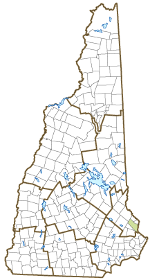
Strafford |
| Labor Market Area |
Dover-Durham, NH-ME Metropolitan NECTA |
| Tourism Region |
Seacoast |
| Planning Commission |
Strafford Regional |
| Regional Development |
Southeast Economic Development Corp.
|
| Election Districts |
|
| US Congress |
District District 1 (All Wards) |
| Executive Council |
District District 1 |
| State Senate |
District District 4 (All Wards) |
| State Representative |
Strafford County Districts 11 (Ward 4), 13 (Ward 6), 14 (Ward 1), 15 (Ward 2), 16 (Ward 3), 17 (Ward 5), 20 (Ward 4), 21 (Wards 1-3, 5, 6) |
| Incorporated: 1623 |
| Origin: For the first fifty years of New Hampshire history, Dover was one of only three communities established in what is now New Hampshire. Settled in 1623 on the banks of the Piscataqua River, Dover was first called Hilton's Point, named after Edward Hilton, who procured for himself the Dover and Squamscot Patent in 1629. The town was also known by the Abenaki names of Newichwannock (river with many waterfalls) and Cocheco (rapidly foaming water); and briefly called Bristol and Northam before permanently becoming Dover. The settlement was an independent government until 1641, when residents agreed to be annexed to Massachusetts; the town returned to New Hampshire when provincial status was restored by King George II in 1741. Dover's location on the Piscataqua and Cocheco Rivers made it a thriving center of trading and manufacturing. Dover was incorporated as a city in 1855. |
| Villages and Place Names: Bellamy, Cocheco, Gates Corner, Sawyers, Wentworth Terrace
|
| Population, Year of the First Census Taken: 1,998 residents in 1790 |
| Population Trends: Population change for Dover totaled 11,908 over 50 years, from 20,850 in 1970 to 32,758 in 2020. The 2022 Census estimate for Dover was 33,416 residents, which ranked fifth among New Hampshire's incorporated cities and towns. |
| Population Density and Land Area, 2022 (US Census Bureau): 1,249.7 persons per square mile of land area. Dover contains 26.7 square miles of land area and 2.3 square miles of inland water area. |
| Municipal Services |
| Type of Government |
Manager & Council |
| Budget: Municipal Appropriations, 2023 |
$49,383,238 |
| Budget: School Appropriations, 2022-2023 |
$67,866,258 |
| Zoning Ordinance |
1948/21 |
| Master Plan |
2021 |
| Capitol Improvement Plan |
Yes |
| Industrial Plans Reviewed By |
Planning Board |
| Boards and Commissions | |
| Elected: | City Council |
| Appointed: | Planning; Zoning; Conservation; Library; Cemetery; Recreation; Ethics; Open Lands; Arts; Transportation; Pool |
| Public Library |
Dover Public |
| Emergency Services |
| Police Department |
Full-time |
| Fire Department |
Full-time |
| Emergency Medical Service |
Municipal |
| Nearest Hospital(s) |
Distance |
Staffed Beds |
| Wentworth-Douglass, Dover |
Local |
173 |
|
|
|
|
|
|
| Utilities |
| Electric Supplier |
Eversource Energy |
| Natural Gas Supplier |
Unitil |
| Water Supplier |
City of Dover |
| Sanitation |
Municipal |
| Municipal Wastewater Treatment Plant |
Yes |
| Solid Waste Disposal |
| Curbside Trash Pickup | Municipal |
| Pay-As-You-Throw Program | Yes |
| Recycling Program | Voluntary |
| Telephone Company |
Consolidated Communications |
| Cellular Telephone Access |
Yes |
| Cable Television Access |
Yes |
| Public Access Television Station |
Yes |
| High Speed Internet Service: |
| Business | Yes |
| Residential | Yes |
| (NH Dept. of Revenue Administration) Property Taxes |
| 2022 Total Tax Rate (per $1,000 of value) |
$19.84 |
| 2022 Equalization Ratio |
90.2 |
| 2022 Full Value Tax Rate (per $1,000 of value) |
$17.34 |
| 2022 Percent of Local Assessed Value by Property Type |
| Residential Land and Buildings | 74.3% |
| Commercial Land and Buildings | 23.7% |
| Public Utilities, Current Use, and Other | 2.0% |
| (ACS 2017-2021) Housing |
| Total Housing Units |
15,353 |
| Single-Family Units, Detached or Attached |
7,567 |
| Units in Multiple-Family Structures: |
|
| Two to Four Units in Structure |
3,018 |
| Five or More Units in Structure |
4,364 |
| Mobile Homes and Other Housing Units |
404 |
(US Census Bureau) Population
(1-Year Estimates/Decennial) |
| Total Population |
Community |
County |
| 2022 |
33,416 |
132,275 |
| 2020 |
32,741 |
130,889 |
| 2010 |
29,987 |
123,143 |
| 2000 |
26,993 |
112,676 |
| 1990 |
25,420 |
104,348 |
| 1980 |
22,377 |
85,324 |
| |
| Demographics, American Community Survey (ACS) 2017-2021 |
| Population by Gender |
| Male: 16,078 |
|
Female: 16,521 |
| Population by Age Group |
| Under age 5 |
|
1,967 |
| Age 5 to 19 |
|
4,077 |
| Age 20 to 34 |
|
9,479 |
| Age 35 to 54 |
|
8,084 |
| Age 55 to 64 |
|
3,674 |
| Age 65 and over |
|
5,318 |
| Median Age |
|
36.2 years |
| Educational Attainment, population 25 years and over |
|
23,336 |
| High school graduate or higher |
|
94.9% |
| Bachelor's degree or higher |
|
47.8% |
| (ACS 2017-2021) Income, Inflation Adjusted $ |
| Per capita income |
$47,343 |
| Median family income |
$115,240 |
| Median household income |
$82,387 |
| Median Earnings, full-time, year-round workers |
| Male |
$69,958 |
| Female |
$52,106 |
| Individuals below the poverty level |
8.0% |
| (NHES - ELMI) Labor Force |
| Annual Average |
2012 |
2022 |
| Civilian Labor Force |
17,494 |
18,791 |
| Employed |
16,662 |
18,383 |
| Unemployed |
832 |
408 |
| Unemployment Rate |
4.8% |
2.2% |
| (NHES - ELMI) Employment & Wages |
| Annual Average Covered Employment |
2012 |
2022 |
| Goods Producing Industries |
| Average Employment |
1,293 |
1,646 |
| Average Weekly Wage |
$929 |
$1,188 |
| |
|
|
| Service Providing Industries |
| Average Employment |
13,720 |
14,345 |
| Average Weekly Wage |
$1,011 |
$1,377 |
| |
|
|
| Total Private Industry |
| Average Employment |
15,013 |
15,990 |
| Average Weekly Wage |
$1,004 |
$1,357 |
| |
|
|
| Government (Federal, State, and Local) |
| Average Employment |
1,760 |
1,795 |
| Average Weekly Wage |
$771 |
$1,082 |
| |
|
|
| Total, Private plus Government |
| Average Employment |
16,773 |
17,785 |
| Average Weekly Wage |
$980 |
$1,329 |
If "n" appears, data does not meet disclosure standards.
| (NH Dept. of Education) Education and Child Care |
| Schools students attend: |
Dover operates grades K-12 |
SAU 11 |
| Career Technology Center(s): |
Dover Career Technical Center; R.W. Creteau Regional Technology Ctr.; Somersworth Career Technical Center |
| Educational Facilities (includes Charter Schools) |
Elementary |
Middle/Junior High |
High School |
Private/Parochial |
| Number of Schools |
4 |
1 |
1 |
4 |
| Grade Levels |
P K 1-8 |
5-8 |
9-12 |
9-12 |
| Total Enrollment |
1,519 |
1,018 |
1,482 |
1,282 |
| 2022 NH Licensed Child Care Facilities (Bureau of Child Care Licensing): |
Total Facilities: 20 |
Total Capacity: 1,318 |
| Nearest Community/Technical College: Great Bay |
| Nearest Colleges or Universities: University of NH |
| Largest Businesses |
Product/Service |
Employees |
Established |
| Wentworth-Douglass Hospital |
Health care services |
2,620 |
|
| Lincoln Financial Group |
Financial services |
1,011 |
|
| Strafford County |
County government services |
474 |
|
| Dover Schools/Sau 11 |
Education |
471 |
|
| Community Partners |
Counseling & mental health services |
360 |
|
| City of Dover |
Municipal services |
275 |
|
| Stonewall Kitchen |
Distribution center |
150 |
|
| Vishay HiRrel Systems |
Custom magnetics |
104 |
|
| United Parcel Services |
Shipping services |
95 |
|
| Forward Merch/JSR |
Brand merchandise |
91 |
|
Employer Information Supplied by Municipality
| (Distance estimated from city/town hall) Transportation |
| Road Access |
US Routes |
4 |
|
State Routes |
4, 9, 16, 16A, 16B, 108, 155 |
| Nearest Interstate, Exit |
Spaulding Tpk., Exits 6-9; I-95, Exit 5 |
|
Distance |
Local access; 10 miles |
| Railroad |
Amtrak Downeaster; Guilford Rail Service |
| Public Transportation |
COAST; Wildcat Transit |
| |
| Nearest Public Use Airport, General Aviation |
| Skyhaven, Rochester | Runway | 4,200 ft. asphalt |
| Lighted? |
Yes |
Navigational Aids? |
Yes |
| Nearest Airport with Scheduled Service |
| Manchester-Boston Regional |
Distance |
43 miles |
| Number of Passenger Airlines Serving Airport |
4 |
| |
| Driving distance to selected cities: |
| Manchester, NH |
39 miles |
| Portland, ME |
50 miles |
| Boston, MA |
65 miles |
| New York City, NY |
272 miles |
| Montreal, Quebec |
285 miles |
| (ACS 2017-2021) Commuting to Work |
| Workers 16 years and over |
19,165 |
| Drove alone, car/truck/van |
75.8% |
| Carpooled, car/truck/van |
6.3% |
| Public transportation |
2.8% |
| Walked |
1.9% |
| Other Means |
1.1% |
| Worked at home |
12.1% |
| Mean Travel Time to Work |
23.2 minutes |
| |
| Percent of Working Residents: |
(ACS 2017-2021) |
| Working in community of residence |
39.4% |
| Commuting to another NH community |
49.9% |
| Commuting out-of-state |
10.7% |
| Recreation, Attractions, and Events |
| Municipal Parks |
| YMCA/YWCA |
| Boys Club/Girls Club |
| Golf Courses |
| Swimming: Indoor Facility |
| Swimming: Outdoor Facility |
| Tennis Courts: Indoor Facility |
| Tennis Courts: Outdoor Facility |
| Ice Skating Rink: Indoor Facility |
| Bowling Facilities |
| Museums |
| Cinemas |
| Performing Arts Facilities |
| Tourist Attractions |
| Youth Organizations (i.e., Scouts, 4-H) |
| Youth Sports: Baseball |
| Youth Sports: Soccer |
| Youth Sports: Football |
| Youth Sports: Basketball |
| Youth Sports: Hockey |
| Campgrounds |
| Fishing/Hunting |
| Boating/Marinas |
| Snowmobile Trails |
| Bicycle Trails |
| Cross Country Skiing |
| Beach or Waterfront Recreational Area |
| Overnight or Day Camps |
| |
|
|
Nearest Ski Area(s): Gunstock |
| |
|
|
Other: Woodman Institute; Bellamy River Sanctuary |
Economic & Labor Market Information Bureau, NH Employment Security, October 2023. Community Response Received 7/12/23
All information regarding the communities is from sources deemed reliable and is submitted subject to errors, omissions, modifications, and withdrawals without notice. No warranty or representation is made as to the accuracy of the information contained herein. Specific questions regarding individual cities and towns should be directed to the community contact.


