 |
Community Contact |
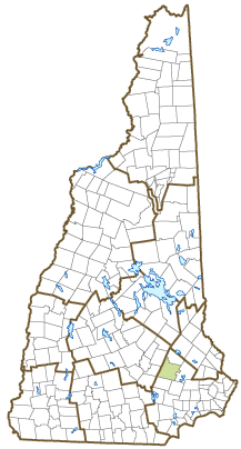
Town of Deerfield
John H. Harrington, Jr., Town Administrator
8 Raymond Road, PO Box 159
Deerfield, NH
03037
|
| Telephone |
(603) 463-8811 x309 |
| Fax |
(603) 463-5846 |
| E-mail |
bos@townofdeerfieldnh.com |
| Web Site |
www.townofdeerfieldnh.com
|
| Municipal Office Hours |
Town Administrator: Monday to Friday, 8-4:30; Town Clerk/Tax Collector Monday, Wednesday, Thursday, Friday, 8-2:30, Tuesday, 8-7
|
| County |
Rockingham |
| Labor Market Area |
Raymond, NH LMA |
| Tourism Region |
Merrimack Valley |
| Planning Commission |
Southern NH |
| Regional Development |
Regional Economic Development Corp.
|
| Election Districts |
|
| US Congress |
District District 2 |
| Executive Council |
District District 4 |
| State Senate |
District District 17 |
| State Representative |
Rockingham County Districts 2, 31 |
| Incorporated: 1766 |
| Origin: Originally a parish of Nottingham, Deerfield was incorporated as a separate town in 1766. It was probably named for Deerfield, Massachusetts, from where several early settlers had come to New Hampshire. An early resident was John Simpson, who achieved fame at the Battle of Bunker Hill by disobeying orders not to fire until you see the whites of their eyes and firing the first shot in the Revolution. Situated on the main road between Portsmouth and Concord, Deerfield was once a candidate for the state capitol. The first Deerfield Fair was held in 1876, and became an annual event in 1924 when the Deerfield Fair Association was formed. |
| Villages and Place Names: Deerfield Center, Deerfield Parade, Leavitts Hill, South Deerfield, Mt. Delight
|
| Population, Year of the First Census Taken: 1,619 residents in 1790 |
| Population Trends: Population change for Deerfield totaled 3,681 over 50 years, from 1,178 in 1970 to 4,859 in 2020. The 2022 Census estimate for Deerfield was 4,957 residents, ranking 75th among New Hampshire's incorporated cities and towns. |
| Population Density and Land Area, 2022 (US Census Bureau): 97.6 persons per square mile of land area. Deerfield contains 50.8 square miles of land area and 1.3 square miles of inland water area. |
| Municipal Services |
| Type of Government |
Town Meeting |
| Budget: Municipal Appropriations, 2022-2023 |
$5,310,117 |
| Budget: School Appropriations, 2023-2024 |
$16,746,611 |
| Zoning Ordinance |
1970/20 |
| Master Plan |
2009 |
| Capitol Improvement Plan |
Yes |
| Industrial Plans Reviewed By |
Planning Board |
| Boards and Commissions | |
| Elected: | Selectmen; Planning; Treasurer; Trust Fund; Philbrick James Library Trustees; Water; Checklist; Budget |
| Appointed: | Emergency Mgmnt; Animal Control Officer; Heritage; Veasey Park; Zoning; Conservation; Parks & Recreation; Cemetery; Energy; Forestry |
| Public Library |
Philbrick-James |
| Emergency Services |
| Police Department |
Full-time |
| Fire Department |
Volunteer |
| Emergency Medical Service |
Volunteer |
| Nearest Hospital(s) |
Distance |
Staffed Beds |
| Concord Hospital, Concord |
23 miles |
236 |
| Elliot Hospital, Manchester |
18 miles |
292 |
| Catholic Medical Center, Manchester |
19 miles |
262 |
| Utilities |
| Electric Supplier |
Eversource Energy; NH Electric Coop |
| Natural Gas Supplier |
None |
| Water Supplier |
Private wells |
| Sanitation |
Private septic |
| Municipal Wastewater Treatment Plant |
No |
| Solid Waste Disposal |
| Curbside Trash Pickup | None |
| Pay-As-You-Throw Program | No |
| Recycling Program | Voluntary |
| Telephone Company |
Consolidated Communications |
| Cellular Telephone Access |
Yes |
| Cable Television Access |
Yes |
| Public Access Television Station |
Yes |
| High Speed Internet Service: |
| Business | Limited |
| Residential | Limited |
| (NH Dept. of Revenue Administration) Property Taxes |
| 2022 Total Tax Rate (per $1,000 of value) |
$18.32 |
| 2022 Equalization Ratio |
70.5 |
| 2022 Full Value Tax Rate (per $1,000 of value) |
$12.78 |
| 2022 Percent of Local Assessed Value by Property Type |
| Residential Land and Buildings | 86.8% |
| Commercial Land and Buildings | 3.2% |
| Public Utilities, Current Use, and Other | 10.0% |
| (ACS 2017-2021) Housing |
| Total Housing Units |
1,908 |
| Single-Family Units, Detached or Attached |
1,758 |
| Units in Multiple-Family Structures: |
|
| Two to Four Units in Structure |
65 |
| Five or More Units in Structure |
58 |
| Mobile Homes and Other Housing Units |
27 |
(US Census Bureau) Population
(1-Year Estimates/Decennial) |
| Total Population |
Community |
County |
| 2022 |
4,957 |
319,424 |
| 2020 |
4,855 |
314,176 |
| 2010 |
4,280 |
295,223 |
| 2000 |
3,700 |
278,748 |
| 1990 |
3,139 |
246,744 |
| 1980 |
1,979 |
190,345 |
| |
| Demographics, American Community Survey (ACS) 2017-2021 |
| Population by Gender |
| Male: 2,275 |
|
Female: 2,533 |
| Population by Age Group |
| Under age 5 |
|
168 |
| Age 5 to 19 |
|
846 |
| Age 20 to 34 |
|
1,071 |
| Age 35 to 54 |
|
1,096 |
| Age 55 to 64 |
|
784 |
| Age 65 and over |
|
843 |
| Median Age |
|
42.1 years |
| Educational Attainment, population 25 years and over |
|
3,337 |
| High school graduate or higher |
|
91.6% |
| Bachelor's degree or higher |
|
39.1% |
| (ACS 2017-2021) Income, Inflation Adjusted $ |
| Per capita income |
$47,170 |
| Median family income |
$121,029 |
| Median household income |
$112,931 |
| Median Earnings, full-time, year-round workers |
| Male |
$64,000 |
| Female |
$67,250 |
| Individuals below the poverty level |
5.7% |
| (NHES - ELMI) Labor Force |
| Annual Average |
2012 |
2022 |
| Civilian Labor Force |
2,543 |
2,862 |
| Employed |
2,410 |
2,797 |
| Unemployed |
133 |
65 |
| Unemployment Rate |
5.2% |
2.3% |
| (NHES - ELMI) Employment & Wages |
| Annual Average Covered Employment |
2012 |
2022 |
| Goods Producing Industries |
| Average Employment |
107 |
134 |
| Average Weekly Wage |
$752 |
$1,138 |
| |
|
|
| Service Providing Industries |
| Average Employment |
227 |
335 |
| Average Weekly Wage |
$548 |
$894 |
| |
|
|
| Total Private Industry |
| Average Employment |
333 |
469 |
| Average Weekly Wage |
$613 |
$964 |
| |
|
|
| Government (Federal, State, and Local) |
| Average Employment |
52 |
73 |
| Average Weekly Wage |
$553 |
$604 |
| |
|
|
| Total, Private plus Government |
| Average Employment |
385 |
541 |
| Average Weekly Wage |
$605 |
$916 |
If "n" appears, data does not meet disclosure standards.
| (NH Dept. of Education) Education and Child Care |
| Schools students attend: |
Deerfield operates grades K-8; grades 9-12 are tuitioned to Concord or Pembroke |
SAU 53 |
| Career Technology Center(s): |
Manchester School of Technology; Concord Regional Technical Center; Pinkerton Academy Center for CTE; Salem HS Career & Technical Ed Ctr |
| Educational Facilities (includes Charter Schools) |
Elementary |
Middle/Junior High |
High School |
Private/Parochial |
| Number of Schools |
1 |
|
|
1 |
| Grade Levels |
K 1-8 |
|
|
9-12 |
| Total Enrollment |
528 |
|
|
22 |
| 2022 NH Licensed Child Care Facilities (Bureau of Child Care Licensing): |
Total Facilities: 1 |
Total Capacity: 24 |
| Nearest Community/Technical College: NHTI-Concord; Manchester |
| Nearest Colleges or Universities: St. Anselm; Southern NH University; UNH-Manchester; Franklin Pierce-Manchester; MCPHS; University of NH |
| Largest Businesses |
Product/Service |
Employees |
Established |
| The Cordwainer Shop |
Handmade custom shoes |
4 |
1954 |
|
|
|
|
|
|
|
|
|
|
|
|
|
|
|
|
|
|
|
|
|
|
|
|
|
|
|
|
|
|
|
|
|
|
|
|
Employer Information Supplied by Municipality
| (Distance estimated from city/town hall) Transportation |
| Road Access |
US Routes |
|
|
State Routes |
43, 107 |
| Nearest Interstate, Exit |
I-93, Exit 7 |
|
Distance |
15 miles |
| Railroad |
No |
| Public Transportation |
No |
| |
| Nearest Public Use Airport, General Aviation |
| Manchester-Boston Regional | Runway | 9,250 ft. asphalt |
| Lighted? |
Yes |
Navigational Aids? |
Yes |
| Nearest Airport with Scheduled Service |
| Manchester-Boston Regional |
Distance |
22 miles |
| Number of Passenger Airlines Serving Airport |
4 |
| |
| Driving distance to selected cities: |
| Manchester, NH |
18 miles |
| Portland, ME |
82 miles |
| Boston, MA |
66 miles |
| New York City, NY |
265 miles |
| Montreal, Quebec |
268 miles |
| (ACS 2017-2021) Commuting to Work |
| Workers 16 years and over |
2,671 |
| Drove alone, car/truck/van |
85.3% |
| Carpooled, car/truck/van |
3.8% |
| Public transportation |
0.0% |
| Walked |
4.4% |
| Other Means |
1.1% |
| Worked at home |
5.4% |
| Mean Travel Time to Work |
35.4 minutes |
| |
| Percent of Working Residents: |
(ACS 2017-2021) |
| Working in community of residence |
15.6% |
| Commuting to another NH community |
76.9% |
| Commuting out-of-state |
7.5% |
| Recreation, Attractions, and Events |
| Municipal Parks |
| YMCA/YWCA |
| Boys Club/Girls Club |
| Golf Courses |
| Swimming: Indoor Facility |
| Swimming: Outdoor Facility |
| Tennis Courts: Indoor Facility |
| Tennis Courts: Outdoor Facility |
| Ice Skating Rink: Indoor Facility |
| Bowling Facilities |
| Museums |
| Cinemas |
| Performing Arts Facilities |
| Tourist Attractions |
| Youth Organizations (i.e., Scouts, 4-H) |
| Youth Sports: Baseball |
| Youth Sports: Soccer |
| Youth Sports: Football |
| Youth Sports: Basketball |
| Youth Sports: Hockey |
| Campgrounds |
| Fishing/Hunting |
| Boating/Marinas |
| Snowmobile Trails |
| Bicycle Trails |
| Cross Country Skiing |
| Beach or Waterfront Recreational Area |
| Overnight or Day Camps |
| |
|
|
Nearest Ski Area(s): Pat's Peak |
| |
|
|
Other: Youth Flag Football; Deerfield Fair |
Economic & Labor Market Information Bureau, NH Employment Security, October 2023. Community Response Received 7/25/23
All information regarding the communities is from sources deemed reliable and is submitted subject to errors, omissions, modifications, and withdrawals without notice. No warranty or representation is made as to the accuracy of the information contained herein. Specific questions regarding individual cities and towns should be directed to the community contact.


