 |
Community Contact |
Danbury Board of Selectmen
Jessica Hatch, Chair
23 High Street
Danbury, NH
03230
|
| Telephone |
(603) 768-3313 |
| Fax |
(603) 768-3313 |
| E-mail |
danbury_selectmen@comcast.net |
| Web Site |
www.townofdanburynh.com
|
| Municipal Office Hours |
Selectmen: Monday and Thursday, 8-4, Tuesday, 1-5, Wednesday, 11:30-5:30, Friday, 8-12; Town Clerk/Tax Collector: Monday, 12-6, Tuesday, 12-7, Wednesday, 11-6, Thursday, 9-3, third Saturday each month, 9-12
|
| County |
Merrimack |
| Labor Market Area |
New London, NH LMA |
| Tourism Region |
Dartmouth-Lake Sunapee |
| Planning Commission |
Lakes Region |
| Regional Development |
Capital Regional Development Council
|
| Election Districts |
|
| US Congress |
District District 2 |
| Executive Council |
District District 1 |
| State Senate |
District District 7 |
| State Representative |
Merrimack County Districts 5, 26 |
| Incorporated: 1795 |
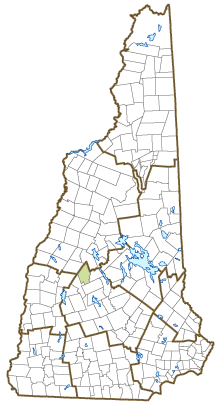
| Origin: This town was not an original colonial grant, but was formed from part of Alexandria to the north. In 1794, a group of Alexandria residents petitioned the state legislature to separate Alexandria into two towns due to the inconvenience of having a mountain divide the town, making it difficult for all residents to gather in a single place. The petition was granted in 1795, and the lower piece was incorporated as Danbury in that year. The name was suggested by a settler from Danbury, Connecticut. Land from Hill and Wilmot was added to Danbury later, and in July 1874, the town was transferred from Grafton County to Merrimack County. |
| Villages and Place Names: Elmwood, Fords Crossing, Fords Mill, South Danbury, Converse Station
|
| Population, Year of the First Census Taken: 165 residents in 1800 |
| Population Trends: Population change for Danbury totaled 779 over 50 years, from 489 in 1970 to 1,268 in 2020. The 2022 Census estimate for Danbury was 1,283 residents, which ranked 175th among New Hampshire's incorporated cities and towns. |
| Population Density and Land Area, 2022 (US Census Bureau): 34.0 persons per square mile of land area. Danbury contains 37.8 square miles of land area and 0.3 square miles of inland water area. |
| Municipal Services |
| Type of Government |
Selectmen |
| Budget: Municipal Appropriations, 2023 |
$1,914,975 |
| Budget: School Appropriations, 2020-2021 |
$2,409,641 |
| Zoning Ordinance |
2002/22 |
| Master Plan |
2011 |
| Capitol Improvement Plan |
Yes |
| Industrial Plans Reviewed By |
Planning Board |
| Boards and Commissions | |
| Elected: | Selectmen; Planning; Trust Funds; Checklist; ZBA; Library; Recreation; Auditor |
| Appointed: | |
| Public Library |
George Gamble |
| Emergency Services |
| Police Department |
Part-time |
| Fire Department |
Volunteer |
| Emergency Medical Service |
Volunteer |
| Nearest Hospital(s) |
Distance |
Staffed Beds |
| New London Hospital, New London |
16 miles |
25 |
|
|
|
|
|
|
| Utilities |
| Electric Supplier |
Eversource Energy; NH Electric Coop |
| Natural Gas Supplier |
None |
| Water Supplier |
Private wells |
| Sanitation |
Private septic |
| Municipal Wastewater Treatment Plant |
No |
| Solid Waste Disposal |
| Curbside Trash Pickup | None |
| Pay-As-You-Throw Program | No |
| Recycling Program | Voluntary |
| Telephone Company |
Consolidated Communications |
| Cellular Telephone Access |
Yes |
| Cable Television Access |
Limited |
| Public Access Television Station |
No |
| High Speed Internet Service: |
| Business | Yes |
| Residential | Yes |
| (NH Dept. of Revenue Administration) Property Taxes |
| 2022 Total Tax Rate (per $1,000 of value) |
$17.50 |
| 2022 Equalization Ratio |
78.9 |
| 2022 Full Value Tax Rate (per $1,000 of value) |
$13.78 |
| 2022 Percent of Local Assessed Value by Property Type |
| Residential Land and Buildings | 93.4% |
| Commercial Land and Buildings | 3.7% |
| Public Utilities, Current Use, and Other | 2.9% |
| (ACS 2017-2021) Housing |
| Total Housing Units |
705 |
| Single-Family Units, Detached or Attached |
560 |
| Units in Multiple-Family Structures: |
|
| Two to Four Units in Structure |
12 |
| Five or More Units in Structure |
0 |
| Mobile Homes and Other Housing Units |
133 |
(US Census Bureau) Population
(1-Year Estimates/Decennial) |
| Total Population |
Community |
County |
| 2022 |
1,283 |
156,020 |
| 2020 |
1,250 |
153,808 |
| 2010 |
1,164 |
146,445 |
| 2000 |
1,073 |
136,716 |
| 1990 |
884 |
120,618 |
| 1980 |
680 |
98,302 |
| |
| Demographics, American Community Survey (ACS) 2017-2021 |
| Population by Gender |
| Male: 666 |
|
Female: 700 |
| Population by Age Group |
| Under age 5 |
|
68 |
| Age 5 to 19 |
|
171 |
| Age 20 to 34 |
|
141 |
| Age 35 to 54 |
|
465 |
| Age 55 to 64 |
|
222 |
| Age 65 and over |
|
299 |
| Median Age |
|
51.6 years |
| Educational Attainment, population 25 years and over |
|
1,096 |
| High school graduate or higher |
|
92.6% |
| Bachelor's degree or higher |
|
16.7% |
| (ACS 2017-2021) Income, Inflation Adjusted $ |
| Per capita income |
$32,654 |
| Median family income |
$85,357 |
| Median household income |
$60,268 |
| Median Earnings, full-time, year-round workers |
| Male |
$52,102 |
| Female |
$47,330 |
| Individuals below the poverty level |
13.0% |
| (NHES - ELMI) Labor Force |
| Annual Average |
2012 |
2022 |
| Civilian Labor Force |
688 |
695 |
| Employed |
656 |
678 |
| Unemployed |
32 |
17 |
| Unemployment Rate |
4.7% |
2.4% |
| (NHES - ELMI) Employment & Wages |
| Annual Average Covered Employment |
2012 |
2022 |
| Goods Producing Industries |
| Average Employment |
25 |
85 |
| Average Weekly Wage |
$899 |
$1,207 |
| |
|
|
| Service Providing Industries |
| Average Employment |
83 |
113 |
| Average Weekly Wage |
$413 |
$592 |
| |
|
|
| Total Private Industry |
| Average Employment |
108 |
199 |
| Average Weekly Wage |
$524 |
$856 |
| |
|
|
| Government (Federal, State, and Local) |
| Average Employment |
31 |
40 |
| Average Weekly Wage |
$520 |
$614 |
| |
|
|
| Total, Private plus Government |
| Average Employment |
138 |
238 |
| Average Weekly Wage |
$523 |
$816 |
If "n" appears, data does not meet disclosure standards.
| (NH Dept. of Education) Education and Child Care |
| Schools students attend: |
Grades K-12 are part of Newfound Area (Alexandria, Bridgewater, Bristol, Danbury, Groton, Hebron, New Hampton) |
SAU 4 |
| Career Technology Center(s): |
Plymouth Applied Technology Center |
| Educational Facilities (includes Charter Schools) |
Elementary |
Middle/Junior High |
High School |
Private/Parochial |
| Number of Schools |
1 |
|
|
|
| Grade Levels |
K 1-5 |
|
|
9-12 |
| Total Enrollment |
76 |
|
|
|
| 2022 NH Licensed Child Care Facilities (Bureau of Child Care Licensing): |
Total Facilities: 0 |
Total Capacity: 0 |
| Nearest Community/Technical College: River Valley |
| Nearest Colleges or Universities: Colby-Sawyer; Magdalen; Dartmouth; Franklin Pierce-Lebanono; Upper Valley Educators Institute; Plymouth State |
| Largest Businesses |
Product/Service |
Employees |
Established |
| Ragged Mountain Resort |
Ski area, golf course |
20 |
1964 |
| William Wallace Prefab |
Manufactured house panels |
32 |
2002 |
| Danbury Country Store |
Country store |
11 |
2013 |
|
|
|
|
|
|
|
|
|
|
|
|
|
|
|
|
|
|
|
|
|
|
|
|
|
|
|
|
Employer Information Supplied by Municipality
| (Distance estimated from city/town hall) Transportation |
| Road Access |
US Routes |
4 |
|
State Routes |
104 |
| Nearest Interstate, Exit |
I-93, Exit 23 |
|
Distance |
15 miles |
| Railroad |
No |
| Public Transportation |
No |
| |
| Nearest Public Use Airport, General Aviation |
| Newfound Valley, Bristol | Runway | 1,900 ft. asphalt |
| Lighted? |
No |
Navigational Aids? |
No |
| Nearest Airport with Scheduled Service |
| Lebanon Municipal |
Distance |
27 miles |
| Number of Passenger Airlines Serving Airport |
1 |
| |
| Driving distance to selected cities: |
| Manchester, NH |
50 miles |
| Portland, ME |
142 miles |
| Boston, MA |
100 miles |
| New York City, NY |
293 miles |
| Montreal, Quebec |
215 miles |
| (ACS 2017-2021) Commuting to Work |
| Workers 16 years and over |
616 |
| Drove alone, car/truck/van |
80.5% |
| Carpooled, car/truck/van |
9.1% |
| Public transportation |
0.0% |
| Walked |
0.0% |
| Other Means |
3.6% |
| Worked at home |
6.8% |
| Mean Travel Time to Work |
38.0 minutes |
| |
| Percent of Working Residents: |
(ACS 2017-2021) |
| Working in community of residence |
10.1% |
| Commuting to another NH community |
83.9% |
| Commuting out-of-state |
6.0% |
| Recreation, Attractions, and Events |
| Municipal Parks |
| YMCA/YWCA |
| Boys Club/Girls Club |
| Golf Courses |
| Swimming: Indoor Facility |
| Swimming: Outdoor Facility |
| Tennis Courts: Indoor Facility |
| Tennis Courts: Outdoor Facility |
| Ice Skating Rink: Indoor Facility |
| Bowling Facilities |
| Museums |
| Cinemas |
| Performing Arts Facilities |
| Tourist Attractions |
| Youth Organizations (i.e., Scouts, 4-H) |
| Youth Sports: Baseball |
| Youth Sports: Soccer |
| Youth Sports: Football |
| Youth Sports: Basketball |
| Youth Sports: Hockey |
| Campgrounds |
| Fishing/Hunting |
| Boating/Marinas |
| Snowmobile Trails |
| Bicycle Trails |
| Cross Country Skiing |
| Beach or Waterfront Recreational Area |
| Overnight or Day Camps |
| |
|
|
Nearest Ski Area(s): Ragged Mountain |
| |
|
|
Other: Community Center; Independence Park; NH Railtrail; Danbury North Road Schoolhouse Museum |
Economic & Labor Market Information Bureau, NH Employment Security, October 2023. Community Response Received 6/9/22
All information regarding the communities is from sources deemed reliable and is submitted subject to errors, omissions, modifications, and withdrawals without notice. No warranty or representation is made as to the accuracy of the information contained herein. Specific questions regarding individual cities and towns should be directed to the community contact.


