 |
Community Contact |
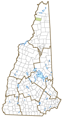
Town of Colebrook
Heidi Lawton, Administrative Assistant
17 Bridge Street
Colebrook, NH
03576
|
| Telephone |
(603) 237-4142; 237-4070 |
| Fax |
(603) 237-5069 |
| E-mail |
hlawton@colebrooknh.org |
| Web Site |
www.colebrooknh.org
|
| Municipal Office Hours |
Town Manager and Tax Collector: Monday to Friday, 8-4; Town Clerk: Monday to Thursday, 8-3:30, Friday, 8-1
|
| County |
Coos |
| Labor Market Area |
Colebrook, NH-VT LMA, NH part |
| Tourism Region |
Great North Woods |
| Planning Commission |
North Country Council |
| Regional Development |
Coos Economic Development Corp.
|
| Election Districts |
|
| US Congress |
District District 2 |
| Executive Council |
District District 1 |
| State Senate |
District District 1 |
| State Representative |
Coos County District 3 |
| Incorporated: 1796 |
| Origin: This territory was first granted to settlers in 1762 by Governor Benning Wentworth, who named it Dryden, after English poet and playwright John Dryden. Among them were Dutch settlers from New York, who were selected in an effort to colonize territory west of the Connecticut River. The New York government also wanted to colonize the territory, and as a result, settlers formed the independent state of Vermont. Dryden grantees failed to meet the prescribed terms, and in 1770, Governor John Wentworth regranted the area to Sir George Colebrooke, Chairman of the British East India Company, and three others. At that time, the town was renamed Colebrook. |
| Villages and Place Names: Kidderville, Upper Kidderville, Factory Village
|
| Population, Year of the First Census Taken: 29 residents in 1790 |
| Population Trends: |
| Population Density and Land Area, 2022 (US Census Bureau): 51.7 persons per square mile of land area. Colebrook contains 40.8 square miles of land area and 0 square miles of inland water area. |
| Municipal Services |
| Type of Government |
Selectmen |
| Budget: Municipal Appropriations, 2019 |
$5,057,871 |
| Budget: School Appropriations, 2020-2021 |
$6,909,825 |
| Zoning Ordinance |
1957/10 |
| Master Plan |
2013 |
| Capitol Improvement Plan |
Yes |
| Industrial Plans Reviewed By |
Planning Board |
| Boards and Commissions | |
| Elected: | Selectmen; Planning; Cemetery; Library |
| Appointed: | Zoning; Conservation |
| Public Library |
Colebrook Public |
| Emergency Services |
| Police Department |
Full-time |
| Fire Department |
Volunteer |
| Emergency Medical Service |
Private |
| Nearest Hospital(s) |
Distance |
Staffed Beds |
| Upper Connecticut Valley, Colebrook |
Local |
16 |
|
|
|
|
|
|
| Utilities |
| Electric Supplier |
Eversource Energy; NH Electric Coop |
| Natural Gas Supplier |
C. Bean, C.N. Brown |
| Water Supplier |
Colebrook Water Works |
| Sanitation |
Municipal |
| Municipal Wastewater Treatment Plant |
Yes |
| Solid Waste Disposal |
| Curbside Trash Pickup | Private |
| Pay-As-You-Throw Program | No |
| Recycling Program | Mandatory |
| Telephone Company |
Consolidated Communications |
| Cellular Telephone Access |
Yes |
| Cable Television Access |
Yes |
| Public Access Television Station |
No |
| High Speed Internet Service: |
| Business | Yes |
| Residential | Yes |
| (NH Dept. of Revenue Administration) Property Taxes |
| 2022 Total Tax Rate (per $1,000 of value) |
$28.32 |
| 2022 Equalization Ratio |
56.3 |
| 2022 Full Value Tax Rate (per $1,000 of value) |
$15.91 |
| 2022 Percent of Local Assessed Value by Property Type |
| Residential Land and Buildings | 66.7% |
| Commercial Land and Buildings | 23.2% |
| Public Utilities, Current Use, and Other | 10.2% |
| (ACS 2017-2021) Housing |
| Total Housing Units |
1,360 |
| Single-Family Units, Detached or Attached |
903 |
| Units in Multiple-Family Structures: |
|
| Two to Four Units in Structure |
164 |
| Five or More Units in Structure |
115 |
| Mobile Homes and Other Housing Units |
178 |
(US Census Bureau) Population
(1-Year Estimates/Decennial) |
| Total Population |
Community |
County |
| 2022 |
2,108 |
31,504 |
| 2020 |
2,084 |
31,268 |
| 2010 |
2,301 |
33,055 |
| 2000 |
2,325 |
33,156 |
| 1990 |
2,453 |
34,879 |
| 1980 |
2,459 |
35,014 |
| |
| Demographics, American Community Survey (ACS) 2017-2021 |
| Population by Gender |
| Male: 1,038 |
|
Female: 957 |
| Population by Age Group |
| Under age 5 |
|
61 |
| Age 5 to 19 |
|
236 |
| Age 20 to 34 |
|
328 |
| Age 35 to 54 |
|
428 |
| Age 55 to 64 |
|
448 |
| Age 65 and over |
|
494 |
| Median Age |
|
52.8 years |
| Educational Attainment, population 25 years and over |
|
1,629 |
| High school graduate or higher |
|
87.0% |
| Bachelor's degree or higher |
|
16.4% |
| (ACS 2017-2021) Income, Inflation Adjusted $ |
| Per capita income |
$37,410 |
| Median family income |
$64,950 |
| Median household income |
$48,048 |
| Median Earnings, full-time, year-round workers |
| Male |
$58,125 |
| Female |
$35,398 |
| Individuals below the poverty level |
11.8% |
| (NHES - ELMI) Labor Force |
| Annual Average |
2012 |
2022 |
| Civilian Labor Force |
1,200 |
1,108 |
| Employed |
1,114 |
1,058 |
| Unemployed |
86 |
50 |
| Unemployment Rate |
7.2% |
4.5% |
| (NHES - ELMI) Employment & Wages |
| Annual Average Covered Employment |
2012 |
2022 |
| Goods Producing Industries |
| Average Employment |
137 |
209 |
| Average Weekly Wage |
$711 |
$916 |
| |
|
|
| Service Providing Industries |
| Average Employment |
861 |
805 |
| Average Weekly Wage |
$540 |
$905 |
| |
|
|
| Total Private Industry |
| Average Employment |
998 |
1,014 |
| Average Weekly Wage |
$563 |
$907 |
| |
|
|
| Government (Federal, State, and Local) |
| Average Employment |
172 |
152 |
| Average Weekly Wage |
$583 |
$814 |
| |
|
|
| Total, Private plus Government |
| Average Employment |
1,170 |
1,165 |
| Average Weekly Wage |
$566 |
$895 |
If "n" appears, data does not meet disclosure standards.
| (NH Dept. of Education) Education and Child Care |
| Schools students attend: |
Colebrook operates grades K-12 |
SAU 7 |
| Career Technology Center(s): |
Berlin Regional Career & Technical Center |
| Educational Facilities (includes Charter Schools) |
Elementary |
Middle/Junior High |
High School |
Private/Parochial |
| Number of Schools |
1 |
|
1 |
|
| Grade Levels |
P K 1-8 |
|
9-12 |
9-12 |
| Total Enrollment |
198 |
|
118 |
|
| 2022 NH Licensed Child Care Facilities (Bureau of Child Care Licensing): |
Total Facilities: 3 |
Total Capacity: 111 |
| Nearest Community/Technical College: White Mountains |
| Nearest Colleges or Universities: Plymouth State; Northern VT - Lyndon (VT) |
| Largest Businesses |
Product/Service |
Employees |
Established |
| Upper Connecticut Valley Hospital |
Health care services |
140 |
1970 |
| Codet |
Stitching |
18 |
1992 |
| Town of Colebrook |
Municipal services |
34 |
1770 |
| Colebrook School District |
Education |
65 |
1900 |
| Bangor Savings Bank |
Banking services |
25 |
1889 |
|
|
|
|
|
|
|
|
|
|
|
|
|
|
|
|
|
|
|
|
Employer Information Supplied by Municipality
| (Distance estimated from city/town hall) Transportation |
| Road Access |
US Routes |
3 |
|
State Routes |
26, 145 |
| Nearest Interstate, Exit |
I-91 (VT), Exit 28; Aut-55 (QC), Exit 21 |
|
Distance |
49 miles; 43 miles |
| Railroad |
State owned line |
| Public Transportation |
No |
| |
| Nearest Public Use Airport, General Aviation |
| Gifford Field, Colebrook | Runway | 2,440 ft. turf |
| Lighted? |
No |
Navigational Aids? |
No |
| Nearest Airport with Scheduled Service |
| Portland (ME) International |
Distance |
129 miles |
| Number of Passenger Airlines Serving Airport |
8 |
| |
| Driving distance to selected cities: |
| Manchester, NH |
152 miles |
| Portland, ME |
133 miles |
| Boston, MA |
202 miles |
| New York City, NY |
382 miles |
| Montreal, Quebec |
130 miles |
| (ACS 2017-2021) Commuting to Work |
| Workers 16 years and over |
1,047 |
| Drove alone, car/truck/van |
80.6% |
| Carpooled, car/truck/van |
10.1% |
| Public transportation |
0.0% |
| Walked |
1.3% |
| Other Means |
1.7% |
| Worked at home |
6.2% |
| Mean Travel Time to Work |
17.8 minutes |
| |
| Percent of Working Residents: |
(ACS 2017-2021) |
| Working in community of residence |
57.1% |
| Commuting to another NH community |
36.1% |
| Commuting out-of-state |
6.8% |
| Recreation, Attractions, and Events |
| Municipal Parks |
| YMCA/YWCA |
| Boys Club/Girls Club |
| Golf Courses |
| Swimming: Indoor Facility |
| Swimming: Outdoor Facility |
| Tennis Courts: Indoor Facility |
| Tennis Courts: Outdoor Facility |
| Ice Skating Rink: Indoor Facility |
| Bowling Facilities |
| Museums |
| Cinemas |
| Performing Arts Facilities |
| Tourist Attractions |
| Youth Organizations (i.e., Scouts, 4-H) |
| Youth Sports: Baseball |
| Youth Sports: Soccer |
| Youth Sports: Football |
| Youth Sports: Basketball |
| Youth Sports: Hockey |
| Campgrounds |
| Fishing/Hunting |
| Boating/Marinas |
| Snowmobile Trails |
| Bicycle Trails |
| Cross Country Skiing |
| Beach or Waterfront Recreational Area |
| Overnight or Day Camps |
| |
|
|
Nearest Ski Area(s): Bretton Woods, Jay Peak |
| |
|
|
Other: Coleman State Park; Beaver Brook Falls; Outdoor Skating Facility |
Economic & Labor Market Information Bureau, NH Employment Security, October 2023. Community Response Received 6/2/23
All information regarding the communities is from sources deemed reliable and is submitted subject to errors, omissions, modifications, and withdrawals without notice. No warranty or representation is made as to the accuracy of the information contained herein. Specific questions regarding individual cities and towns should be directed to the community contact.


