 |
Community Contact |
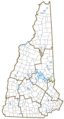
Town of Brookfield
Cassandra Rodil, Administrative Assistant
267 Wentworth Road
Brookfield, NH
03872
|
| Telephone |
(603) 522-3688 |
| Fax |
Not Available |
| E-mail |
admin.asst@brookfieldnh.org |
| Web Site |
www.brookfieldnh.org
|
| Municipal Office Hours |
Selectmen: last Saturday each month, 8-10; Town Clerk: Monday, 9-5, Tuesday and Wednesday, 3-5, last Saturday each month, 9-12; Administrative Assistant: Wednesday, 8:30-12:30; Tax Collector: second and fourth Friday each month,10-2, or by appointment
|
| County |
Carroll |
| Labor Market Area |
Wolfeboro, NH LMA |
| Tourism Region |
Lakes |
| Planning Commission |
Strafford Regional |
| Regional Development |
Wentworth Economic Development Corp.
|
| Election Districts |
|
| US Congress |
District District 1 |
| Executive Council |
District District 1 |
| State Senate |
District District 3 |
| State Representative |
Carroll County District 4 |
| Incorporated: 1794 |
| Origin: Settled in 1726 by Scotch-Irish immigrants while still under Massachusetts rule, this territory was part of a planned grant named Coleraine, after the Irish town of the same name. The grant was never authorized, and the settlement became part of Middleton. In 1785 residents of the northern portion of Middleton and part of Wolfeboro petitioned for a separately incorporated town. The petition was at first denied, but then was granted in 1794 as Brookfield, probably after a town of the same name in Massachusetts. The area was popular with farmers because of its fertile ground. |
| Villages and Place Names: unknown
|
| Population, Year of the First Census Taken: 504 residents in 1800 |
| Population Trends: Population change for Brookfield totaled 560 over 50 years, from 198 in 1970 to 758 in 2020. The 2022 Census estimate for Brookfield was 804 residents, which ranked 201st among New Hampshire's incorporated cities and towns. |
| Population Density and Land Area, 2022 (US Census Bureau): 35.2 persons per square mile of land area. Brookfield contains 22.9 square miles of land area and 0.4 square miles of inland water area. |
| Municipal Services |
| Type of Government |
Selectmen |
| Budget: Municipal Appropriations, 2021 |
$1,235,288 |
| Budget: School Appropriations, 2021-2022 |
$1,647,487 |
| Zoning Ordinance |
1961/21 |
| Master Plan |
2010 |
| Capitol Improvement Plan |
No |
| Industrial Plans Reviewed By |
Planning Board |
| Boards and Commissions | |
| Elected: | Tax Collector; Town Clerk; Treasurer; Selectmen; Planning; Cemetery; Auditors; Trust Funds |
| Appointed: | Conservation; ZBA; Heritage; Agriculture; Webmaster; Grant Review; Communications; Joint Loss Mgmnt. |
| Public Library |
No Library |
| Emergency Services |
| Police Department |
Wakefield PD - Full-time |
| Fire Department |
Wakefield FD - Full-time |
| Emergency Medical Service |
Wakefield - Municipal |
| Nearest Hospital(s) |
Distance |
Staffed Beds |
| Huggins Hospital, Wolfeboro |
11 miles |
25 |
|
|
|
|
|
|
| Utilities |
| Electric Supplier |
Eversource Energy; NH Electric Coop |
| Natural Gas Supplier |
None |
| Water Supplier |
Private wells |
| Sanitation |
Private septic |
| Municipal Wastewater Treatment Plant |
No |
| Solid Waste Disposal |
| Curbside Trash Pickup | Private |
| Pay-As-You-Throw Program | No |
| Recycling Program | Mandatory |
| Telephone Company |
Consolidated Communications |
| Cellular Telephone Access |
Yes |
| Cable Television Access |
Limited |
| Public Access Television Station |
No |
| High Speed Internet Service: |
| Business | Yes |
| Residential | Yes |
| (NH Dept. of Revenue Administration) Property Taxes |
| 2022 Total Tax Rate (per $1,000 of value) |
$19.23 |
| 2022 Equalization Ratio |
68.3 |
| 2022 Full Value Tax Rate (per $1,000 of value) |
$13.11 |
| 2022 Percent of Local Assessed Value by Property Type |
| Residential Land and Buildings | 97.4% |
| Commercial Land and Buildings | 0.8% |
| Public Utilities, Current Use, and Other | 1.8% |
| (ACS 2017-2021) Housing |
| Total Housing Units |
313 |
| Single-Family Units, Detached or Attached |
313 |
| Units in Multiple-Family Structures: |
|
| Two to Four Units in Structure |
0 |
| Five or More Units in Structure |
0 |
| Mobile Homes and Other Housing Units |
0 |
(US Census Bureau) Population
(1-Year Estimates/Decennial) |
| Total Population |
Community |
County |
| 2022 |
804 |
52,199 |
| 2020 |
755 |
50,107 |
| 2010 |
712 |
47,818 |
| 2000 |
609 |
43,918 |
| 1990 |
520 |
35,526 |
| 1980 |
385 |
27,929 |
| |
| Demographics, American Community Survey (ACS) 2017-2021 |
| Population by Gender |
| Male: 307 |
|
Female: 307 |
| Population by Age Group |
| Under age 5 |
|
9 |
| Age 5 to 19 |
|
75 |
| Age 20 to 34 |
|
92 |
| Age 35 to 54 |
|
198 |
| Age 55 to 64 |
|
103 |
| Age 65 and over |
|
137 |
| Median Age |
|
49.8 years |
| Educational Attainment, population 25 years and over |
|
480 |
| High school graduate or higher |
|
96.0% |
| Bachelor's degree or higher |
|
35.4% |
| (ACS 2017-2021) Income, Inflation Adjusted $ |
| Per capita income |
$43,214 |
| Median family income |
$93,661 |
| Median household income |
$80,250 |
| Median Earnings, full-time, year-round workers |
| Male |
$58,672 |
| Female |
$35,500 |
| Individuals below the poverty level |
3.7% |
| (NHES - ELMI) Labor Force |
| Annual Average |
2012 |
2022 |
| Civilian Labor Force |
318 |
291 |
| Employed |
301 |
282 |
| Unemployed |
17 |
9 |
| Unemployment Rate |
5.3% |
3.1% |
| (NHES - ELMI) Employment & Wages |
| Annual Average Covered Employment |
2012 |
2022 |
| Goods Producing Industries |
| Average Employment |
5 |
n |
| Average Weekly Wage |
$821 |
n |
| |
|
|
| Service Providing Industries |
| Average Employment |
15 |
n |
| Average Weekly Wage |
$670 |
n |
| |
|
|
| Total Private Industry |
| Average Employment |
20 |
24 |
| Average Weekly Wage |
$708 |
$1,096 |
| |
|
|
| Government (Federal, State, and Local) |
| Average Employment |
0 |
0 |
| Average Weekly Wage |
$0 |
$0 |
| |
|
|
| Total, Private plus Government |
| Average Employment |
20 |
24 |
| Average Weekly Wage |
$708 |
$1,096 |
If "n" appears, data does not meet disclosure standards.
| (NH Dept. of Education) Education and Child Care |
| Schools students attend: |
Grades K-12 are part of Governor Wentworth Regional (Brookfield, Effingham, Middleton, New Durham, Ossipee, Tuftonboro, Wolfeboro) |
SAU 49 |
| Career Technology Center(s): |
Lakes Region Technology Center (Wolfeboro) |
| Educational Facilities (includes Charter Schools) |
Elementary |
Middle/Junior High |
High School |
Private/Parochial |
| Number of Schools |
|
|
|
|
| Grade Levels |
|
|
|
|
| Total Enrollment |
|
|
|
|
| 2022 NH Licensed Child Care Facilities (Bureau of Child Care Licensing): |
Total Facilities: 0 |
Total Capacity: 0 |
| Nearest Community/Technical College: Lakes Region |
| Nearest Colleges or Universities: University of NH; St. Joseph's (ME) |
| Largest Businesses |
Product/Service |
Employees |
Established |
| Not Available |
|
|
|
|
|
|
|
|
|
|
|
|
|
|
|
|
|
|
|
|
|
|
|
|
|
|
|
|
|
|
|
|
|
|
|
|
|
|
|
Employer Information Supplied by Municipality
| (Distance estimated from city/town hall) Transportation |
| Road Access |
US Routes |
|
|
State Routes |
109 |
| Nearest Interstate, Exit |
Spaulding Tpk., Exit 18; I-95, Exit 5 |
|
Distance |
7 miles; 40 miles |
| Railroad |
No |
| Public Transportation |
No |
| |
| Nearest Public Use Airport, General Aviation |
| Skyhaven, Rochester | Runway | 4,200 ft. asphalt |
| Lighted? |
Yes |
Navigational Aids? |
Yes |
| Nearest Airport with Scheduled Service |
| Manchester-Boston Regional |
Distance |
66 miles |
| Number of Passenger Airlines Serving Airport |
4 |
| |
| Driving distance to selected cities: |
| Manchester, NH |
63 miles |
| Portland, ME |
53 miles |
| Boston, MA |
95 miles |
| New York City, NY |
302 miles |
| Montreal, Quebec |
256 miles |
| (ACS 2017-2021) Commuting to Work |
| Workers 16 years and over |
375 |
| Drove alone, car/truck/van |
86.7% |
| Carpooled, car/truck/van |
0.3% |
| Public transportation |
0.0% |
| Walked |
1.1% |
| Other Means |
1.9% |
| Worked at home |
10.1% |
| Mean Travel Time to Work |
33.7 minutes |
| |
| Percent of Working Residents: |
(ACS 2017-2021) |
| Working in community of residence |
20.5% |
| Commuting to another NH community |
76.0% |
| Commuting out-of-state |
3.5% |
| Recreation, Attractions, and Events |
| Municipal Parks |
| YMCA/YWCA |
| Boys Club/Girls Club |
| Golf Courses |
| Swimming: Indoor Facility |
| Swimming: Outdoor Facility |
| Tennis Courts: Indoor Facility |
| Tennis Courts: Outdoor Facility |
| Ice Skating Rink: Indoor Facility |
| Bowling Facilities |
| Museums |
| Cinemas |
| Performing Arts Facilities |
| Tourist Attractions |
| Youth Organizations (i.e., Scouts, 4-H) |
| Youth Sports: Baseball |
| Youth Sports: Soccer |
| Youth Sports: Football |
| Youth Sports: Basketball |
| Youth Sports: Hockey |
| Campgrounds |
| Fishing/Hunting |
| Boating/Marinas |
| Snowmobile Trails |
| Bicycle Trails |
| Cross Country Skiing |
| Beach or Waterfront Recreational Area |
| Overnight or Day Camps |
| |
|
|
Nearest Ski Area(s): King Pine, Abenaki |
| |
|
|
Other: Town Clean Up Day; Hiking; Old Home Day; Frisbee Golf; Wolfeboro Parks & Rec |
Economic & Labor Market Information Bureau, NH Employment Security, October 2023. Community Response Received 7/26/23
All information regarding the communities is from sources deemed reliable and is submitted subject to errors, omissions, modifications, and withdrawals without notice. No warranty or representation is made as to the accuracy of the information contained herein. Specific questions regarding individual cities and towns should be directed to the community contact.


