 |
Community Contact |
Bethlehem Board of Selectmen
Veronica Morris, Chair
PO Box 189
Bethlehem, NH
03574
|
| Telephone |
(603) 869-3351 x101 |
| Fax |
(603) 869-2280 |
| E-mail |
admin@bethlehemnh.org |
| Web Site |
www.bethlehemnh.org
|
| Municipal Office Hours |
Selectmen: Monday to Thursday, 8-4, Friday, 8-12; Town Clerk/Tax Collector: Monday to Thursday, 9-3, Friday, 9-12
|
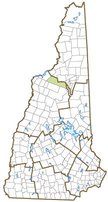
| County |
Grafton |
| Labor Market Area |
Littleton, NH-VT LMA, NH part |
| Tourism Region |
White Mountains |
| Planning Commission |
North Country Council |
| Regional Development |
Grafton County Economic Development Council
|
| Election Districts |
|
| US Congress |
District District 2 |
| Executive Council |
District District 2 |
| State Senate |
District District 1 |
| State Representative |
Grafton County District 2 |
| Incorporated: 1799 |
| Origin: This community was first established in 1774 as Lloyd's Hills, the last of the provincial land grants. Probably because James Lloyd, for whom the town was named, was a loyalist, voters elected to change the name following the Revolution. The name Bethlehem was selected on the last Christmas Day in the century, and the town was so incorporated on December 27, 1799. According to the US Postal Service, Bethlehem is one of several US communities with holiday-themed names who have special holiday postmarks. |
| Villages and Place Names: Alderbrook, Five Corners, Maplewood, Pierce Bridge
|
| Population, Year of the First Census Taken: 171 residents in 1800 |
| Population Trends: Population change for Bethlehem totaled 1,353 over 50 years, from 1,142 in 1970 to 2,495 in 2020. The 2022 Census estimate for Bethlehem was 2,552 residents, which ranked 123rd among New Hampshire's incorporated cities and towns. |
| Population Density and Land Area, 2022 (US Census Bureau): 28.1 persons per square mile of land area. Bethlehem contains 90.9 square miles of land area and 0.1 square miles of inland water area. |
| Municipal Services |
| Type of Government |
Selectmen |
| Budget: Municipal Appropriations, 2023 |
$3,370,220 |
| Budget: School Appropriations, 2020-2021 |
$6,670,000 |
| Zoning Ordinance |
1972/23 |
| Master Plan |
2016 |
| Capitol Improvement Plan |
Yes |
| Industrial Plans Reviewed By |
Planning Board |
| Boards and Commissions | |
| Elected: | Selectmen; Planning; Zoning |
| Appointed: | Conservation; Library; Energy Commission; Transfer Station Committee |
| Public Library |
Bethlehem Public |
| Emergency Services |
| Police Department |
Full-time |
| Fire Department |
Full-time Chief & volunteer |
| Emergency Medical Service |
Volunteer |
| Nearest Hospital(s) |
Distance |
Staffed Beds |
| Littleton Regional, Littleton |
8 miles |
25 |
|
|
|
|
|
|
| Utilities |
| Electric Supplier |
Eversource Energy; Littleton Water & Light |
| Natural Gas Supplier |
None |
| Water Supplier |
Bethlehem Village District |
| Sanitation |
Private septic & municipal |
| Municipal Wastewater Treatment Plant |
Yes |
| Solid Waste Disposal |
| Curbside Trash Pickup | Municipal |
| Pay-As-You-Throw Program | No |
| Recycling Program | Voluntary |
| Telephone Company |
Time Warner; Consolidated Communications |
| Cellular Telephone Access |
Yes |
| Cable Television Access |
Yes |
| Public Access Television Station |
No |
| High Speed Internet Service: |
| Business | Yes |
| Residential | Yes |
| (NH Dept. of Revenue Administration) Property Taxes |
| 2022 Total Tax Rate (per $1,000 of value) |
$23.89 |
| 2022 Equalization Ratio |
55.0 |
| 2022 Full Value Tax Rate (per $1,000 of value) |
$13.07 |
| 2022 Percent of Local Assessed Value by Property Type |
| Residential Land and Buildings | 78.7% |
| Commercial Land and Buildings | 17.9% |
| Public Utilities, Current Use, and Other | 3.5% |
| (ACS 2017-2021) Housing |
| Total Housing Units |
1,370 |
| Single-Family Units, Detached or Attached |
1,138 |
| Units in Multiple-Family Structures: |
|
| Two to Four Units in Structure |
84 |
| Five or More Units in Structure |
75 |
| Mobile Homes and Other Housing Units |
73 |
(US Census Bureau) Population
(1-Year Estimates/Decennial) |
| Total Population |
Community |
County |
| 2022 |
2,552 |
91,126 |
| 2020 |
2,484 |
91,118 |
| 2010 |
2,526 |
89,118 |
| 2000 |
2,206 |
81,826 |
| 1990 |
2,018 |
74,998 |
| 1980 |
1,784 |
65,806 |
| |
| Demographics, American Community Survey (ACS) 2017-2021 |
| Population by Gender |
| Male: 1,081 |
|
Female: 1,437 |
| Population by Age Group |
| Under age 5 |
|
69 |
| Age 5 to 19 |
|
316 |
| Age 20 to 34 |
|
279 |
| Age 35 to 54 |
|
731 |
| Age 55 to 64 |
|
552 |
| Age 65 and over |
|
571 |
| Median Age |
|
53.2 years |
| Educational Attainment, population 25 years and over |
|
2,046 |
| High school graduate or higher |
|
97.4% |
| Bachelor's degree or higher |
|
37.7% |
| (ACS 2017-2021) Income, Inflation Adjusted $ |
| Per capita income |
$34,438 |
| Median family income |
$79,236 |
| Median household income |
$68,929 |
| Median Earnings, full-time, year-round workers |
| Male |
$53,661 |
| Female |
$43,403 |
| Individuals below the poverty level |
8.5% |
| (NHES - ELMI) Labor Force |
| Annual Average |
2012 |
2022 |
| Civilian Labor Force |
1,416 |
1,490 |
| Employed |
1,342 |
1,454 |
| Unemployed |
74 |
36 |
| Unemployment Rate |
5.2% |
2.4% |
| (NHES - ELMI) Employment & Wages |
| Annual Average Covered Employment |
2012 |
2022 |
| Goods Producing Industries |
| Average Employment |
13 |
95 |
| Average Weekly Wage |
$559 |
$667 |
| |
|
|
| Service Providing Industries |
| Average Employment |
345 |
326 |
| Average Weekly Wage |
$661 |
$833 |
| |
|
|
| Total Private Industry |
| Average Employment |
357 |
420 |
| Average Weekly Wage |
$658 |
$796 |
| |
|
|
| Government (Federal, State, and Local) |
| Average Employment |
187 |
166 |
| Average Weekly Wage |
$591 |
$821 |
| |
|
|
| Total, Private plus Government |
| Average Employment |
545 |
586 |
| Average Weekly Wage |
$635 |
$803 |
If "n" appears, data does not meet disclosure standards.
| (NH Dept. of Education) Education and Child Care |
| Schools students attend: |
Bethlehem operates grades K-6; grades 7-12 are part of Profile Cooperative (Bethlehem, Easton, Franconia, Sugar Hill) |
SAU 35 |
| Career Technology Center(s): |
Hugh J. Gallen Career & Technical Center (Littleton); White Mountains RHS (Whitefield) |
| Educational Facilities (includes Charter Schools) |
Elementary |
Middle/Junior High |
High School |
Private/Parochial |
| Number of Schools |
1 |
1 |
1 |
3 |
| Grade Levels |
P K 1-6 |
7-8 |
9-12 |
K 1-12 |
| Total Enrollment |
151 |
64 |
146 |
134 |
| 2022 NH Licensed Child Care Facilities (Bureau of Child Care Licensing): |
Total Facilities: 1 |
Total Capacity: 36 |
| Nearest Community/Technical College: White Mountains |
| Nearest Colleges or Universities: Plymouth State; Northern VT - Lyndon (VT) |
| Largest Businesses |
Product/Service |
Employees |
Established |
| Rek-Lis Brewery |
Brewery/restaurant |
60 |
2018 |
| Profile Junior/Senior High School |
Education |
55 |
1976 |
| White Mountain School |
Education |
54 |
|
| Bethlehem Elementary School |
Education |
35 |
|
| Pinetree Power Inc. |
Electric plant |
20 |
1988 |
| Town of Bethlehem |
Municipal services |
15 |
Sper Secret Ice Cream |
| Ice cream store |
30 |
|
|
|
|
|
|
|
|
|
|
|
|
|
|
Employer Information Supplied by Municipality
| (Distance estimated from city/town hall) Transportation |
| Road Access |
US Routes |
3, 302 |
|
State Routes |
18, 116, 142 |
| Nearest Interstate, Exit |
I-93, Exits 39 - 40 |
|
Distance |
Local access |
| Railroad |
No |
| Public Transportation |
No |
| |
| Nearest Public Use Airport, General Aviation |
| Twin Mountain | Runway | 2,640 ft. asphalt |
| Lighted? |
Yes |
Navigational Aids? |
No |
| Nearest Airport with Scheduled Service |
| Lebanon Municipal |
Distance |
67 miles |
| Number of Passenger Airlines Serving Airport |
1 |
| |
| Driving distance to selected cities: |
| Manchester, NH |
100 miles |
| Portland, ME |
105 miles |
| Boston, MA |
151 miles |
| New York City, NY |
344 miles |
| Montreal, Quebec |
173 miles |
| (ACS 2017-2021) Commuting to Work |
| Workers 16 years and over |
1,267 |
| Drove alone, car/truck/van |
69.3% |
| Carpooled, car/truck/van |
4.8% |
| Public transportation |
0.4% |
| Walked |
4.1% |
| Other Means |
0.9% |
| Worked at home |
20.5% |
| Mean Travel Time to Work |
25.1 minutes |
| |
| Percent of Working Residents: |
(ACS 2017-2021) |
| Working in community of residence |
34.9% |
| Commuting to another NH community |
58.9% |
| Commuting out-of-state |
6.2% |
| Recreation, Attractions, and Events |
| Municipal Parks |
| YMCA/YWCA |
| Boys Club/Girls Club |
| Golf Courses |
| Swimming: Indoor Facility |
| Swimming: Outdoor Facility |
| Tennis Courts: Indoor Facility |
| Tennis Courts: Outdoor Facility |
| Ice Skating Rink: Indoor Facility |
| Bowling Facilities |
| Museums |
| Cinemas |
| Performing Arts Facilities |
| Tourist Attractions |
| Youth Organizations (i.e., Scouts, 4-H) |
| Youth Sports: Baseball |
| Youth Sports: Soccer |
| Youth Sports: Football |
| Youth Sports: Basketball |
| Youth Sports: Hockey |
| Campgrounds |
| Fishing/Hunting |
| Boating/Marinas |
| Snowmobile Trails |
| Bicycle Trails |
| Cross Country Skiing |
| Beach or Waterfront Recreational Area |
| Overnight or Day Camps |
| |
|
|
Nearest Ski Area(s): Cannon Mountain, Bretton Woods |
| |
|
|
Other: Antiques; The Rocks Tree Farm; Hiking; Moutain Biking; Bretz Fielder Park |
Economic & Labor Market Information Bureau, NH Employment Security, October 2023. Community Response Received 7/11/23
All information regarding the communities is from sources deemed reliable and is submitted subject to errors, omissions, modifications, and withdrawals without notice. No warranty or representation is made as to the accuracy of the information contained herein. Specific questions regarding individual cities and towns should be directed to the community contact.


